

The coldest air of the season is on its way this weekend, bringing several weather weather alerts across the country, including Extreme Cold Warnings, Winter Storm Warnings, Ice Storm Warnings, and Winter Storm Watches!

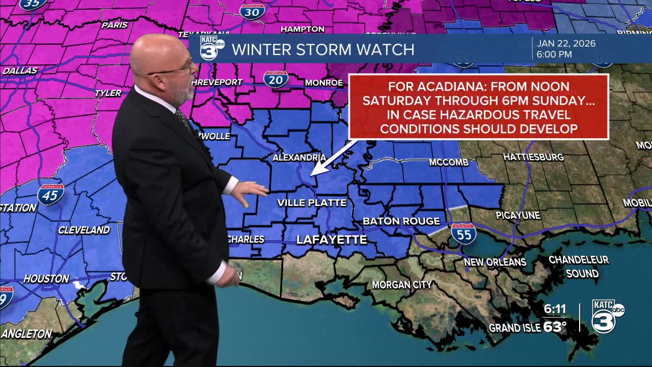
Areas along I-10 and north are under a WINTER STORM WATCH from Saturday afternoon through Sunday afternoon. We may see hazardous travel conditions due to a mix of precipitation.

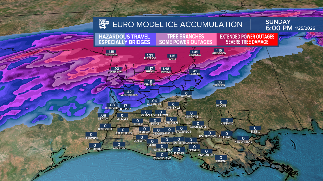
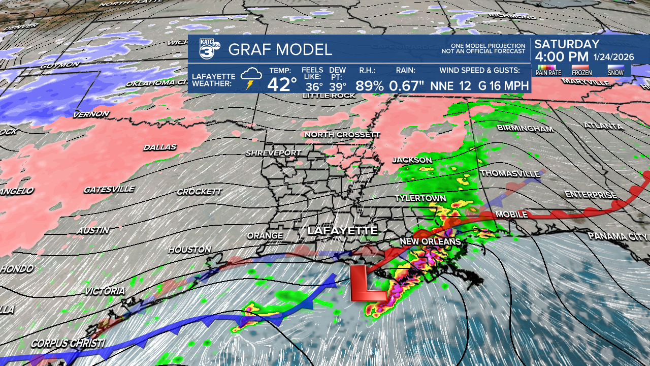
The mix precipitation is expected to come in two rounds, one Saturday morning and another Sunday morning. The latest EURO model shows areas around Alexandria, and north may see ice accumulations ranging from 0.10" to 1.5", while Acadiana will mostly experience just rain.
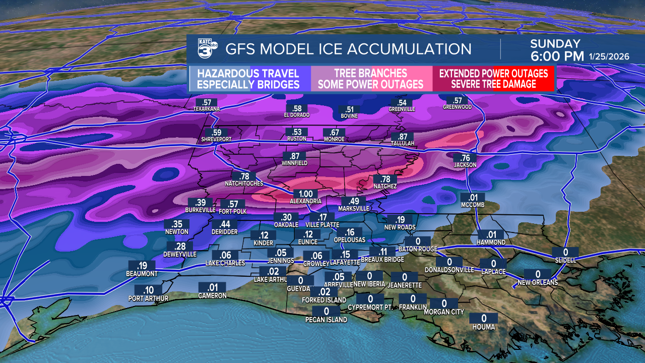
Meanwhile, the GFS model is showing possible accumulations near I-10, ranging from 0.05" to 1".
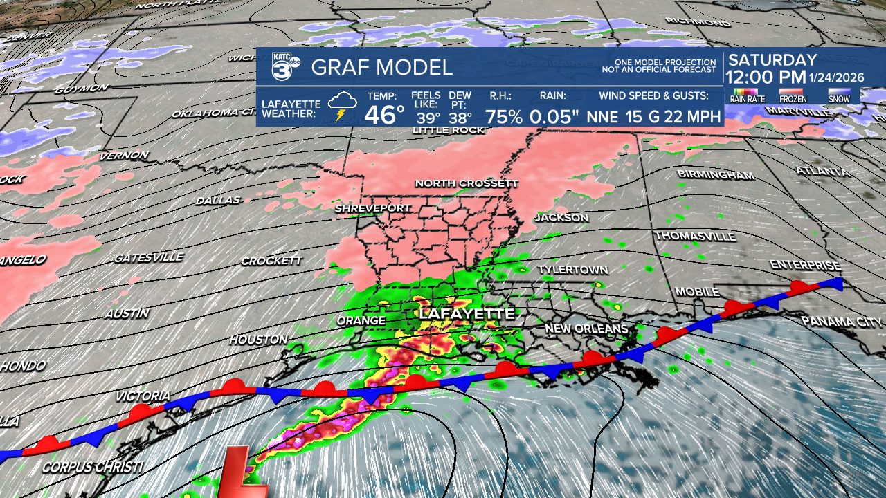
The GRAF model aligns with this, suggesting icy conditions could extend closer to I-10 with accumulations between 0.10" and almost 1". To highlight this, the Winter Storm Watch is still out for this weekend.

Moisture is key as we expect rain and/or freezing rain to begin rolling in Saturday morning.
Central and Northern Louisiana will see the highest chance for freezing rain, while areas along I-10 and south threat continues to decrease (between 10-30%), but the chance isn’t zero!

While freezing rain occurs in the north, a few thunderstorms are possible along the coast Saturday afternoon. Wet roads that freeze early Sunday morning could lead to black ice.


Central Louisiana may experience temperatures below freezing for 24 to 48 hours starting Saturday night. Sunday night is likely to be the coldest one with lows in the 20s, and wind chills dropping to the teens and even single-digits. An Extreme Cold Watch may be issued. We'll be in record-breaking territory as well.

Follow Meteorologist Breyanna Lewis for further updates.
See the KATC 10 Day Forecast for the latest.
