

Canadian cold front is heading our way, bringing a line of showers and storms overnight Sunday into early Monday morning. The current risk levels show Acadiana under a marginal (1/5) to slight (2/5) risk, while Alexandria and the northern areas are under an enhanced (3/5) risk. The enhanced risk is for a higher chance of damaging winds.

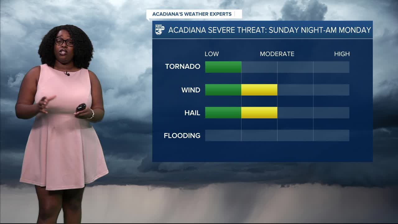
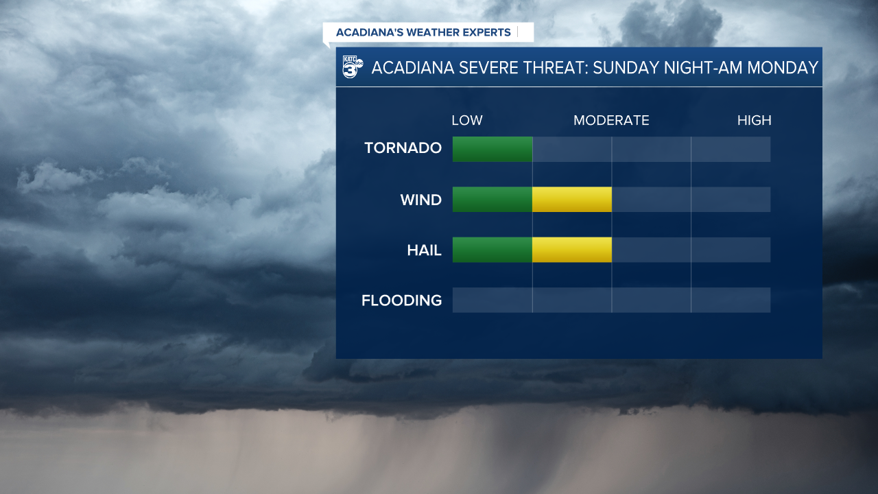
THREATS: The primary threats have not changed, still damaging winds (over 58 mph) and large hail. The tornado threat is low, but not at zero.
EXPECTED RAINFALL AMOUNTS: This quick-moving system is expected to bring light rainfall , averaging around a quarter of an inch or less. No excessive rainfall is expected.

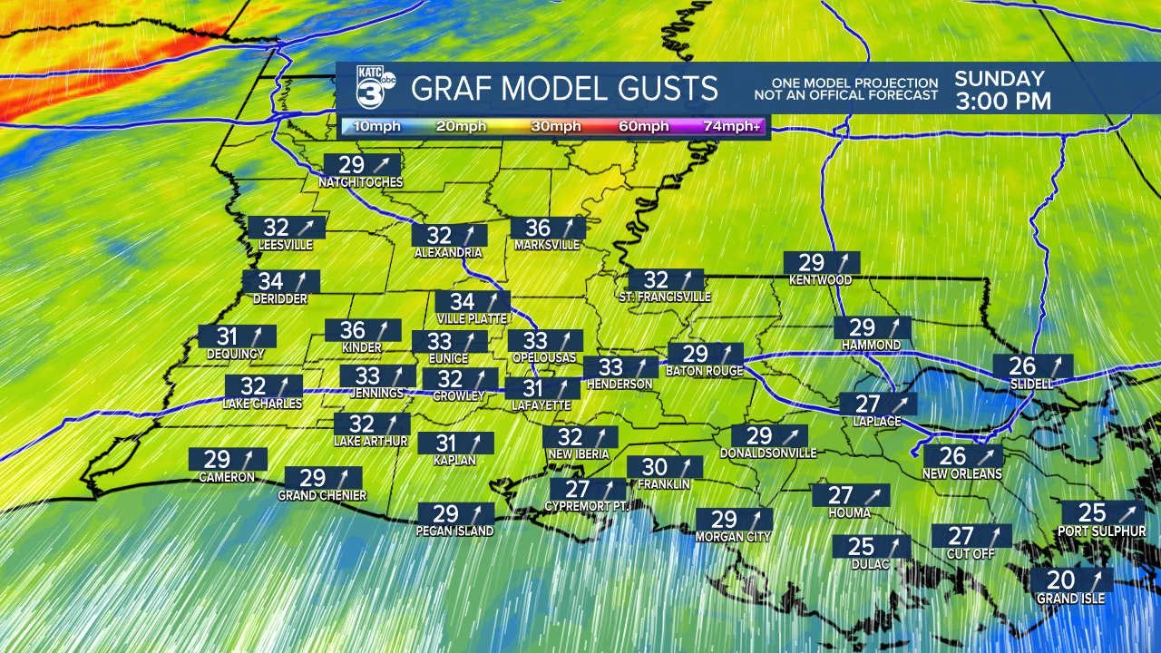
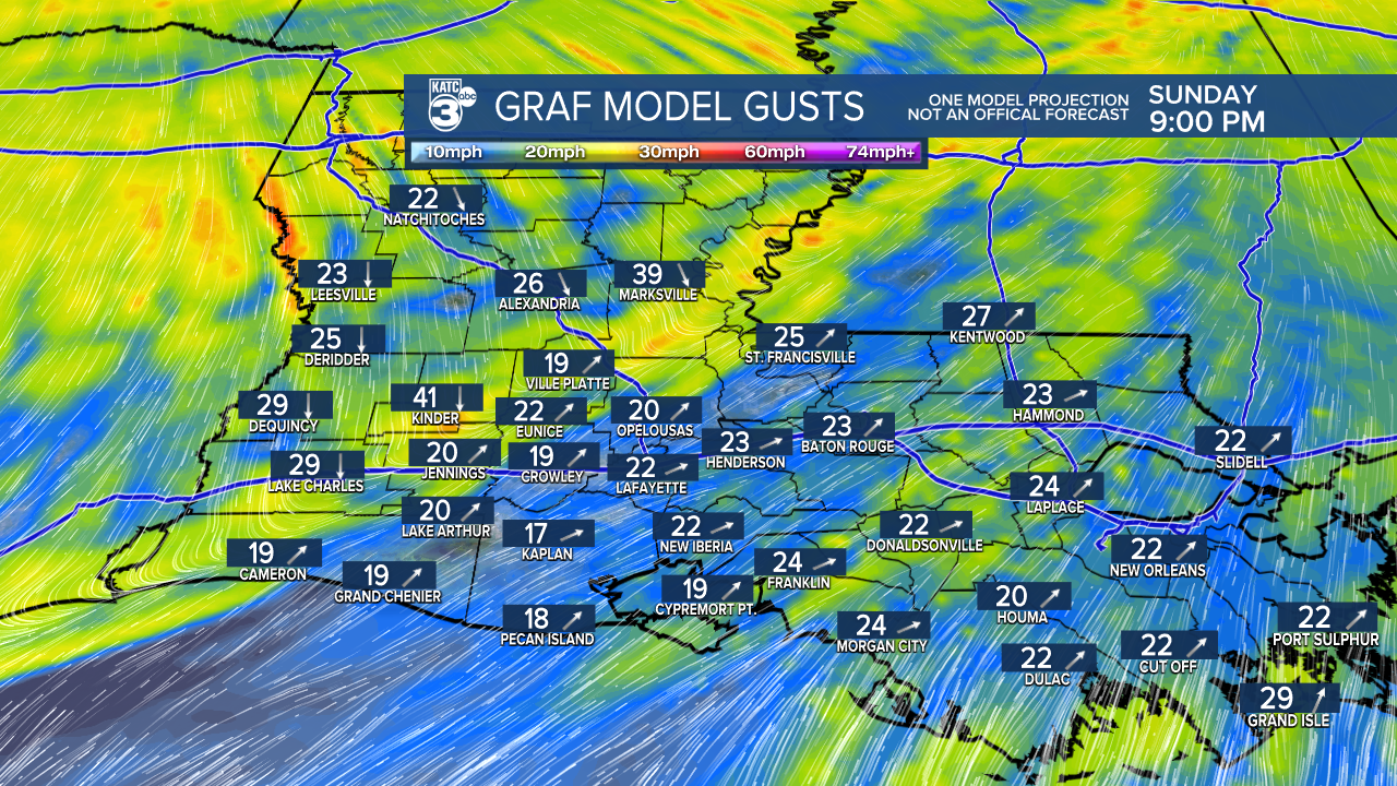
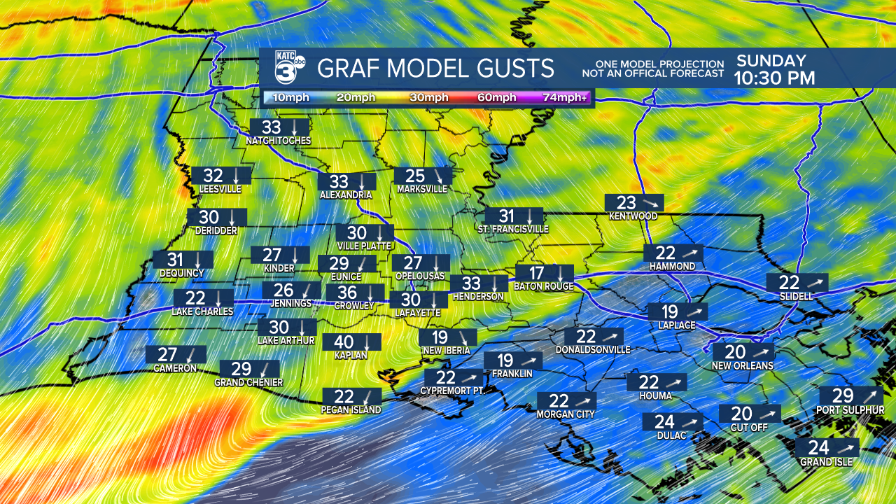
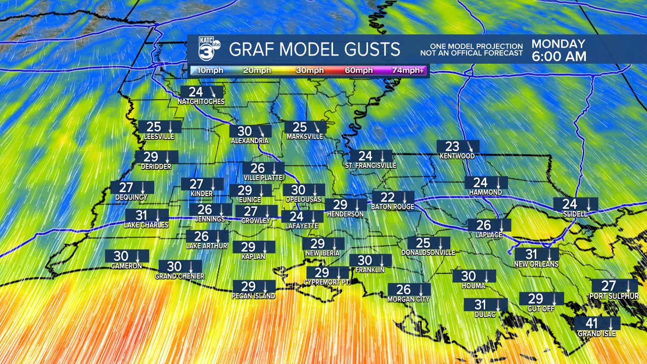
TIMING: Most of Sunday will be dry; however, expect the storms to start moving in around 7 or 8 PM over Alexandria. By 8 or 9 PM, they’ll shift towards Allen and Evangeline Parishes. The storms should be over Lafayette around 10 or 11 PM, with them clearing St. Mary Parish around midnight.

As advertised, a Wind Advisory goes into effect tomorrow morning and lasts through Monday evening.
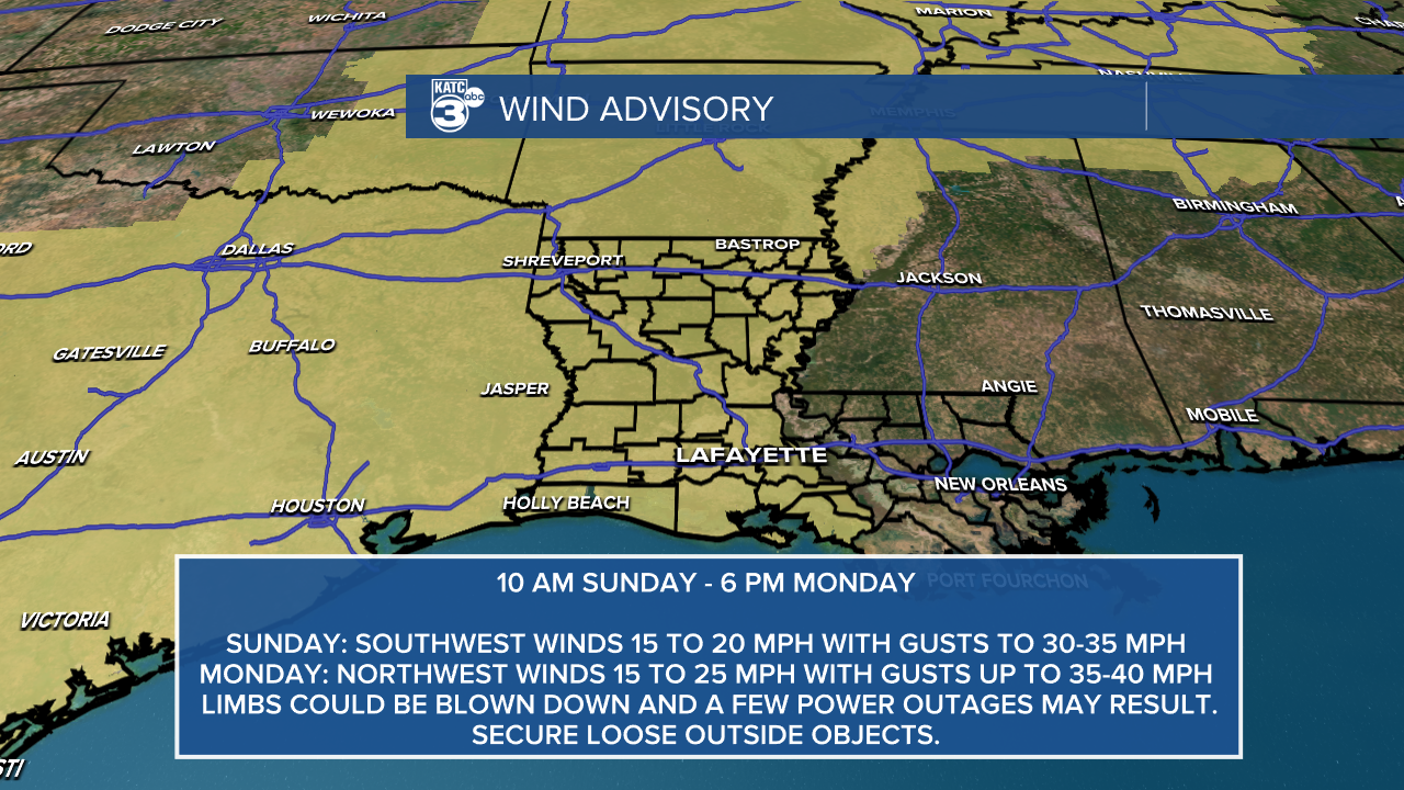
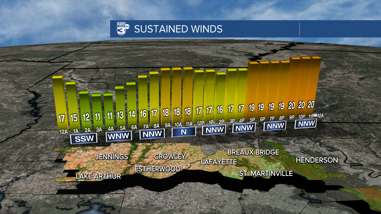
We're expecting some strong winds outside of any storms. Expect wind speeds up to 25 mph with gusts between 30 and 40 mph. The winds finally begin to ease Monday evening.
Secure any loose items in your yard to prevent them from being blown away. Also, power outages are possible due to the gusty winds.
If you're driving a high-profile vehicle, please exercise extra caution on the roads.
Follow Meteorologist Breyanna Lewis for further updates.
See the KATC 10 Day Forecast for the latest.
