

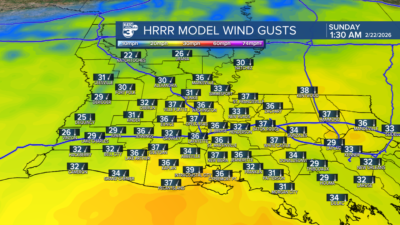
With a cold front moving through the area, expect persistent north winds tonight through tomorrow afternoon, ranging from 10 to 20 mph, with gusts reaching up to 40 mph! Secure any loose objects outdoors.

In combination with severe to extreme drought conditions, warm temperatures, low relative humidity below 20%, and gusty winds, a Red Flag Warning goes into effect tomorrow morning. The Parishes under this warning are Avoyelles, Evangeline, St. Landry, St. Martin, and Iberia. Any fire that develops is likely to spread quickly. Outside burning and activities that cause open flames should be avoided.

The winds begin to ease late Sunday. A BURN BAN is currently in place for Rapides and St. Landry Parishes.
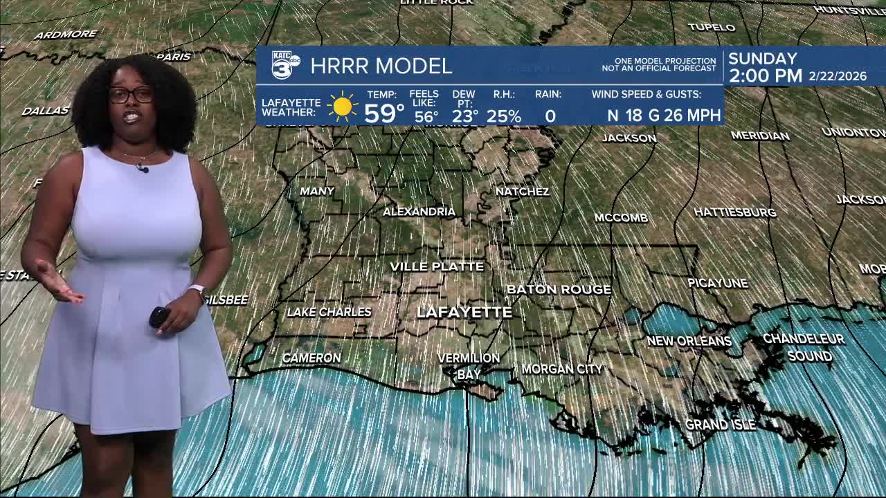
The past week or two has definitely been giving pre-Spring vibes! However, a cold front continues to move through Acadiana this afternoon, leading to significantly cooler/colder temperatures tonight through the middle of next week.
Overnight temperatures are expected to drop into the low to mid-40s tonight.

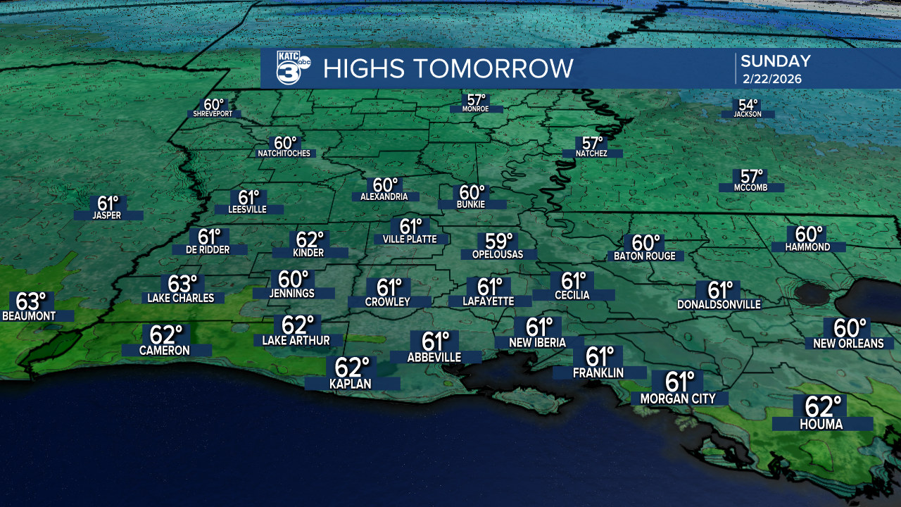
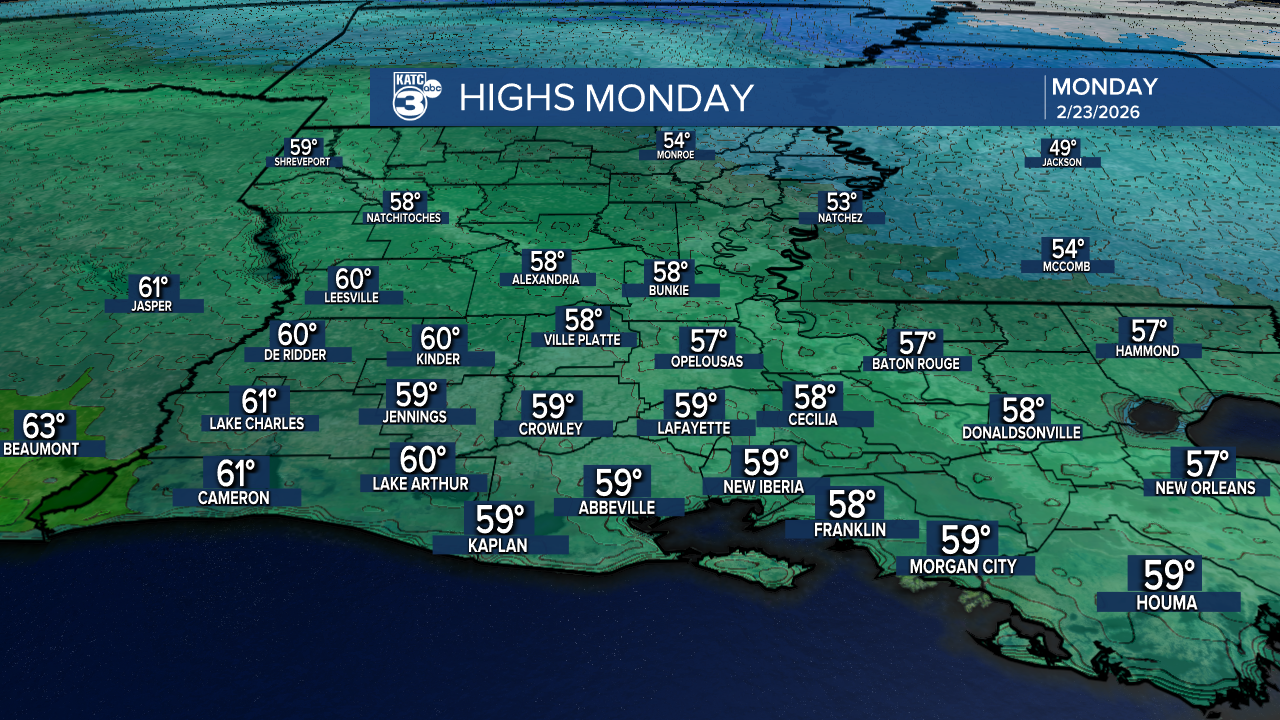
Highs tomorrow warming up into the upper 50s to low 60s.
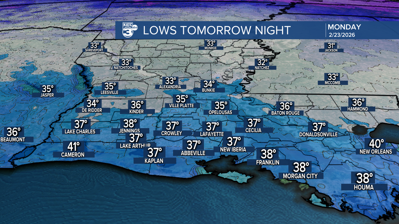
The cold airmass settles, dropping overnight temperatures tomorrow into the mid to upper 30s.
Monday will be the coolest day of the week, struggling to escape the upper 50s. At least we’ll have those beautiful blue skies above!
As we head into Monday night, prepare for the coldest air of the week, with lows in the upper 20s to low 30s, which could result in a light freeze.

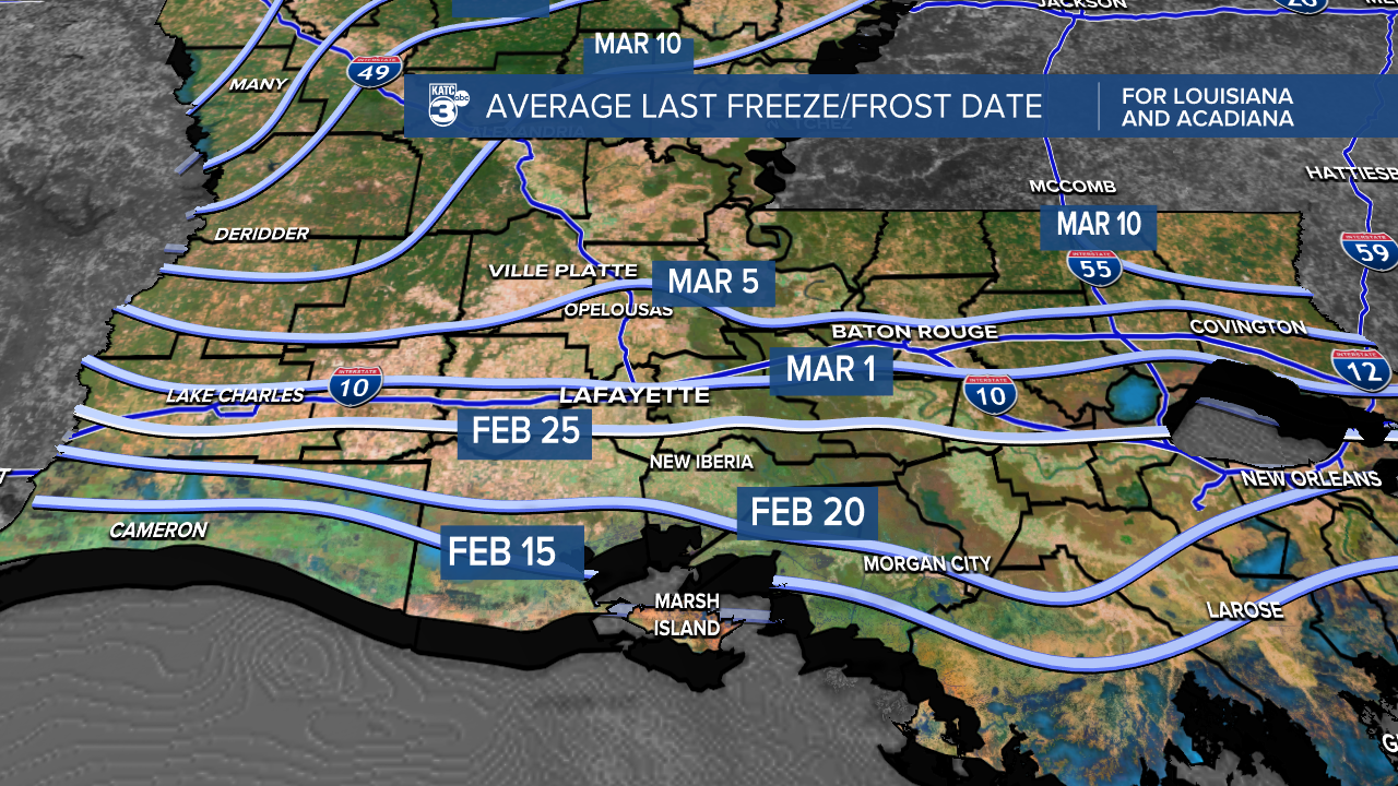
Historically, we often see our last freeze around this time, with North Louisiana averaging its final freeze/frost between the first and second week of March.
For those waiting for the official start, Spring is coming soon in 26 days!
Follow Meteorologist Breyanna Lewis for further updates.
See the KATC 10 Day Forecast for the latest.
