

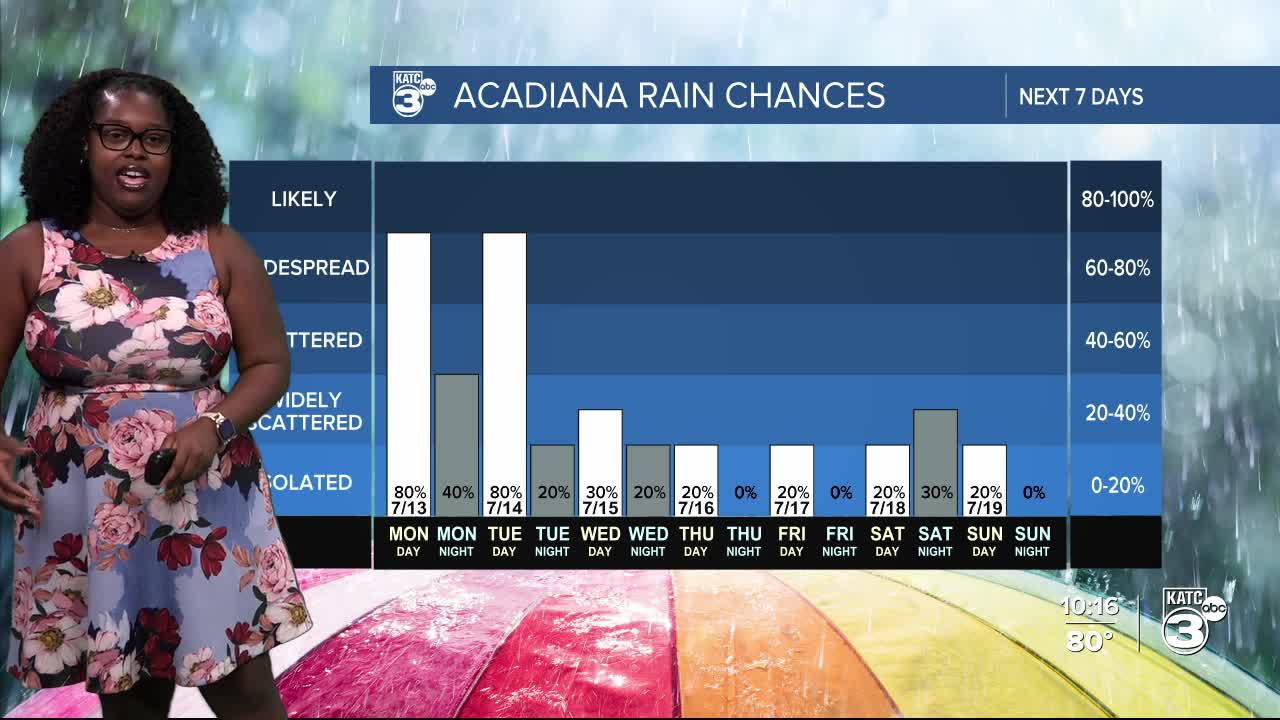


Don’t let that sunshine fool you—scattered showers and thunderstorms are still on track for this afternoon and evening.
Not much has changed from my previous posts; we have deep Gulf moisture in the air combined with a frontal boundary, which means widespread rain and storms are expected through Tuesday.
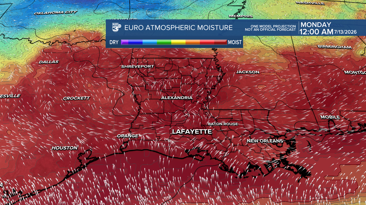
Each day is likely to have heavy downpours and frequent lightning, with an elevated flood risk. The greatest concern for flooding will be tomorrow with a slight risk (2/4) as thunderstorms may bring heavy rainfall and brief gusty winds. Stay alert for any flood alerts, and make sure you can view those watches and warnings!
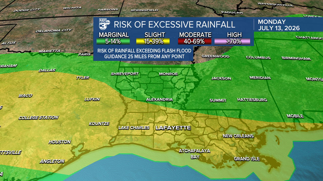
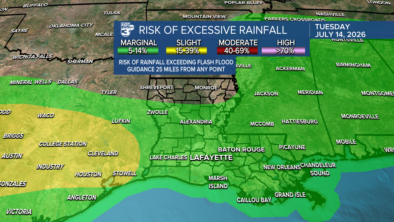
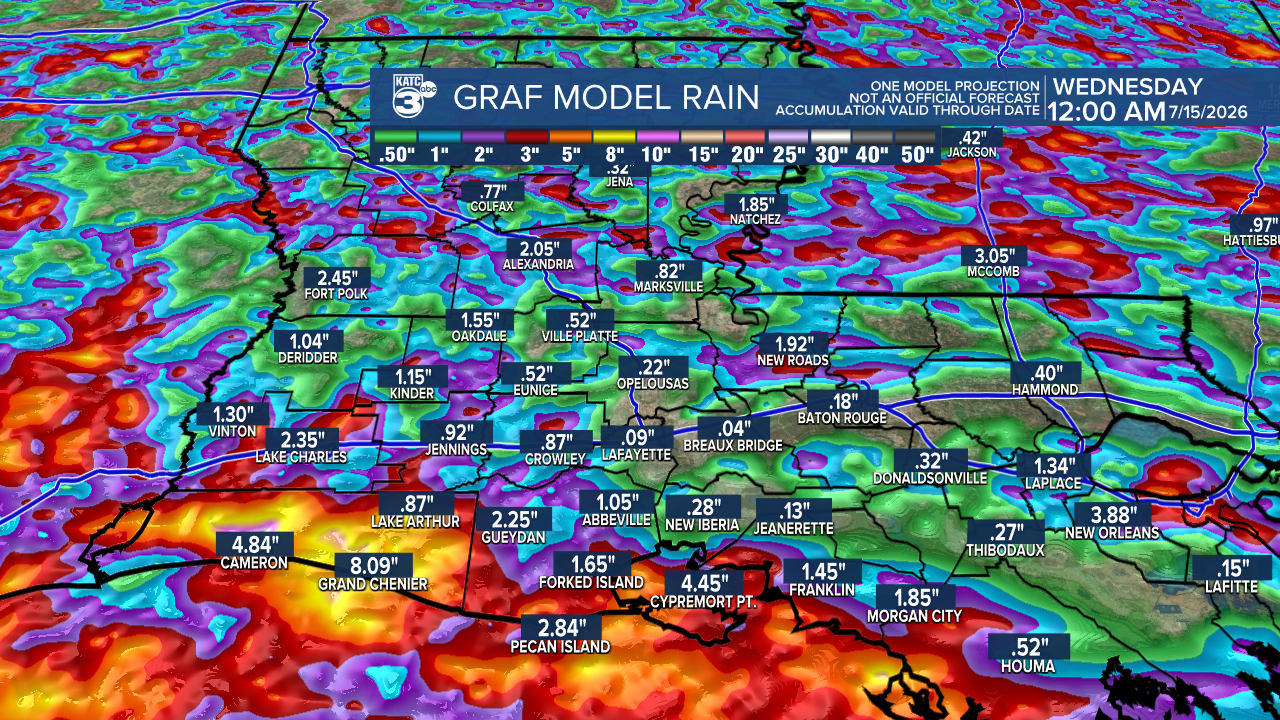
On average, we could see up to 3 inches of rain, with isolated spots receiving between 4-6 inches by early Wednesday. As the rain and clouds roll in, expect temperatures to drop into the upper 70s and low 80s.
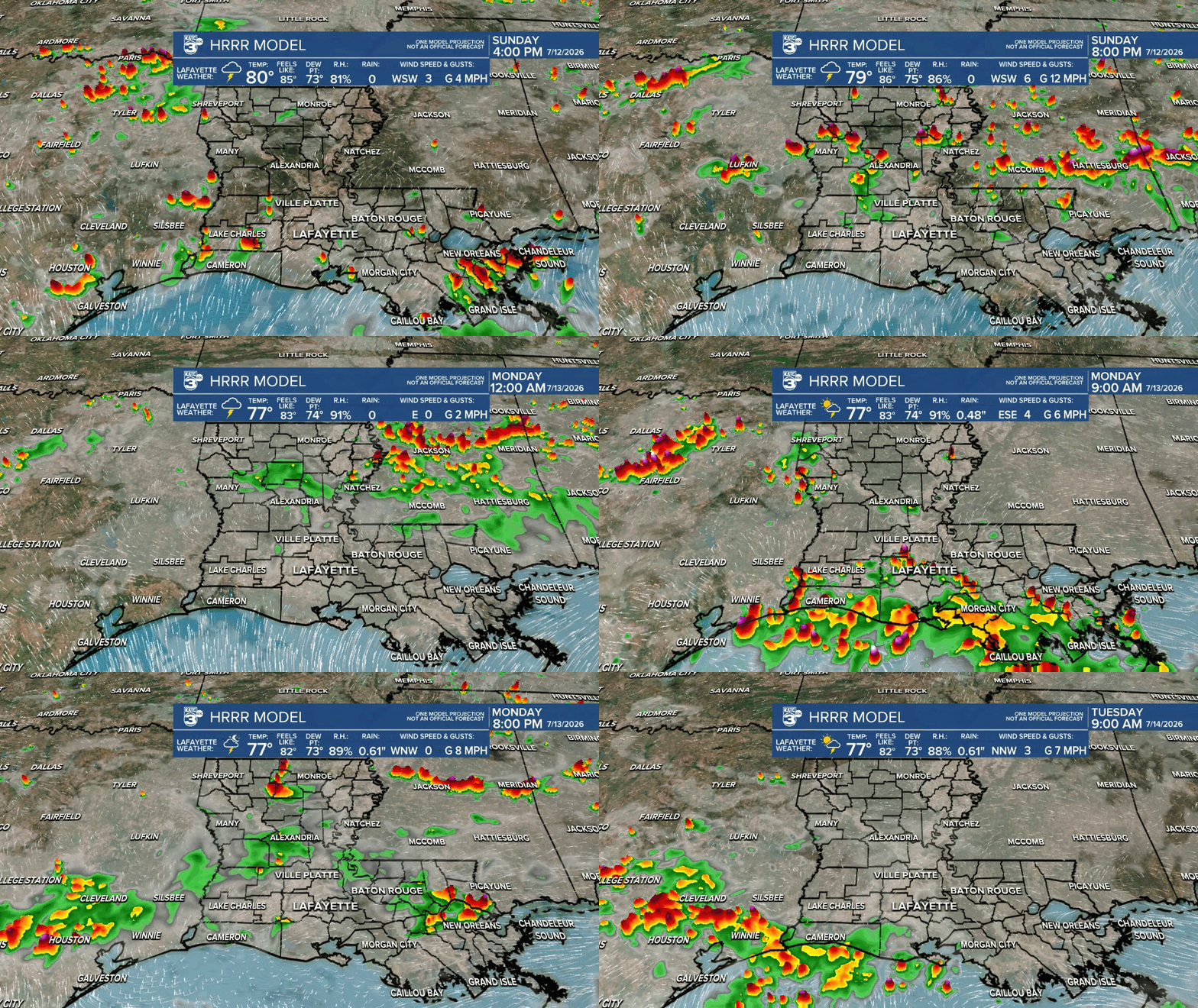
Most of the rain should taper off after sunset, but with a primed atmosphere, storms are likely to redevelop after midnight into the early hours of Monday.
As the tropical moisture lessens midweek, we’ll see our usual afternoon pop-up thunderstorms return from Wednesday through the end of the week, along with rising temperatures.
Follow Meteorologist Breyanna Lewis for further updates.
See the KATC 10 Day Forecast for the latest.

