


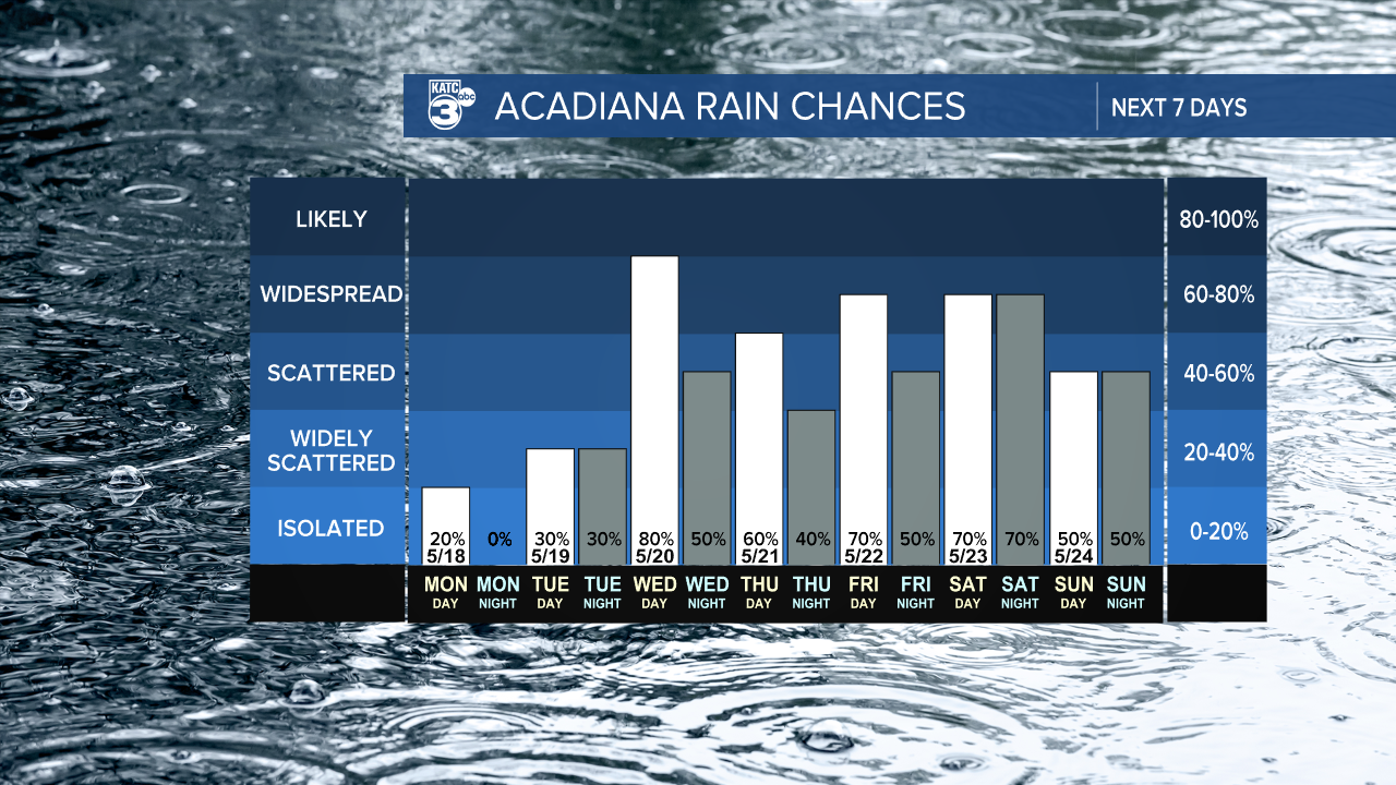
Starting Tuesday, we're expecting a change in the weather pattern to a wet and soggy one. The rain gear will definitely be a must! We're talking high-end rain chances between 50% to 80%.
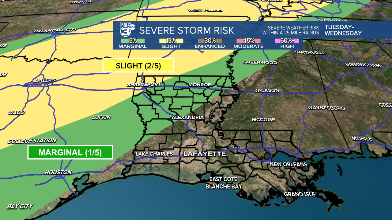
A marginal (1/5) risk for severe weather covers our area from Tuesday into Wednesday, so we'll keep an eye on this if it shifts further south.
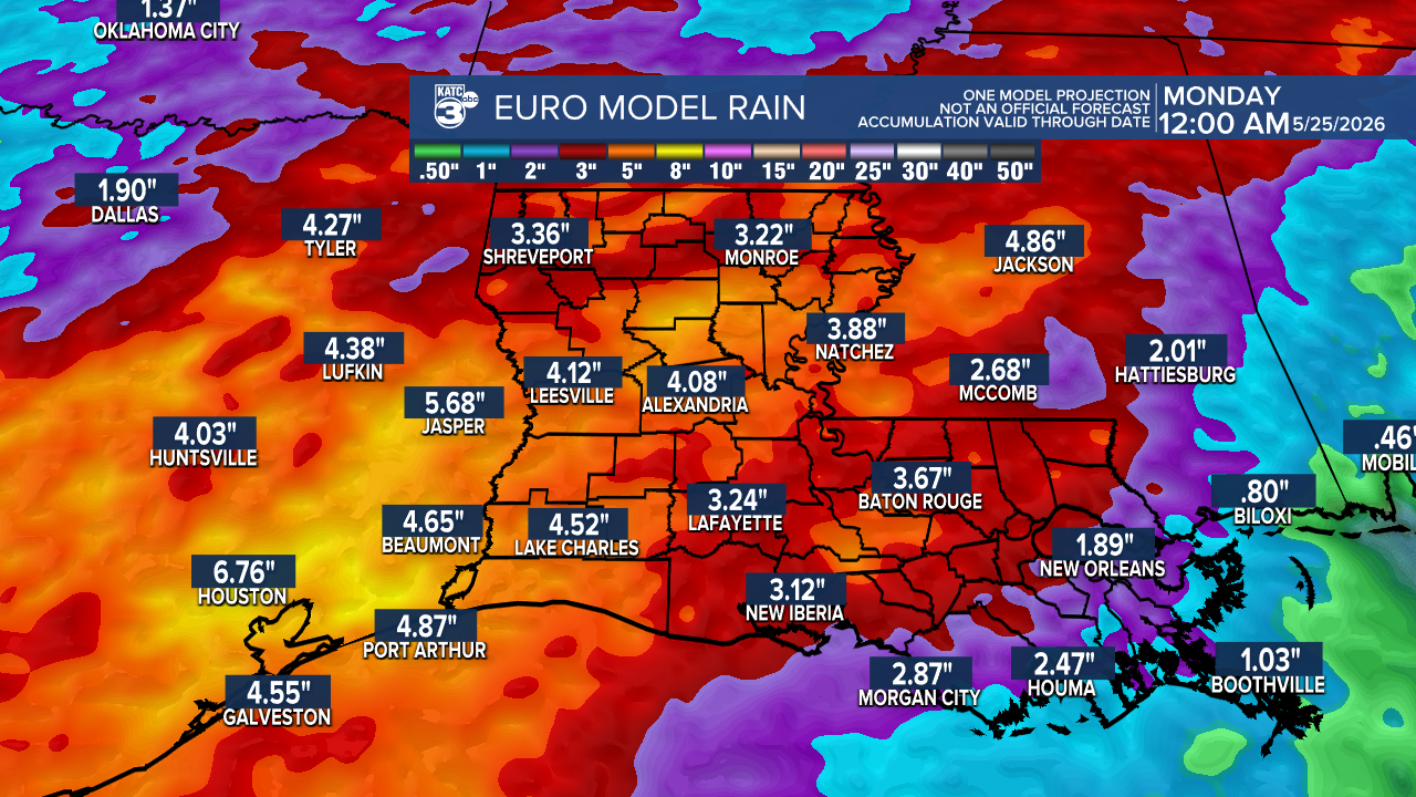
We could see several inches of rain through next weekend, with the EURO model predicting totals of up to 4 or 5 inches by next Monday. This can be higher in some storms producing heavy rain. The conditions are ripe for widespread showers and thunderstorms, with a moist airmass setting the stage for some torrential downpours.
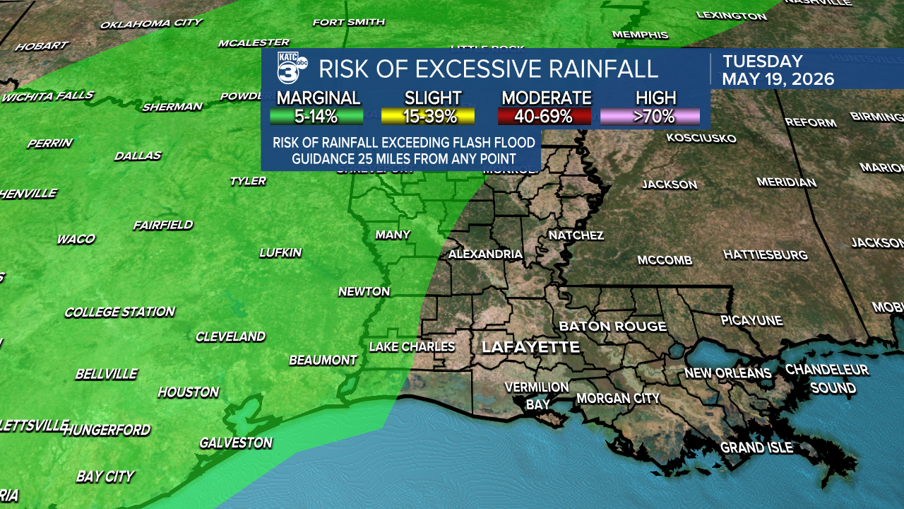
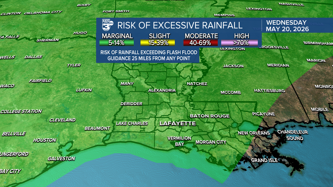
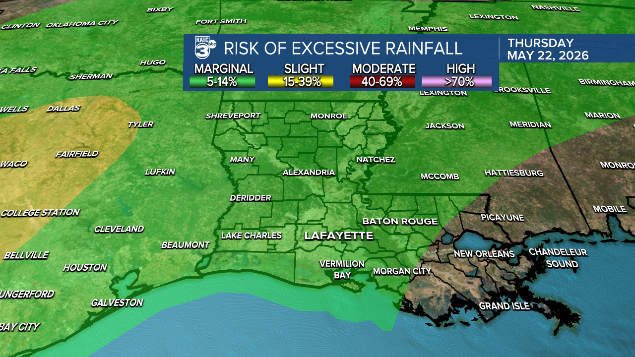
There is a multi-day flash flood risk beginning Tuesday, currently at a marginal (1/4) threat, which may increase as the ground starts to saturate.
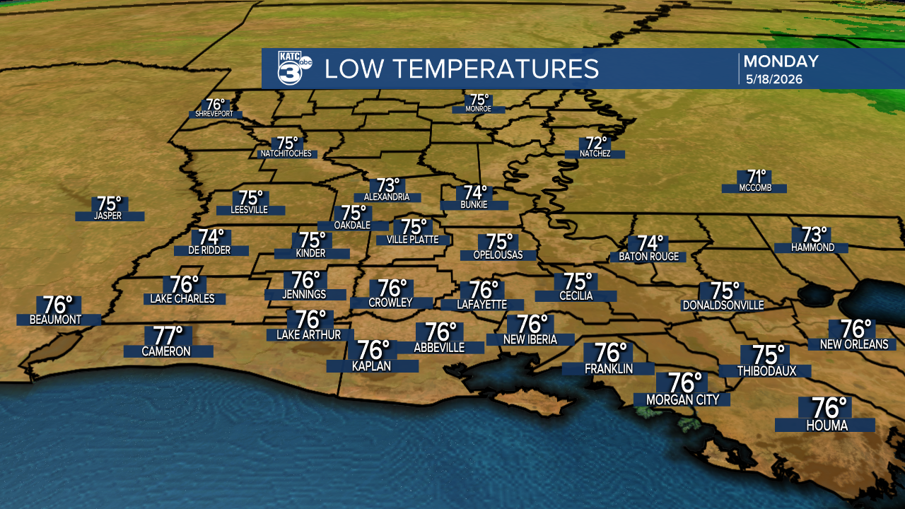
Tonight will be another warm one in the mid-70s.
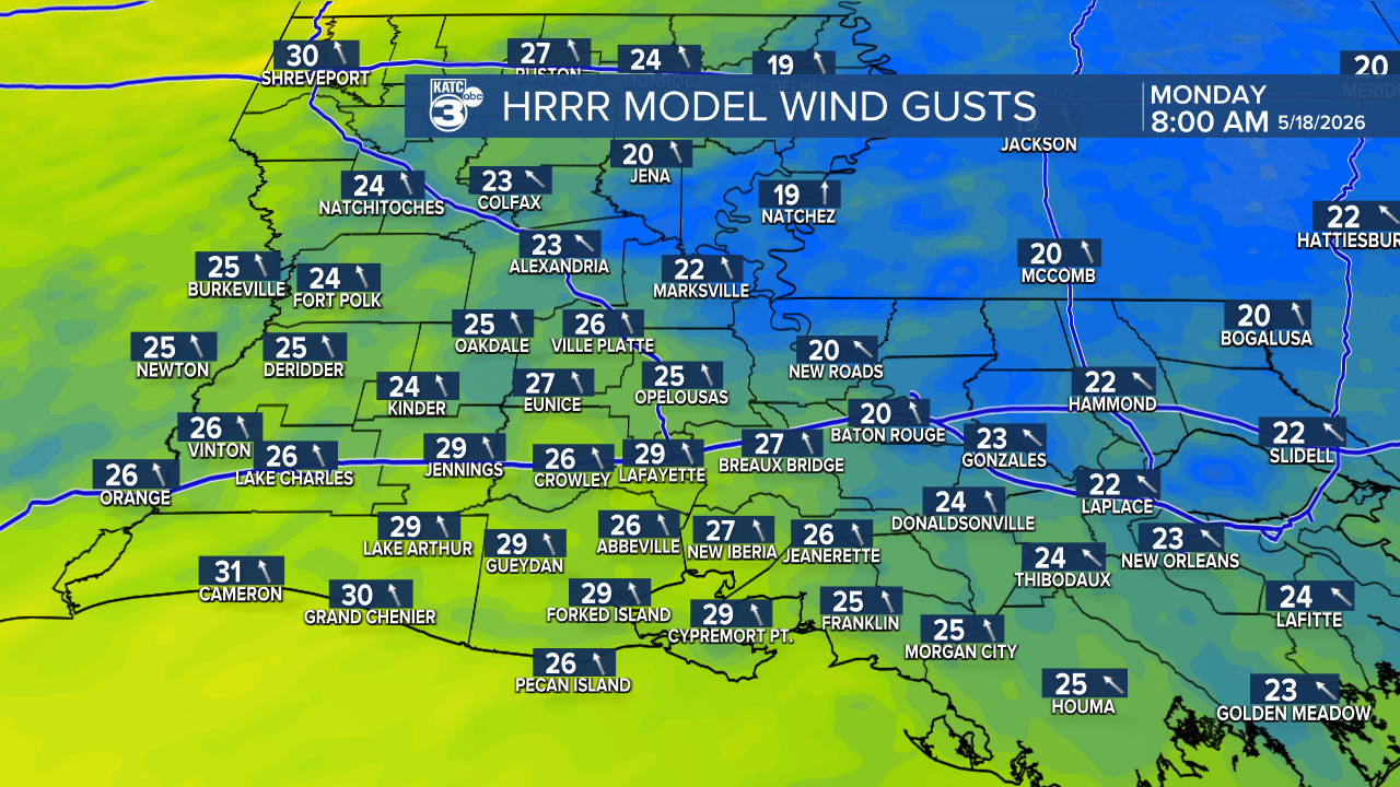
Highs tomorrow heat up into the upper 80s along with breezy winds.
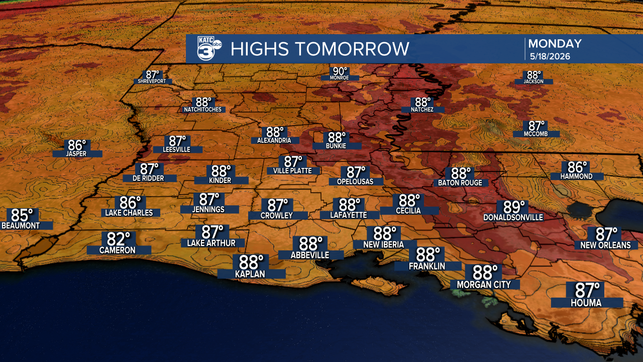
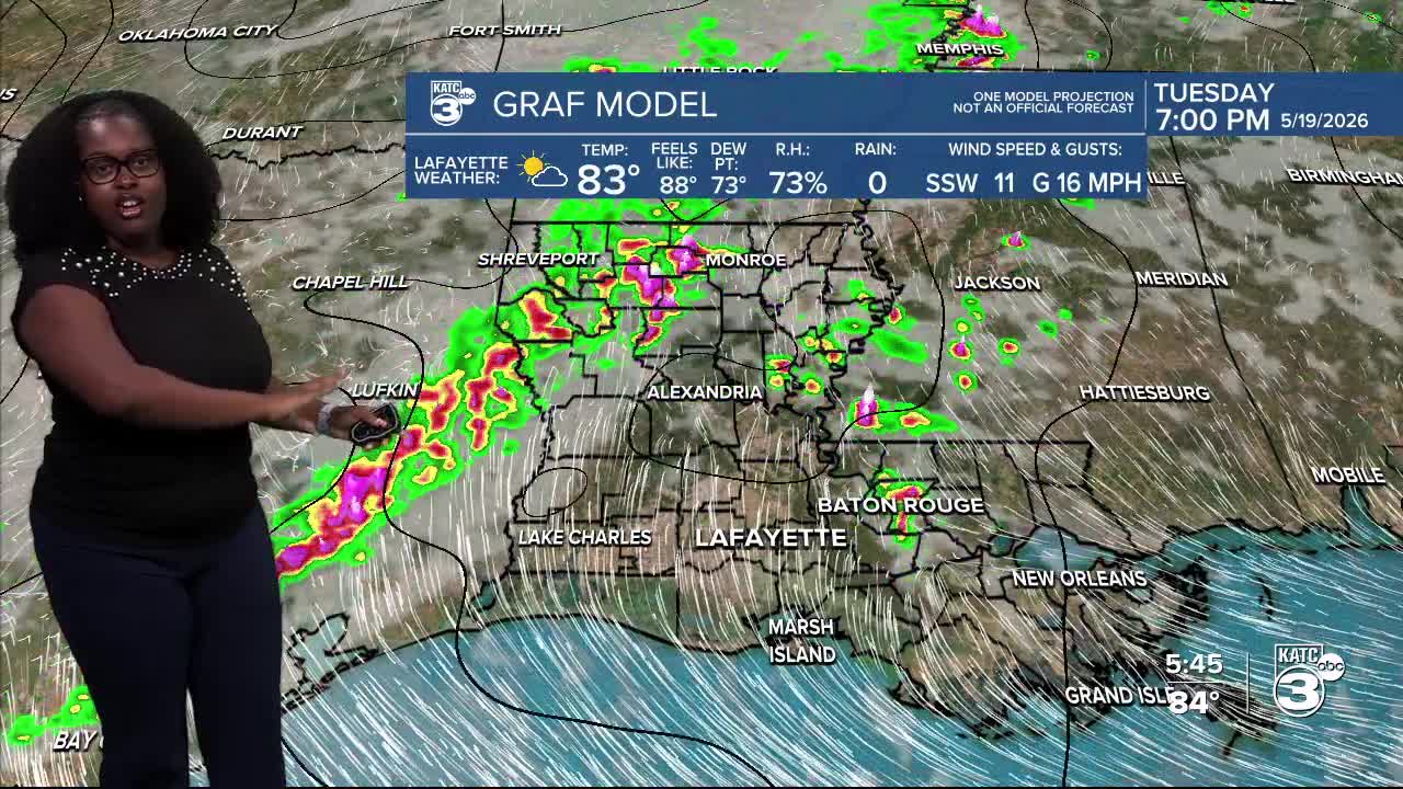
A wind advisory may be in the cards. Also, a few isolated afternoon showers are possible.
Follow Meteorologist Breyanna Lewis for further updates.
See the KATC 10 Day Forecast for the latest.
