
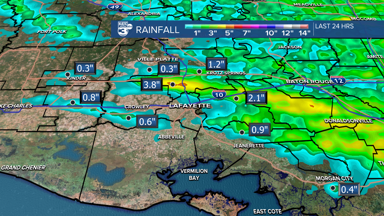
Last night's rain made it close to the coast, with some areas receiving up to 2 inches. There was even an isolated spot between Opelousas and Sunset that saw nearly 4 inches of heavy rain!
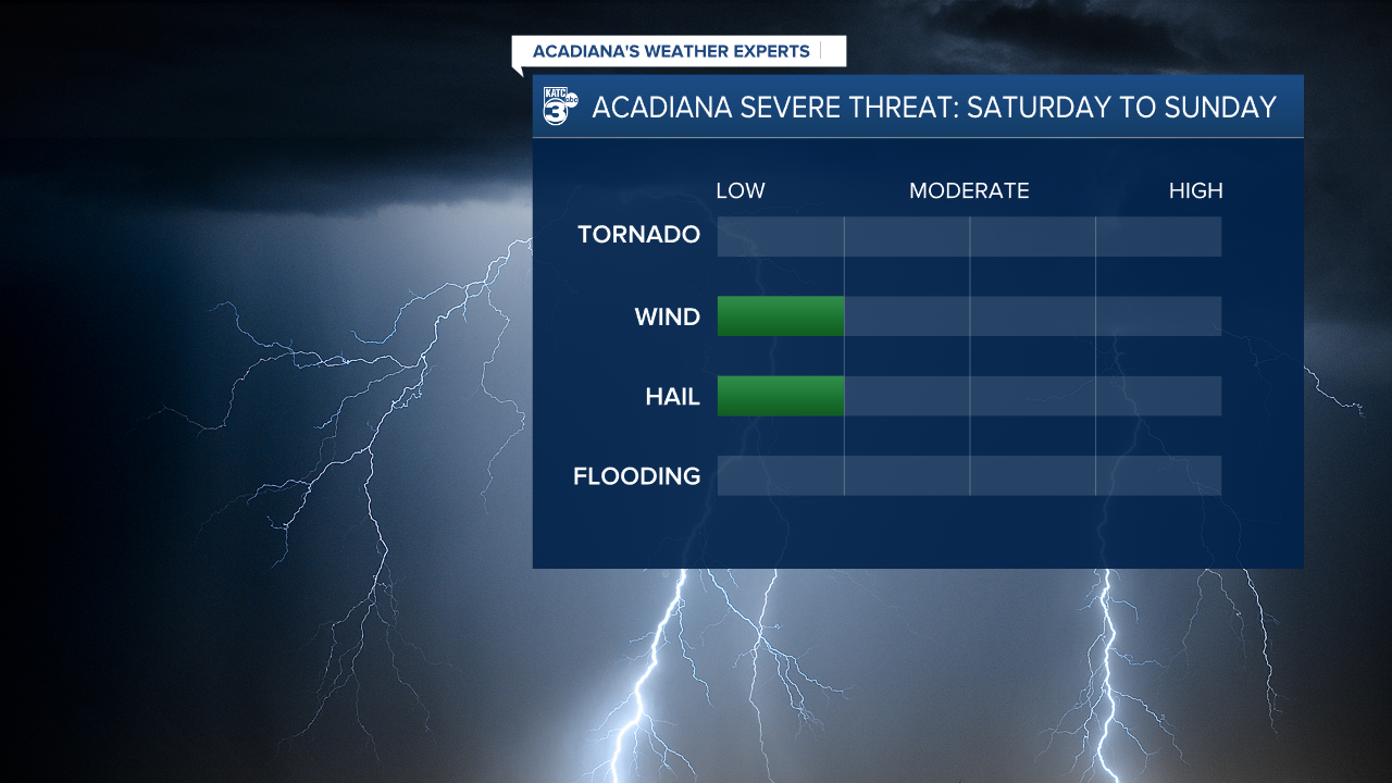
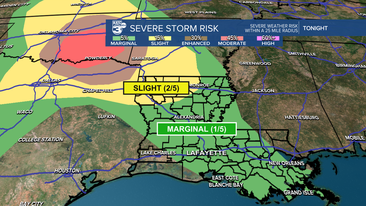
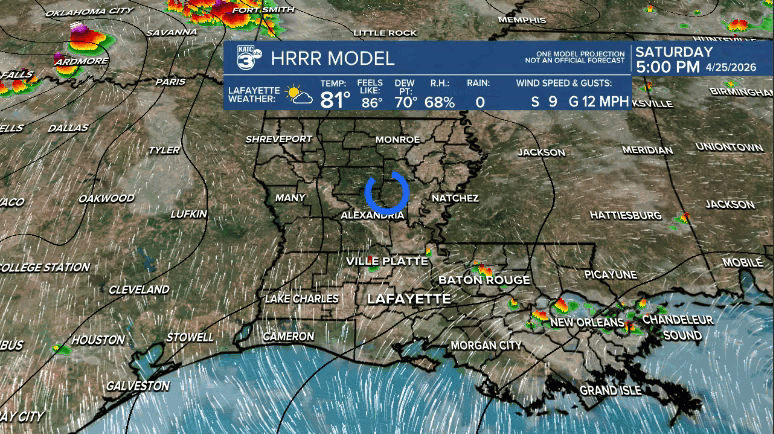
Looking ahead to tonight, rain chances are low. The SPC has most of Louisiana under a marginal risk (1/5) for severe weather, mainly due to potential damaging winds and large hail.
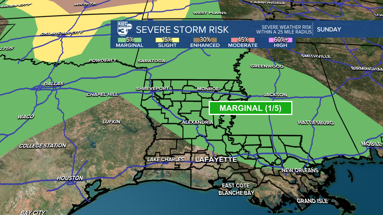
Unlike yesterday, we’re not expecting widespread rainfall—maybe up to 1 inch in some areas, while others might not see any rain at all.
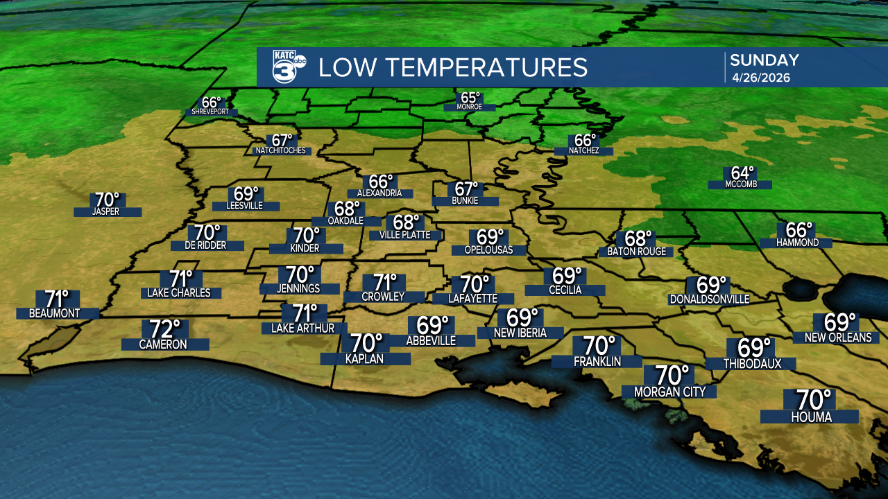
Most of the activity will be along or east of I-49, with conditions likely to fizzle out further south. For Acadiana, we might see a few isolated showers and storms early in the morning (after 5/6 AM), with mild and muggy lows in the upper 60s to low 70s.
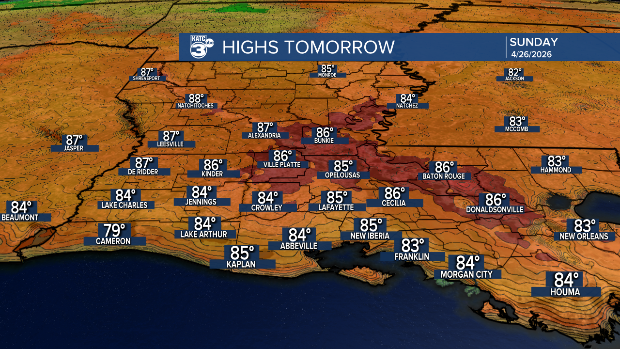
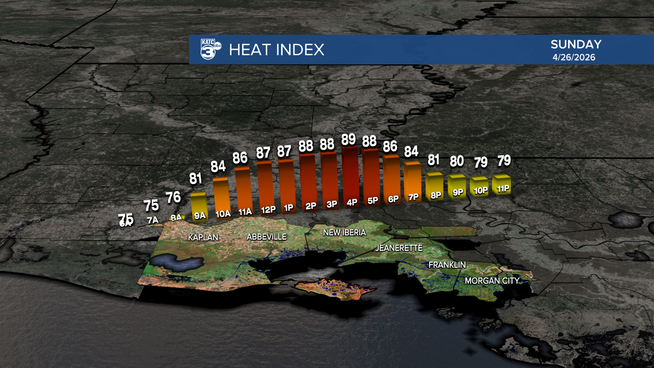
After 12 PM, another warm and humid day is shaping up, with highs in the 80s and the heat index creeping close to 90°.
Follow Meteorologist Breyanna Lewis for further updates.
See the KATC 10 Day Forecast for the latest.
