


The warm weather is sticking around, and we're staying above average as we head into the weekend. But there’s a silver lining: Saturday night is bringing some much-needed rain with a cool front!
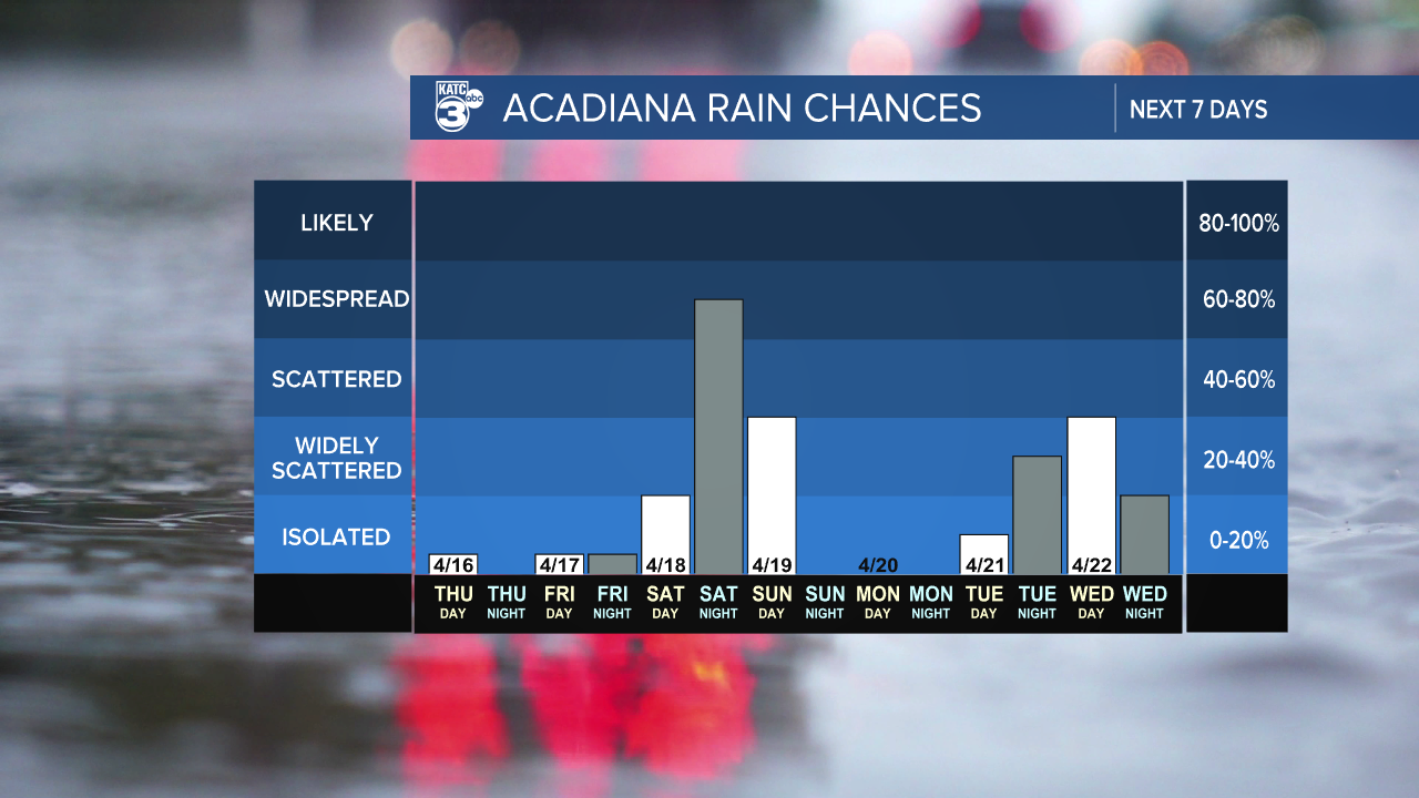

For now, a high-pressure system is keeping our rain chances low, but a shower or two can make an appearance during the afternoon. While severe weather isn’t expected, a few thunderstorms could pop up. The WPC has flagged northern Acadiana and CENLA with a marginal (1/4) risk for flash flooding.
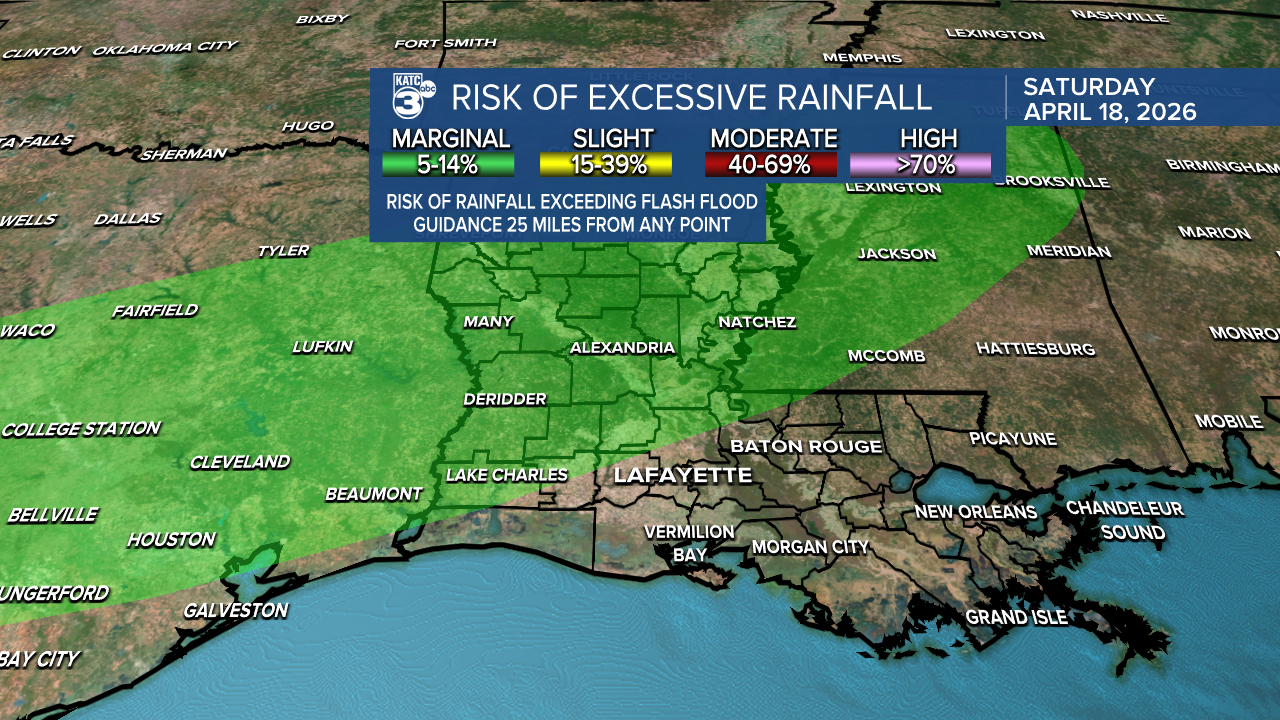
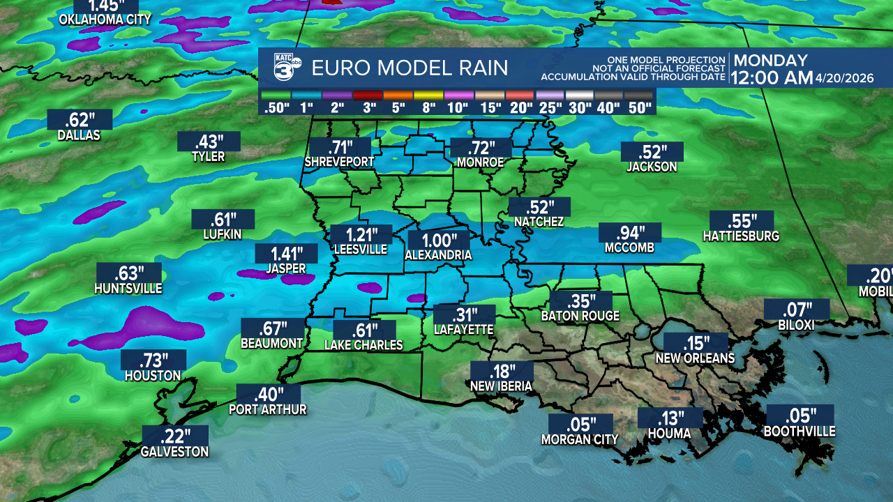
We could have rainfall amounts reach up to an inch in some areas, with a few fortunate spots getting even more.
As we wait for the cool down, our nights will remain warm and sticky, with lows in the mid to upper 60s and a chance of patchy fog.


Expect daytime highs in the mid to upper 80s.

Follow Meteorologist Breyanna Lewis for further updates.
See the KATC 10 Day Forecast for the latest.
