


The NHC has expanded the outlook area for a tropical wave in the Bay of Campeche, now raising the odds for development to 20%.

According to the NHC, "Environmental conditions are forecast to be only marginally conducive for development before the system moves inland over eastern Mexico late Saturday or Sunday. The system could re-emerge over the northwestern Gulf on Tuesday and Wednesday while interacting with a frontal boundary, but there too, conditions are only expected to be marginally conducive for any development."
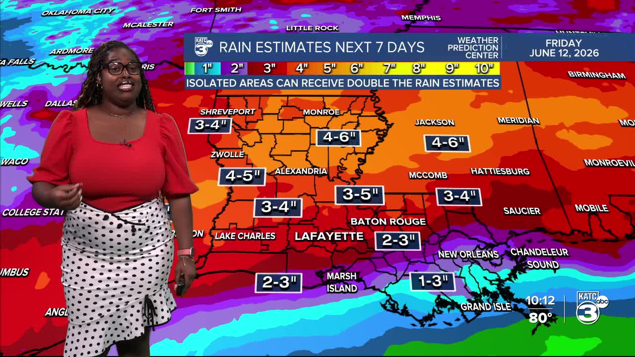
So, what does this mean for us in Louisiana? With a surge of tropical moisture and a weak front moving in, we’re looking at a potential for excessive rainfall late this weekend into next week, which could lead to localized flooding from Sunday through Tuesday.


The latest EURO and WPC rainfall estimates show similar trends, with the EURO model predicting the heaviest rain totals in Eastern Texas. Here in Acadiana, we can expect rainfall amounts of up to 5 inches, with isolated areas possibly seeing 8 to 9 inches over the next few days.


I'll provide more details as the weekend continues!
Follow Meteorologist Breyanna Lewis for further updates.
See the KATC 10 Day Forecast for the latest.
