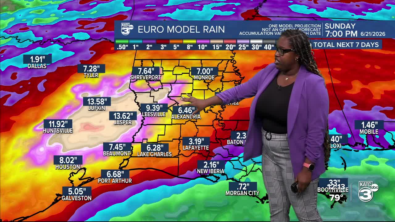


No major changes with the forecast other than the EURO doubling the rainfall amounts near 12" for Eastern Texas.

For Acadiana, we're still looking at 3 to 5 inches of rain over the next week, with isolated spots possibly reaching 8 inches.

A slow-moving frontal boundary is set to move south and stall for several days, combined with a tropical wave, it's likely to bring heavy rain and raise flooding concerns starting tomorrow. No significant development is expected from the tropical wave.

The heaviest rain is expected on Monday and Tuesday, with the WPC highlighting a marginal (1/4) to slight (2/4) chance of excessive rainfall. If you live in low-lying or flood-prone areas, please monitor the flood risk closely.


A coastal flood advisory may also be issued early next week. The frontal boundary should eventually wash out later in the week, which will lead to lower rain chances.
Follow Meteorologist Breyanna Lewis for further updates.
See the KATC 10 Day Forecast for the latest.
