


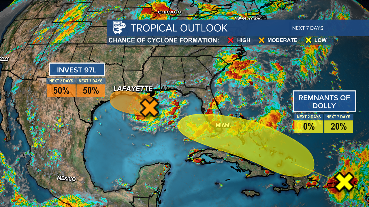
The NHC has placed Invest 97L at a 50% chance of formation.
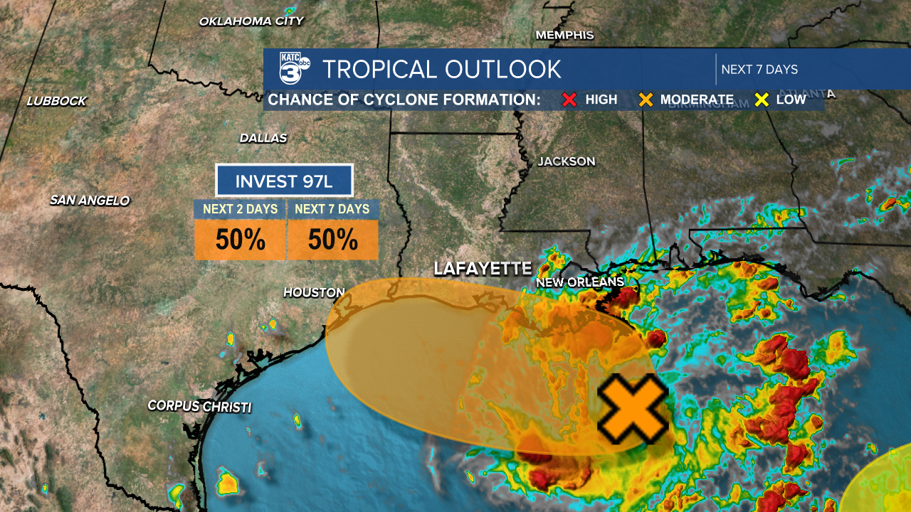
This area of low pressure is located about 125 miles south of southeastern Louisiana and is showing signs of organization.
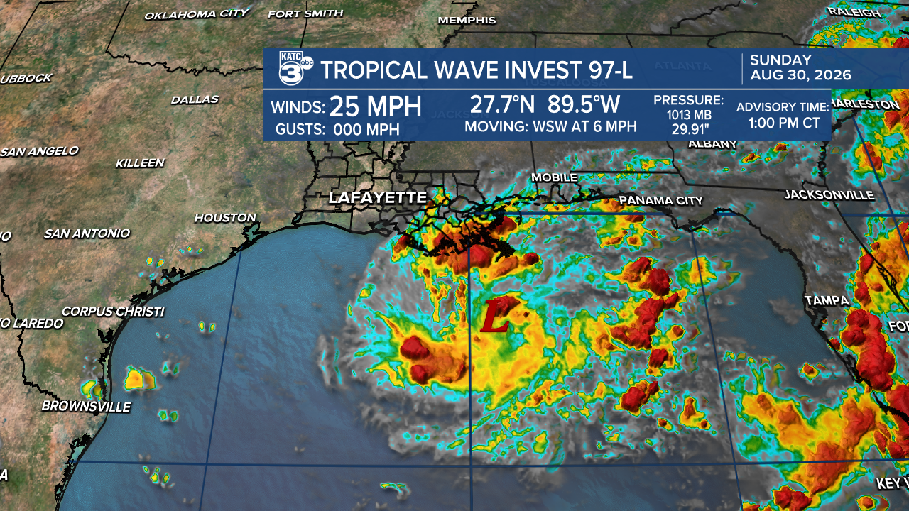
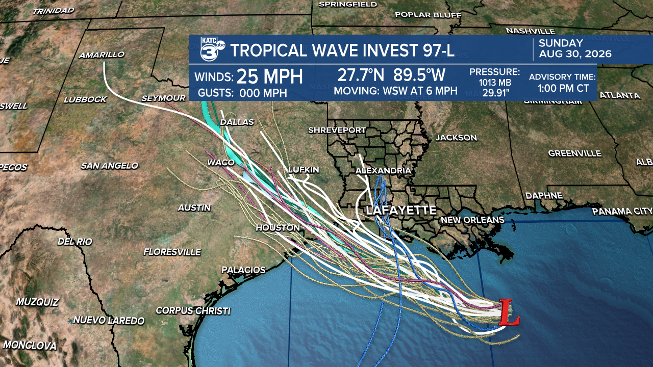
While development is slow, there's a possibility we could see a short-lived tropical depression or storm before it reaches Texas or southwestern Louisiana on Tuesday. If a tropical storm does form, the next name on the list will be Edouard.
The southern half of Louisiana is under a marginal (1/4) risk for heavy rainfall, which may lead to flash flooding, especially given the recent dry conditions.
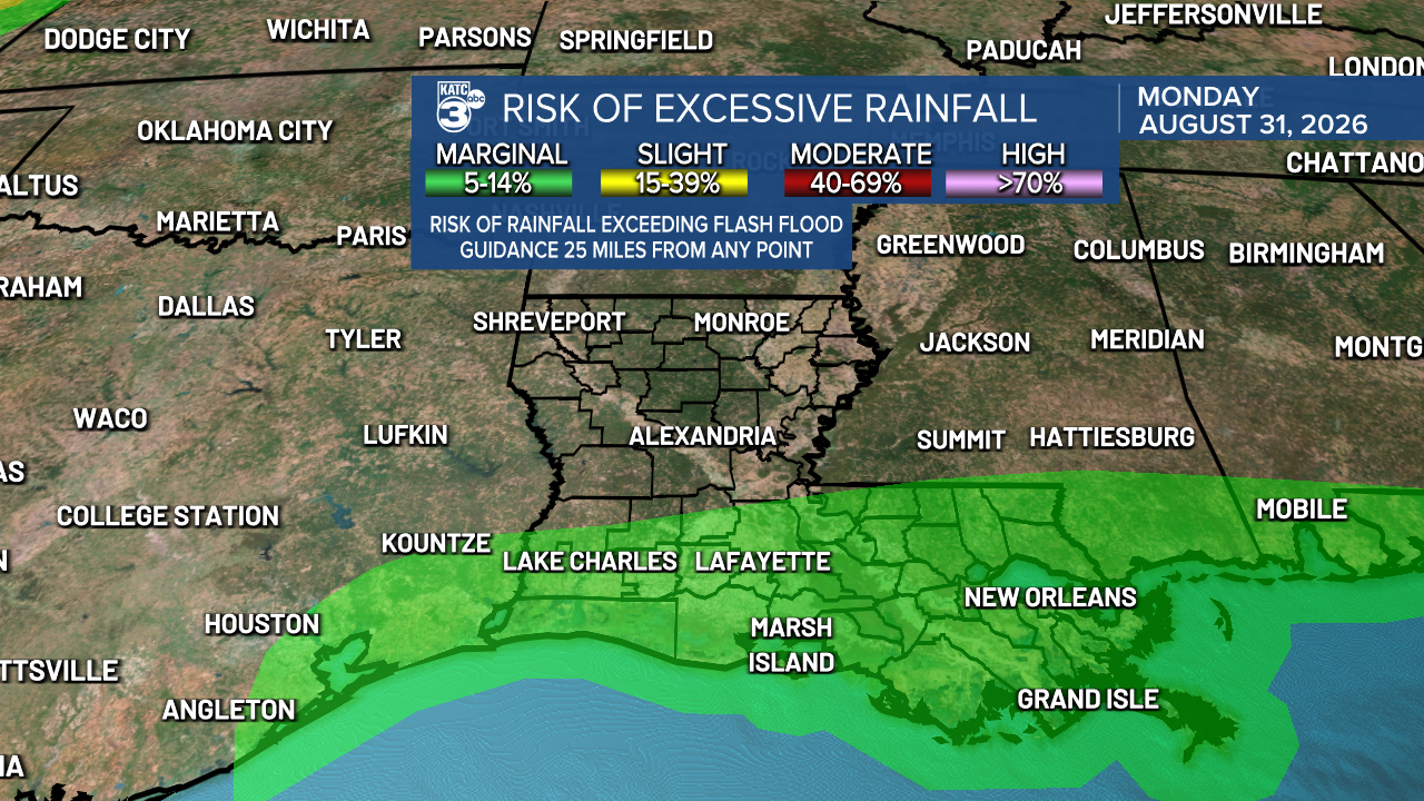
We are expecting rainfall amounts of up to 2 inches, with some localized areas possibly receiving more. While we do need the rain, we'd prefer it not to fall all at once to avoid significant flooding issues.
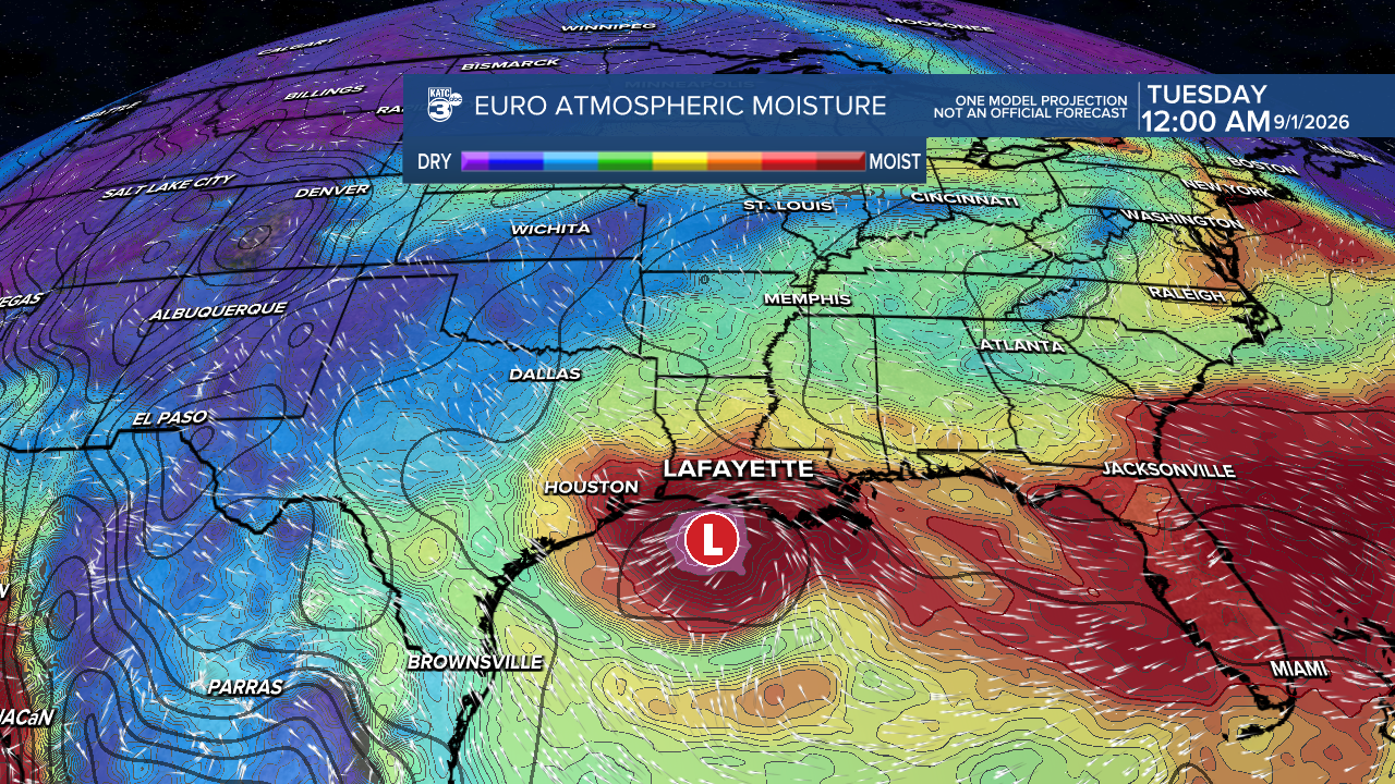
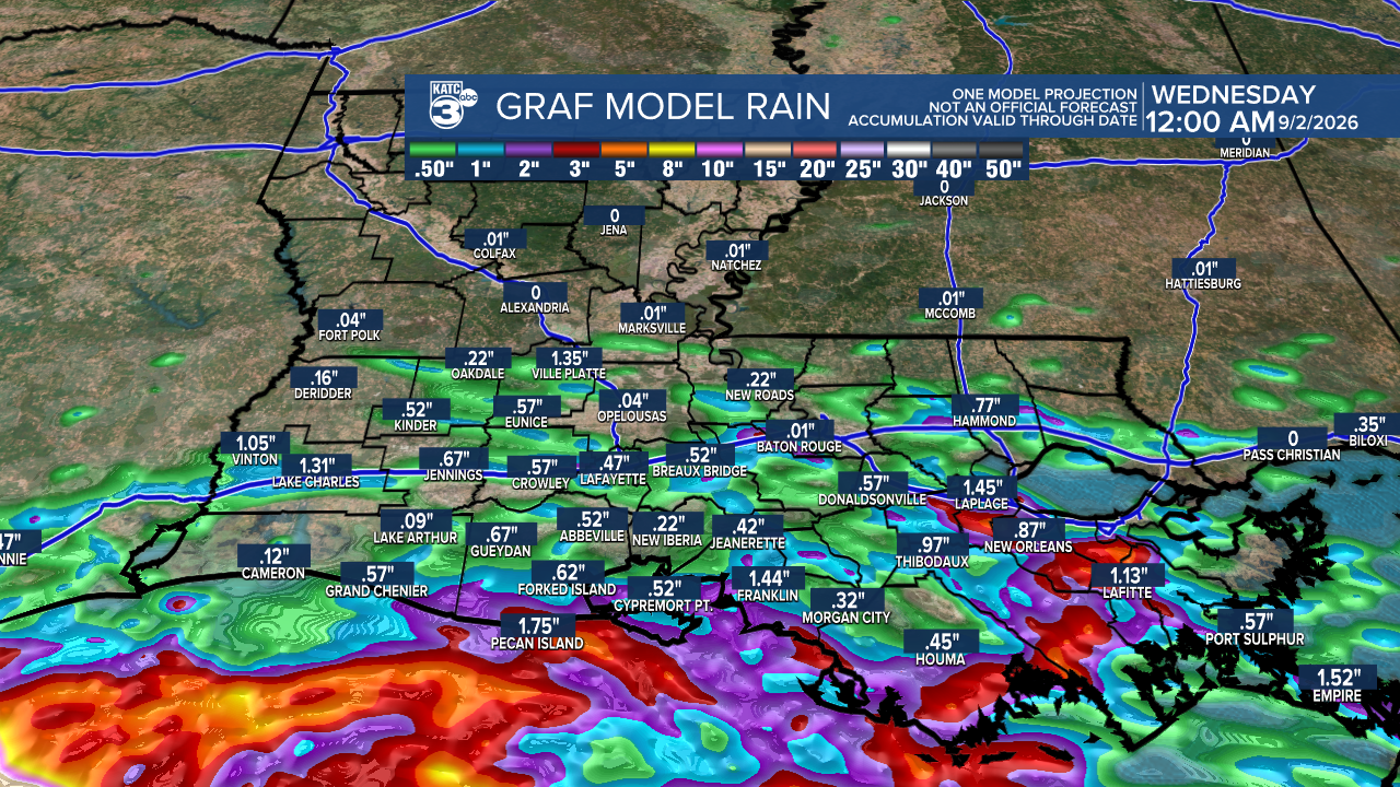
MAIN TAKEAWAYS: Expect scattered tropical showers and thunderstorms starting tomorrow and continuing into Tuesday. The heaviest rainfall is likely to remain offshore, but some areas along the coast can expect pockets of locally heavy rain.
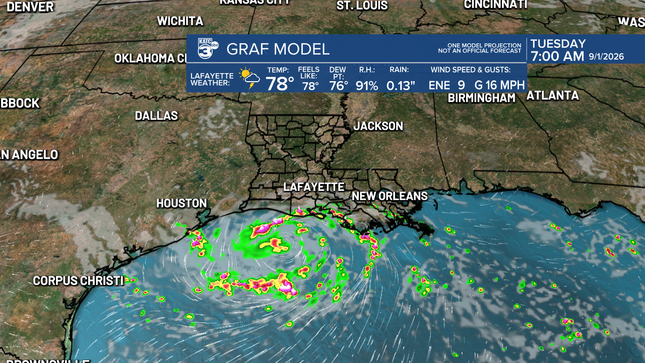
Wind gusts near 30 mph may occur on Monday for areas right along the coast, while areas further inland may experience breezy conditions.
As for Dolly, its remnants are still active, bringing showers and storms from Puerto Rico to the Virgin Islands. While redevelopment isn’t expected in the short term, conditions may become more favorable later in the week.
Follow Meteorologist Breyanna Lewis for further updates.
See the KATC 10 Day Forecast for the latest.

