


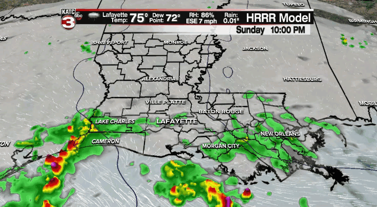
We've seen off and on tropical showers on our Sunday.
A batch of showers offshore late this afternoon is trying to push inland.
We'll see if they hold together, but regardless, I have to maintain slightly elevated rain chances this evening and through the overnight.
There is an ample supply of moisture in the Gulf of Mexico.
All of it is essentially tied to Tropical Storm Nicholas that currently centered in the SW Gulf.
The system will continue to track northwestward in the days ahead as it moves up the Texas coastline.

Although the storm will come onshore into Texas sometime Monday/Tuesday, moisture on the eastern side will continue to stream into the area throughout the week.
As a result, our rain chances will remain elevated.
Heavy rainfall could be possible at times.
Expect a scattering of tropical showers on our Monday.
There will certainly be breaks in the activity, but the day itself will be kind of dreary with cloudy skies in place.
Temperatures will settle into the middle 80s after a start in the lower to middle 70s.
The storm will begin to slow down heading into to mid-week as the steering currents become rather weak.
As a result, rainfall totals will begin to pile up.
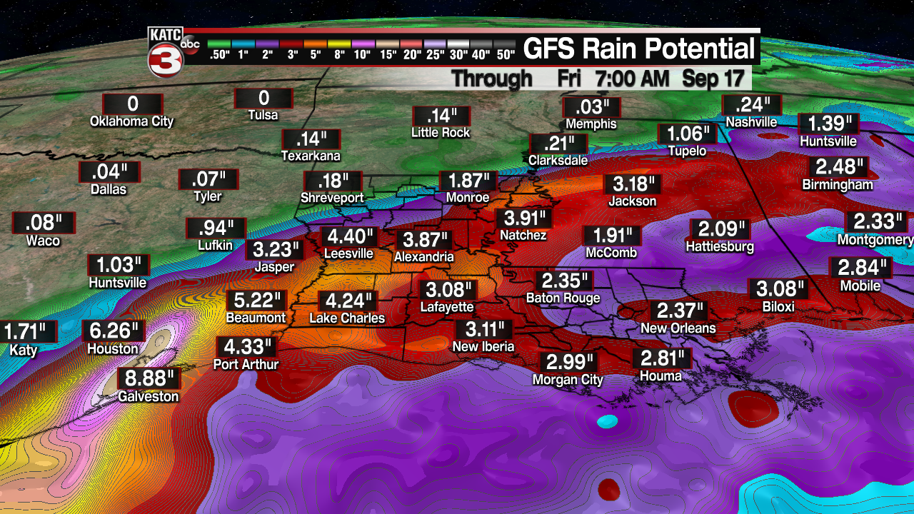
Latest model guidance today has come into a little better agreement on who may end up seeing the highest totals.

Some of the more extreme totals will look to set-up across portions of Texas and may sneak in close to portions of SW LA.
As of now, 4-8"+ of rainfall will be possible across Acadiana through the next week with isolated higher amounts possible, especially along the coastal parishes and points off to the west.
We'll have to watch those models trends closely in case of any subtle shifts.
The rest of the tropics are active with several different areas to keep an eye on, but none of those look to present a threat to the Gulf.
Have a great week and stay dry!
