Acadiana's afternoons will get warmer for the rest of the week but a cool front should arrive in time for the weekend.
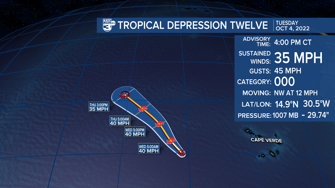
Meanwhile, the tropics are perking up a bit with newly formed Tropical Depression 12 forming in the Eastern Atlantic while another disturbance east of the Caribbean has a high chance of development by this weekend.
Locally, expect pleasant but not as cool temperatures over the next several nights with lows migrating into the low-mid 60s.

Per usual, it will be cooler in the northern Acadiana parishes.
Mostly sunny skies (with a little afternoon sun and cloud mix Wednesday) are anticipated for the rest of the week.

Daytime highs will reach the mid-80s Wednesday and likely push the upper 80s to 90° Thursday and Friday.

Our next front looks to arrive with little fanfare (other than breezy northerly winds) late Friday night into Saturday morning.
The weekend is setting up to be quite nice with highs closer to the low-mid 80s accompanied by comfortable humidity while night-time/morning lows dip back down into the mid-50s.
The pattern will remain dry through the next week, but we could see some shower activity mid-late in the week ahead of what looks to be another cool front.
See the KATC 10 Day Forecast for the latest.
As mentioned earlier, the tropics have become a little more active with Tropical Depression #12 getting an upgrade today in the far Eastern Atlantic.

TD12 could briefly become Tropical Storm "Julia" but will be a short-lived system with no threat to land.

Meanwhile, Disturbance 91L east of the Caribbean has a 70% chance of development, especially when the system approaches the Central/Western Caribbean Sea where atmospheric conditions are expected to be more conducive for development and barring any land interactions with South America.

It remains too early to tell whether 91L will be any threat to the Gulf of Mexico, but as of today, the system looks to take a more southerly route with Central American and/or Mexican impacts the most likely scenarios at this time.

The next name after Julia will be Karl.
------------------------------------------------------------
Stay in touch with us anytime, anywhere.
To reach the newsroom or report a typo/correction, click HERE.
Sign up for newsletters emailed to your inbox. Select from these options: Breaking News, Evening News Headlines, Latest COVID-19 Headlines, Morning News Headlines, Special Offers


