


Acadiana's unseasonably warm weather will continue Friday, but big changes are on the way this weekend with showers likely Saturday followed by a gray winter chill for Sunday into Monday.
In the near term, look for another mild, partly cloudy and probably partly foggy night through daybreak Friday.
The National Weather Service has already issued a Dense Fog Advisory for all of Acadiana between 3 and 9 am.

And after any morning fog and clouds, once again look for intervals of afternoon sun to push our temperatures back into the upper 70s to lower 80s...and once again, the record of 82° for Friday may be threatened.

Rain chances will stay low, in the 10-20% range Friday with the higher end of the range, possible into Friday evening.
Mild temperatures will continue into Saturday with highs reaching the upper 70s to near 80° prior to showers and our next cool front arriving during the afternoon.

Showers, and perhaps a few embedded thunderstorms will likely precede, accompany and follow the front with best rain chances in the afternoon/evening hours.
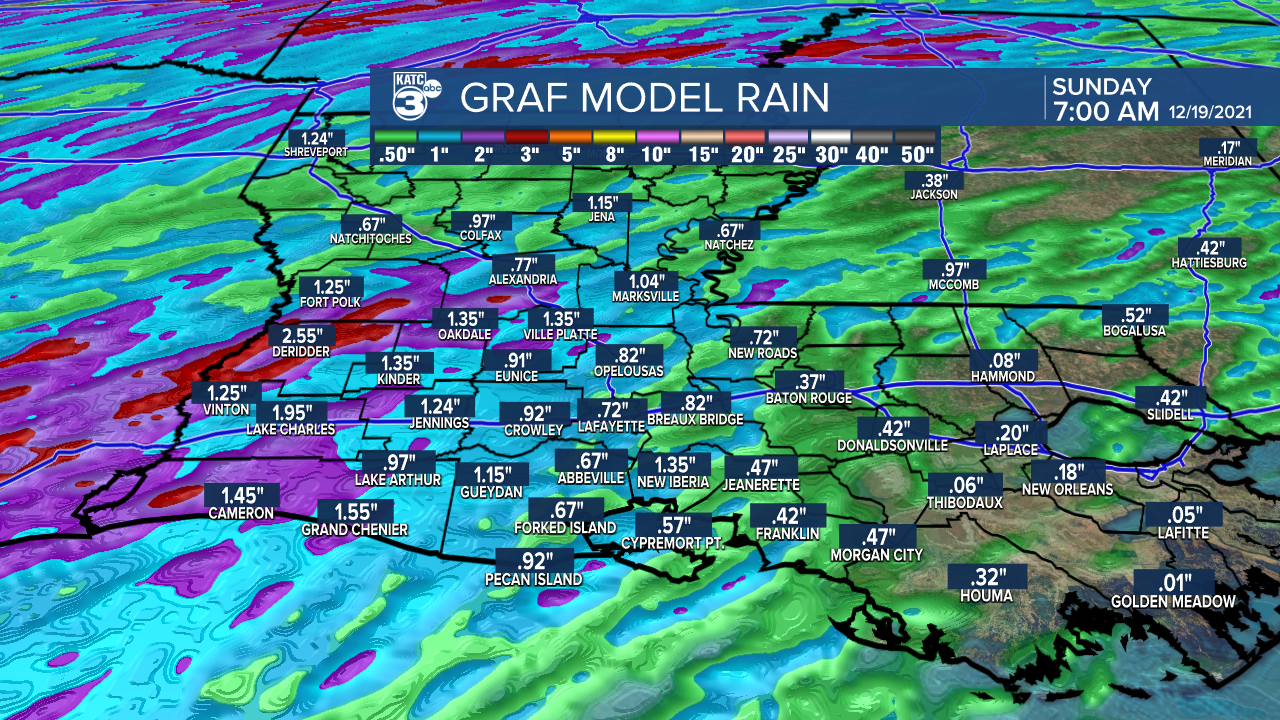
Model estimates are a little more robust on rainfall totals than most of the fronts we've seen in the last couple of months, with weekend totals at least in the 1/2" range...isolated spots may see more than an inch.
In Lafayette's case, 2021 is already the 9th wettest year on record, so any additional rainfall should push us up several levels higher on the top 10 list.
In the wake of Saturday's front look for temperatures to drop into the 50s during the day and 40s at night Sunday and Monday.
And as another upper level disturbance approaches the region by Sunday night, plan on plenty of clouds and perhaps a few sprinkles Sunday with periods of rain and chilly conditions into Monday.
Thereafter, some very nice, and finally seasonable weather is anticipated into mid-next week, while another warm-up is anticipated later in the week and into the weekend.
Highs in the mid-70s will be back from next Thursday through Christmas weekend.
Se the KATC 10 Day Forecast for the latest.
------------------------------------------------------------
Stay in touch with us anytime, anywhere.
To reach the newsroom or report a typo/correction, click HERE.
Sign up for newsletters emailed to your inbox. Select from these options: Breaking News, Evening News Headlines, Latest COVID-19 Headlines, Morning News Headlines, Special Offers
