


After a stormy and noisy Wednesday night, things cleared out nicely this afternoon with full sunshine returning to the region.
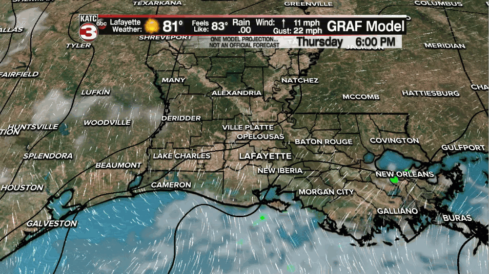
That April sun helped to push temperatures into the mid-80s, so it was certainly a warm one out there.
Clouds will be on the increase overnight tonight as low temperatures struggle to drop into the upper 60s.
Patchy fog will be possible in spots as moisture continues to build across the region thanks to southerly winds.
Expect more clouds around on Friday, although we should still see intervals of sunshine.
It will be a warm and muggy day as afternoon highs approach the lower to middle 80s once again.
With enough low-level moisture and daytime heating in place tomorrow, we can not rule out a passing shower or two, but rain chances will sit no better than 20%.
Impulses of energy within the upper-level pattern will help to generate rounds of scattered showers and storms across a good chunk of the Southeast on Friday.
Of course, when we are talking storms this time of year, there is probably a severe threat to go along with it.
Indeed there is. An enhanced risk (level 3 out of 5) is in place across the northern parts of the state and into Mississippi and Arkansas.

Meanwhile, here across Acadiana, there is a slight risk (level 2 out of 5) in place for northern parishes and a marginal risk (level 1 out of 5) for areas along and south of the interstate.
Timing for us still looks like late Friday night and into Saturday morning... more than likely up until the mid-morning time frame on our Saturday.
Storms that push through could contain locally heavy rainfall, gusty winds, some hail and maybe an isolated tornado, so we will be watching that closely.
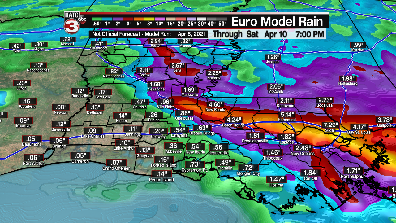
Models have been in fairly good agreement that the worst of the weather and heaviest rainfall totals will be setting up just to our north and east.
Still, a decent soaking can be expected across the region.
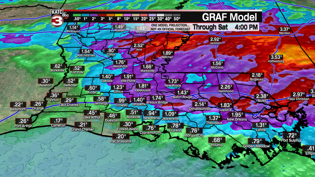
Expect 1/2"-1" of rain with locally higher amounts possible, especially in those heavier thunderstorms.
Since we are once again looking at an overnight event, you'll want to make sure to have ways to receive weather alerts in the event a warning is issued for our area.
Make sure your phone is not on silent so you'll be able to hear any alerts and you can also download the katc weather app for the latest information.
Rain should taper by Saturday afternoon and really, the weekend as a whole does not look too bad.
In fact, mostly sunny skies will be back on Sunday.
Temperatures will still push near 80° this weekend.
Slightly cooler into next week with some daily rain chances remaining in the mix.
------------------------------------------------------------
Stay in touch with us anytime, anywhere.
To reach the newsroom or report a typo/correction, click HERE.
Sign up for newsletters emailed to your inbox. Select from these options: Breaking News, Evening News Headlines, Latest COVID-19 Headlines, Morning News Headlines, Special Offers
