


After a breezy spring-like weekend, Acadiana is in for cooler conditions over the next couple of days with a good chance of showers developing Tuesday into Tuesday evening.
An upper disturbance embedded in the sub-tropical jets stream will draw the cool front that passed through Acadiana early Monday back to the north with clouds returning overnight, and eventually scattered showers for our Tuesday.

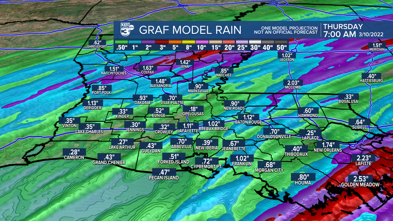
Best rain chances Tuesday look to arrive for the afternoon into the evening hours with rain chances near 70-80%...the day won't be a washout, but more extended periods of rain shower activity is anticipated toward the end of the day.

Rain totals for most folks will generally be less than 1/2" but a few spots may receive more associated with the few embedded thunderstorms that may be possible.
Cooler temperatures in the the 50s are expected overnight, with readings barely making the lower 60s Tuesday.

The temperature forecast will be rather tricky Tuesday with readings still possibly reaching the lower 70s toward St Mary parish while northern portions of Acadiana will be closer to the lower 50s at best.
Rains should end later Tuesday night with a few lingering, isolated showers possible into early Wednesday.
Clouds should stick around Wednesday (along with the sub-tropical jet stream) with lows in the upper 40s and highs mostly in the upper 50s to near 60°.
Sunshine with temperatures rising back into the 70s are anticipated Thursday ahead of a fairly strong March cold front arrives to the area Friday.
Showers and storms will be likely with the next front Friday, with the possibility of severe weather not ruled out at this point.

Behind Friday's front, Acadiana will get a little taste of winter under sunny skies this weekend.
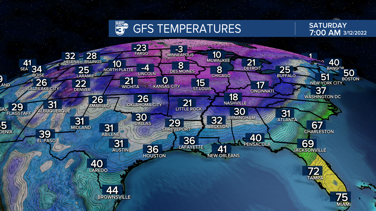
Highs will be suppressed in the low-mid 50s Saturday and upper 50s to lower 60s Sunday while more importantly, overnight lows drop into the low-mid 30s.

The coldest readings, and perhaps for the rest of this month, may come Sunday morning with lows in the lower 30s possible...and we cannot rule out a light freeze, especially for the northern Acadiana parishes.
Thereafter, milder temperatures and a quiet pattern will stay with us for much of next week.
See thee KATC 10 Day Forecast for the latest.
---------------------------------------------------------
Stay in touch with us anytime, anywhere.
To reach the newsroom or report a typo/correction, click HERE.
Sign up for newsletters emailed to your inbox. Select from these options: Breaking News, Evening News Headlines, Latest COVID-19 Headlines, Morning News Headlines, Special Offers
