Happy 4th, everyone!
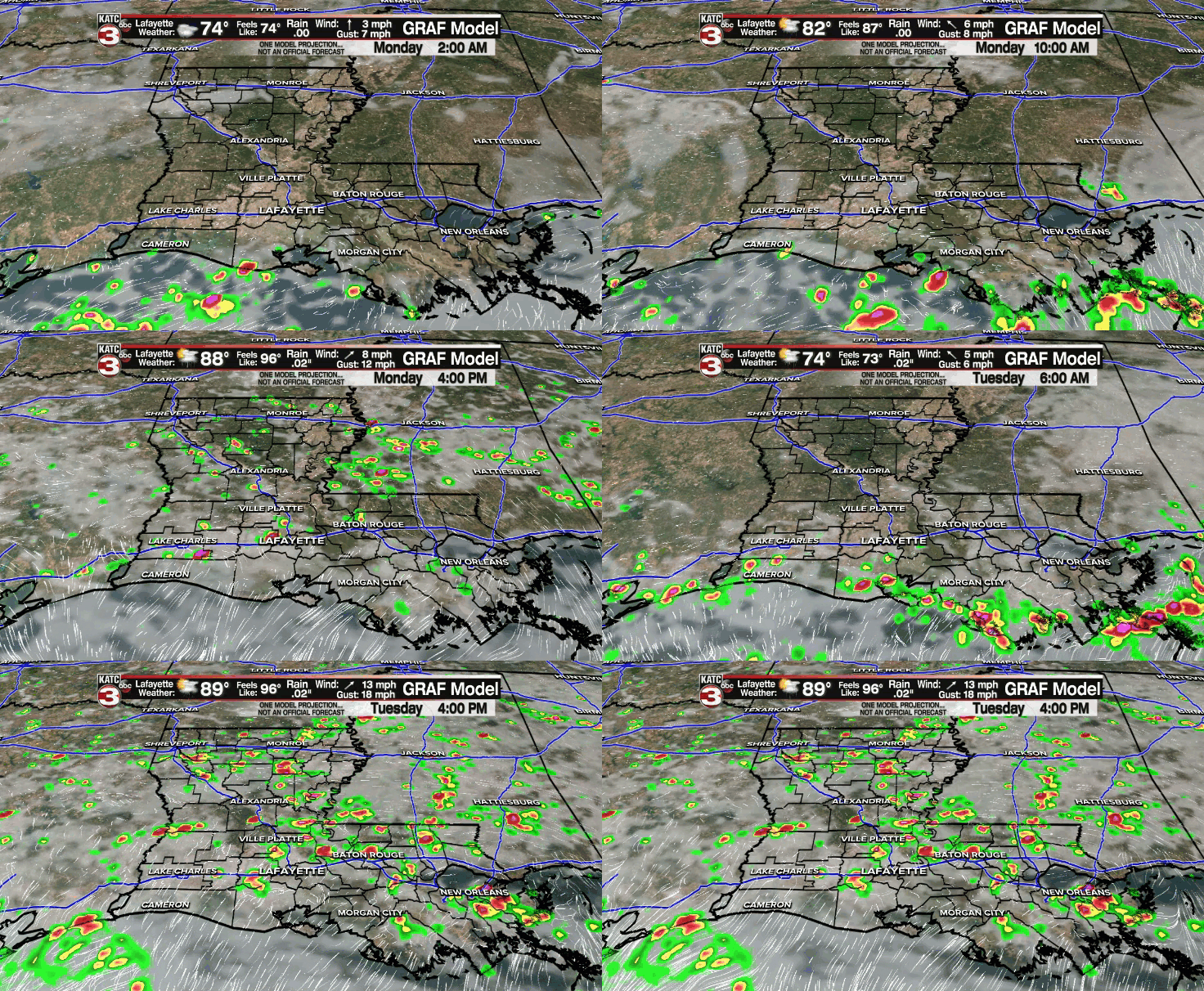
As expected, the frontal boundary that plagued portions of the area yesterday with heavy showers and storms has pushed offshore as drier air filtered in behind it.
As a result, there was fewer storms around today, so hopefully you were able to enjoy!
Overnight lows will be dropping down into the middle 70s with maybe some patchy fog trying to develop in spots.

Monday will look pretty similar with that sun and cloud mix and about a 30% chance for late afternoon/early evening storms.
Afternoon highs will top out near 90°.
By Tuesday and through mid-week, we'll start to see a return of deeper tropical moisture moving in from the Gulf.
That, coupled with our typical daytime heating, will help to generate a slightly better scattering of showers and storms for our afternoons.
Rain chances will sit in the 50-60% range through Thursday.
High temperature will settle into the upper 80s.
A typical summertime scenario looks to take shape into the following weekend.
Have a great week!
In the Tropics:
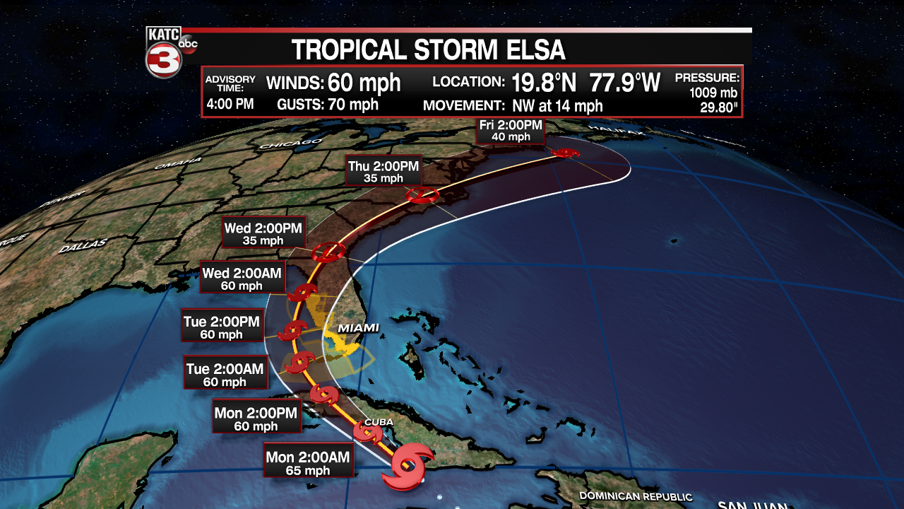
Tropical Storm Elsa will be moving over Cuba by Monday.

It is then expected to emerge into the eastern Gulf and make a turn toward the west coast of Florida sometime late Tuesday into early Wednesday as a tropical storm.
It will then continue to skirt the Georgia and Carolina coasts into the middle and latter parts of the week before eventually heading out to see.
It remains no threat for us in Acadiana.
The rest of the tropics are quiet at this time.
Saharan dust may engulf the Atlantic heading into mid-July which would tend to keep tropical activity at bay, so we'll see how that plays out in the days/weeks ahead...
------------------------------------------------------------
Stay in touch with us anytime, anywhere.
To reach the newsroom or report a typo/correction, click HERE.
Sign up for newsletters emailed to your inbox. Select from these options: Breaking News, Evening News Headlines, Latest COVID-19 Headlines, Morning News Headlines, Special Offers


