


Showers and thunderstorms will be likely for Acadiana Thursday in advance of a strong cold front that will bring a brief period of winter temperatures back to the region into the weekend.

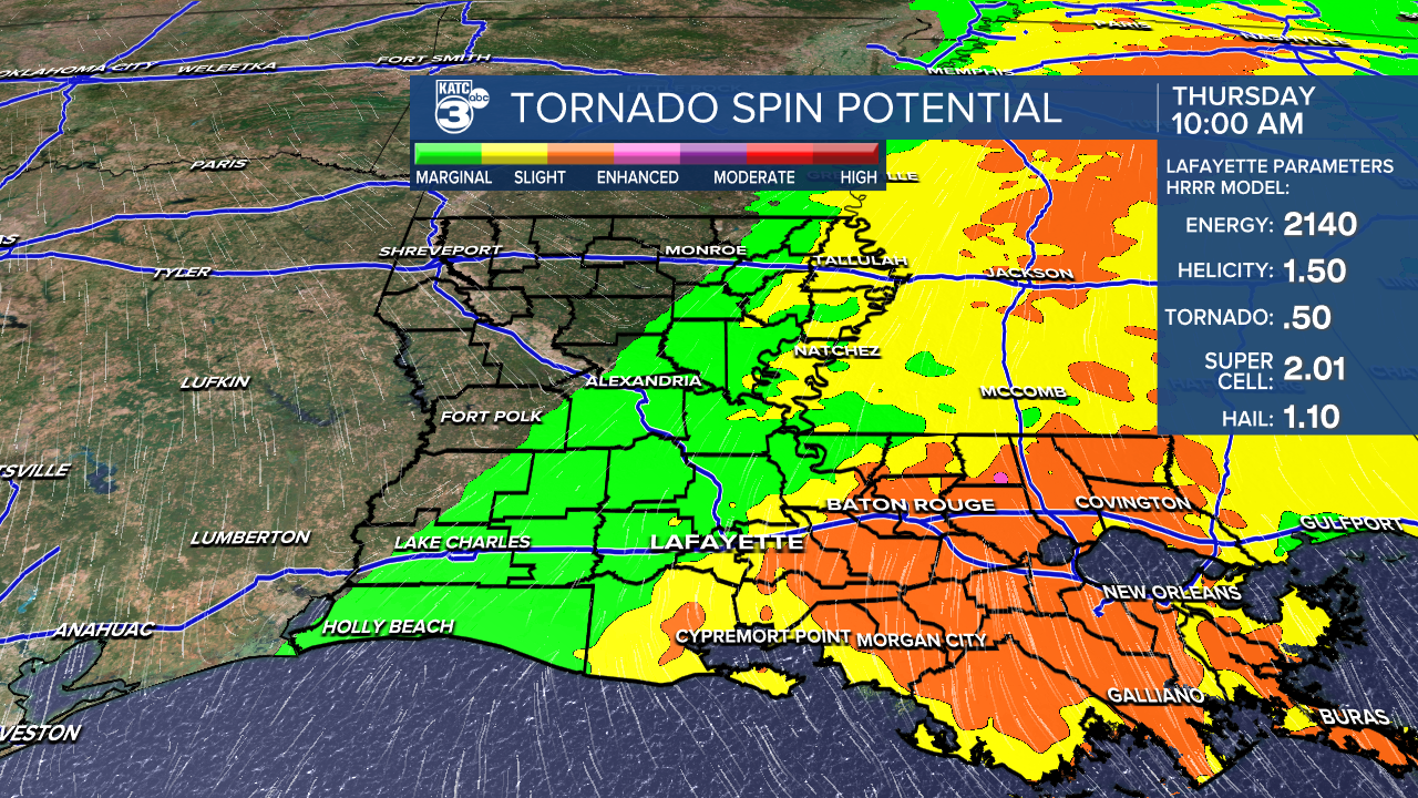
The Storm Prediction Center (SPC) has the Acadiana area hatched in for a "marginal to slight risk" of severe storms with the most robust dynamics in the eastern half of our area.

Storms could become severe primarily from mid-morning through the mid-afternoon period with the severe weather dynamics becoming higher, per usual, into Mississippi.

For Acadiana the primary threat could be damaging winds, but an isolated tornado and/or some hail will be possible in the more intense storms.
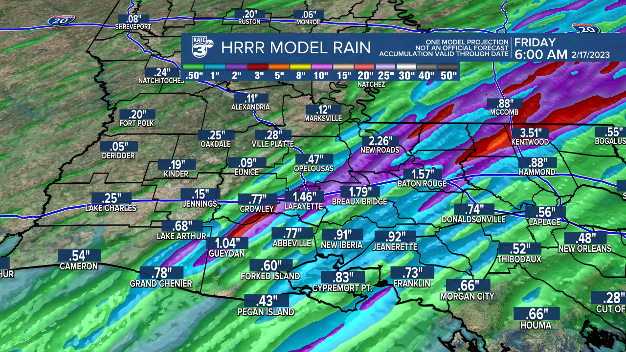
Rainfall for most Thursday will be generally less than an inch, but there will probably be a stripe or two where 1-2" of rain, or a little more may fall wherever storms repeat over a particular isolated area...no significant risk of flooding is anticipated.
Activity will gradually end from west to east while the cold front begins to outpace and undercut the severe weather threat into the latter part of the afternoon and evening.
A blast of a winter chill will follow the front with temperatures dropping into and staying mostly in the 40s Friday while readings dip into the 30s Friday night into Saturday morning.

There will be breezy conditions that follow this system so wind chills by Saturday morning could dip as low as the upper 20s.
The weekend, and all parades Friday and Saturday, look dry and seasonably cold.
The Friday and Saturday night parades will be the coldest while sunshine during the days Saturday will warm things up a little bit.
Wind chill will be less of a factor into Saturday evening but bundle up for all parades!
Editors note: I'll be in the KATC Weather Truck leading the Bonaparte Parade Saturday night!
Daytime highs this weekend might be limited by some high clouds with highs in the mid-50s Saturday but warming back into upper 60s Sunday.
A significant warm-up and extended taste of early spring is anticipated next week under partly to at times mostly cloudy skies.
Highs will be pushing the upper 70s to lower 80s Monday through Thursday.
Mardi Gras looks breezy with partly to mostly cloudy skies accompanied by high temperatures near 80°, along with a slight chance of a shower, no higher than 20%.
Even though another front with some rain chances arrives Wednesday, it's beginning to look like a milder and milder pattern to finish the month of February.
See the KATC 10 Day Forecast for the latest.
------------------------------------------------------------
Stay in touch with us anytime, anywhere.
To reach the newsroom or report a typo/correction, click HERE.
Sign up for newsletters emailed to your inbox. Select from these options: Breaking News, Evening News Headlines, Latest COVID-19 Headlines, Morning News Headlines, Special Offers
