Stormy conditions are expected for Acadiana later Wednesday afternoon into Wednesday evening with some potential for severe weather.

The Storm Prediction Center has upgraded the risk of severe storms for Acadiana to a slight risk, level 2 out of 5, for storms that may be able to produce damaging winds and perhaps, an isolated tornado.

In the near term expect much milder conditions overnight with temperatures holding in the mid-60s.
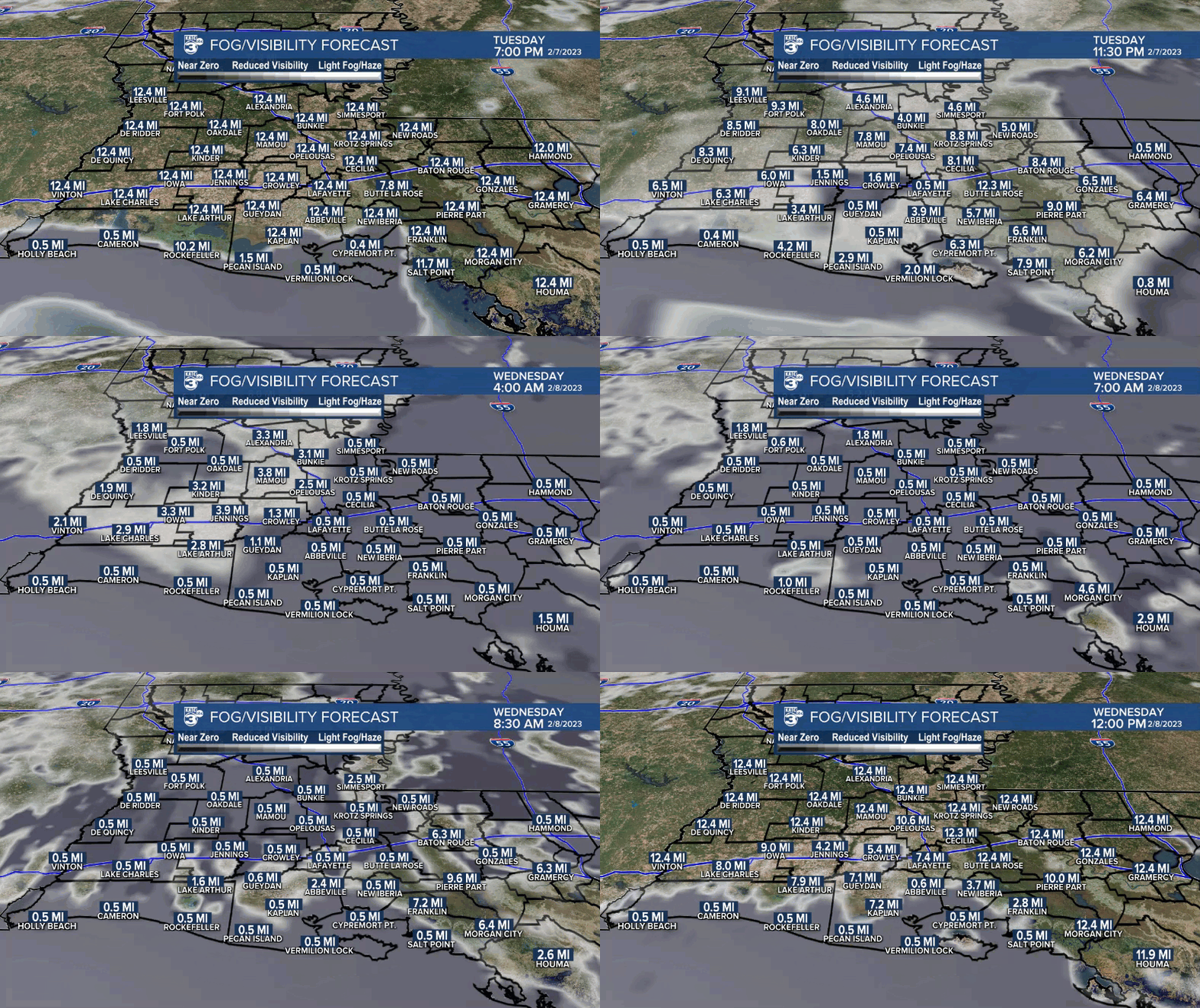
Some areas of sea fog could move into the region later tonight...combined with some lower cloud decks, Acadiana could see some reduced visibilities at daybreak Wednesday.

A vigorous upper level low pressure system in West Texas Tuesday afternoon will advance eastward and northward into Wednesday sparking weak surface low pressure and a frontal boundary that will sweep through the area Wednesday night.
Per usual, it will be interesting to see if the more stable marine layer plays a role in mitigating storm intensity as it tends to do this time of year through April, and the marine layer may keep any potential rotating cells elevated with their damaging winds remaining aloft.
This time around however, the models are initiating thunderstorm activity Wednesday earlier in the day offshore in the Gulf of Mexico from the Upper Texas Coast to coastal Southwest Louisiana...indicating that perhaps the marine layer may not be a significant player this time as there is also more storm "energy" available this time around.

Showers and storms will be likely for Acadiana later Wednesday afternoon into the evening hours with storms prime-time anywhere between 5-10 pm for most...add a few hours to either side of that time-line from west to east across our area.
Fortunately, the storms will be moving along at a relatively quick pace, and provided we don't see too many "training" repetitive storms over any location, most of us will see generally between 0.5-1.5" of rain.
Per usual, there will be a few post that could catch 2"+ but widespread flooding is not expected.
Highs Wednesday should reach the mid-70s in spite of cloud cover and stiff southerly winds developing near 15-25 mph with a few gusts to 30-35 mph possible into the evening hours just ahead of the main line of storms expected.
The precipitation ends most areas before midnight Wednesday night with partly cloudy and slightly cooler conditions anticipated Thursday.
Another upper trough will swing through the area Friday, perhaps producing some high cloudy periods and a low end chance of a shower or sprinkle.
Behind that trough, expect a legitimate winter chill return with highs mostly in the 50s Friday into the weekend.
More importantly night-time lows will drop into the 30s this weekend, with a very light freeze (and/or frost) possible by Sunday morning.
By the way, Lafayette has not seen freezing temperatures since the Christmas 2022 chill, and this may be one of a few remaining chances that we get to to see freezing temperatures...albeit a light freeze.
At least we should see nearly wall to wall sunshine this weekend.
Thereafter, temperatures will begin to moderate late Sunday into early next week with a couple of wet weather systems likely by Tuesday and perhaps again later next week around Thursday.
Still too early to make any call for Mardi Gras, but if attending any parades this weekend (especially the evening ones) dress warmly...temperatures in the 40s with wind chills in the 30s will be likely for Friday and Saturday evenings.
Consult the KATC 10 Day Forecast for the latest.
------------------------------------------------------------
Stay in touch with us anytime, anywhere.
To reach the newsroom or report a typo/correction, click HERE.
Sign up for newsletters emailed to your inbox. Select from these options: Breaking News, Evening News Headlines, Latest COVID-19 Headlines, Morning News Headlines, Special Offers


