


An unsettled and a quite changeable weather pattern is in the forecast for Acadiana this week with spring-temperatures yielding to winter again later in the week, and a good soaking likely in between.
In the near term, a disturbance that has been producing widespread rain in Southeast Texas Monday will be heading for the Gulf of Mexico overnight into Tuesday.

While the system is expected to lose upper support and weaken, there will still likely be a good chance (60%) of scattered showers for our Tuesday.
It will also be a breezy and mild day Tuesday with highs reaching the upper 60s.

Rain chances into Wednesday will be lower (but not out), with temperatures rising into the balmy mid-upper 70s ahead of a strong cold front that looks to arrive early Thursday.

Thursday's front will likely bring the chance of showers and thunderstorms to the region late Wednesday night with periods of rain (near 100%) following the surface front into Thursday.
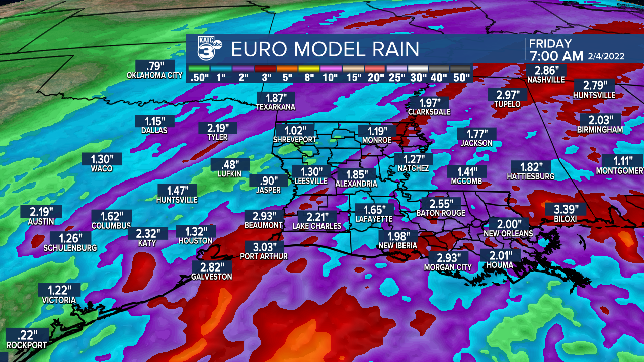
While rain totals Tuesday generally will be 1/2" or much less, the rains Wednesday night into Thursday could bring a good soaking of a couple of inches.
Farther north, Thursday's frontal system and upper level energy will be a prodigious snow and ice-maker from the Plains to the Northeast through late this week.

Well north of the front snow totals of a foot or more will be possible, with a significant, long duration, crippling accumulating icing event possible south of the snow areas...none of this will threaten Acadiana.

Colder weather will arrive to Acadiana Thursday, with temperatures starting out near 70° in the morning dropping into the upper 30s Thursday night.
Clouds and some precipitation chances may linger into the weekend, with a disturbance arriving Saturday night that could bring showers and perhaps a light, non-accumulating wintry mix to the area, but odds are low at this point.
Winter-like temperatures look to stay in Acadiana for at least a week following Thursday morning's cold front.
See the KATC 10 Day Forecast for the latest.
------------------------------------------------------------
Stay in touch with us anytime, anywhere.
To reach the newsroom or report a typo/correction, click HERE.
Sign up for newsletters emailed to your inbox. Select from these options: Breaking News, Evening News Headlines, Latest COVID-19 Headlines, Morning News Headlines, Special Offers
