


After a breezy and warm Friday, the weather pattern is expected to turn stormy for Acadiana after midnight through daybreak Saturday.
Before hand, expect a mild Thursday night/Friday morning with temperatures holding in the mid-upper 60s as winds gradually freshen by morning while clouds gradually increase.

Friday will be staying warm with mostly cloudy skies accompanied by a few intervals of sun.
It should become breezy into the afternoon with the chance (30-40%) of a brief shower or thundershower from the latter part of the afternoon into the early evening hours.
Winds will gust in the 20-25 mph range Friday afternoon with gusts increasing to near 30 mph into Friday night.

After midnight Friday night, a squall line of intense showers and storms will be pushing through the state reaching most of Acadiana prior to daybreak Saturday.

Rain chances should increase area-wide to near 100% after midnight through 7-9 am Saturday.
The Storm Prediction Center has much of Acadiana hatched in for a slight risk (level 2 out of 5) of a few severe storms that could produce damaging winds and/or a few isolated tornadoes.

The greatest risk of severe storms will be from Western into Central Louisiana clipping the northwestern and northern portions of Acadiana.
The risk of severe storms Friday will be greatest in Northeastern Texas through the ArkLaTex where an enhanced risk of storms, especially the possibility of super cell storms, will exist...there will be tornado watches there Friday.

As the storms push through Acadiana they should be losing some of their severe weather dynamics, but do not be surprised if we have a tornado watch or two issued for portions of the Acadiana Friday night.
The good news is that the storms will be east of Acadiana and Baton Rouge by early Saturday afternoon as to not interrupt any college football games.
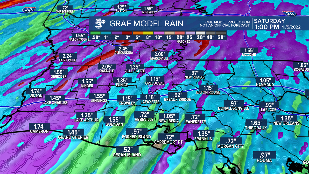
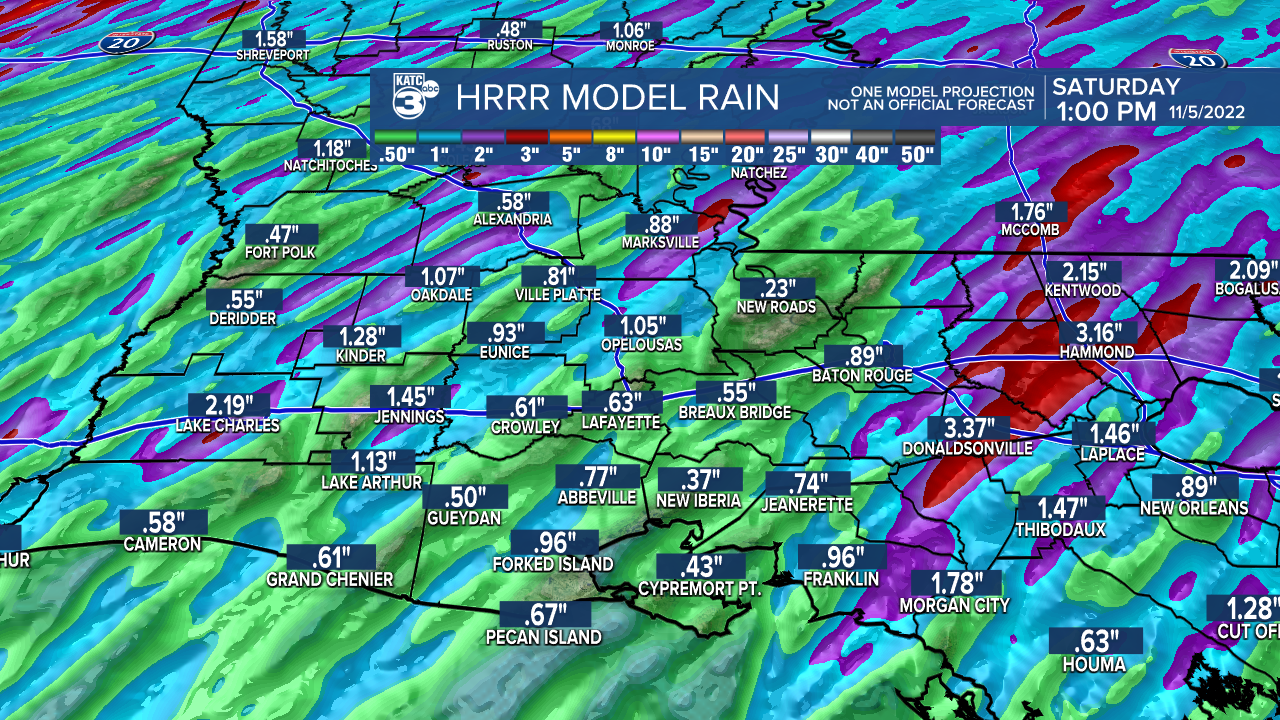
There should be a fairly good soaking for Acadiana with this weather system with models indicating that 1/2-1" of accumulations possible along with a few isolated spots catching up to 2-3" of rain...and where that happens, there could be some brief localized street flooding.
The system coming through the region is expected to stall into Sunday leaving us with more clouds and the lower end chance of an isolated shower.
Thereafter, the pattern into next week looks relatively quiet and nice, albeit warmer than normal.
With any luck we'll see a nice cool front toward the end of next week.
See the KATC 10 Day Forecast for the latest.
------------------------------------------------------------
Stay in touch with us anytime, anywhere.
To reach the newsroom or report a typo/correction, click HERE.
Sign up for newsletters emailed to your inbox. Select from these options: Breaking News, Evening News Headlines, Latest COVID-19 Headlines, Morning News Headlines, Special Offers
