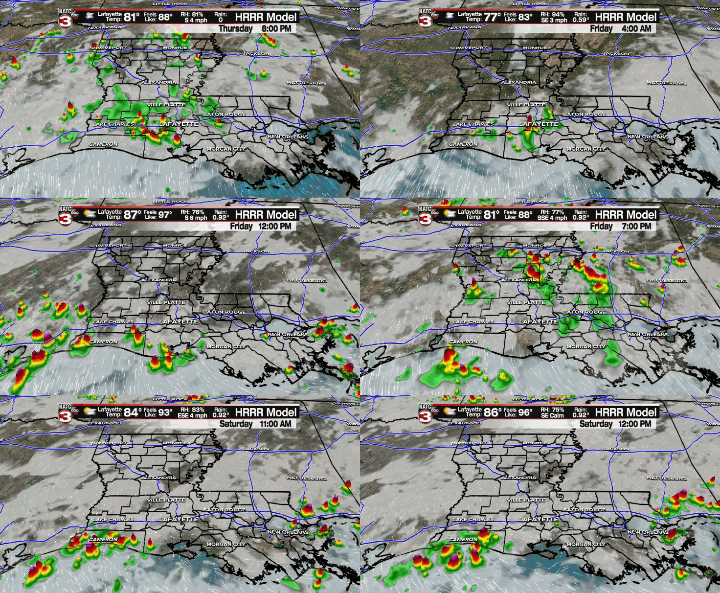
There continues to be no definitive upper-level feature that is driving our weather pattern.
Instead, there continues to be this general weakness in the atmosphere.
As a result, there really isn't anything that is preventing the combination of the sea-breeze front and daytime heating from generating a scattering of those showers and storms.
Additionally, there is no rhyme or reason to the activity... but locally heavy downpours and frequent cloud-to-ground lightning remain possible with any one storm.
Scattered storms will remain with us through the rest of this evening and some re-development later tonight with rain chances in the 30-40% range.
Low temperatures will fall into the lower and middle 70s.
More of the same can be said as we round out the week on Friday with a healthy scattering of those showers and storms.

Rain chances will sit at 70%.
High temperatures will settle into the upper 80s.
Similar story heading into the weekend with rain chances in the 50-60% range.
Temperatures will settle into where they should be this time of year in the upper 80s to lower 90s.
A frontal trough will look to move in going into the first half of next which will likely keep our rain chances elevated.
With any luck, some drier may try and filter in by the latter part of next... but that is yet to be seen.
Bottom line: Just keep the rain gear handy and be prepared to dodge storms over the next several days.
In the Tropics:
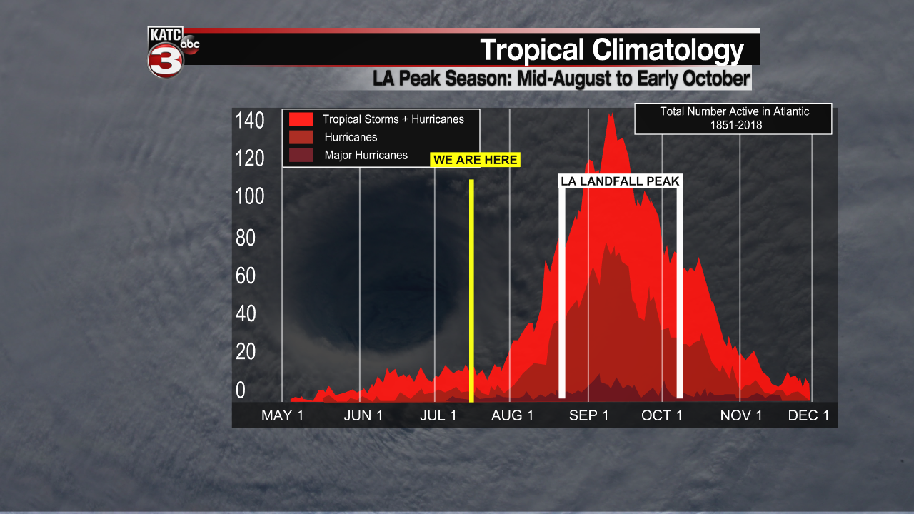
Things are still looking good and quiet with no new developments expected at least through the next five days.
Just so we don't lure anyone to sleep, it is important to note that the peak of the season occurs in August, September (Peak September 11th) and early October... so we still have a ways to go.

BUT, at least at this point, there is nothing that we have to be worried about!


