


There will be a fairly good chance of scattered showers and thunderstorms in the forecast for Acadiana through Thursday, but drier and consequently hotter weather is expected to take over into the weekend.
In the near term, after an early evening shower or storm, look for fair, warm and humid conditions overnight through Wednesday morning with steamy lows in the mid-upper 70s.
Look for more hot and humid weather tomorrow with temperatures topping out in the lower 90s before scattered showers and storms take over into the afternoon and early evening.
Rain chances Wednesday should be near 40-50% and possibly up to 50-60% Thursday. There could also be some lingering shower and storm activity into the overnight hours Wednesday through Thursday morning.

By Friday, a ridge of high pressure should begin to bank in from the east helping to squelch (but likely not eliminating) shower and storm activity likely leading to hotter temperatures.
Highs this this weekend should push into the mid-90s while rain chances drop to 20% Friday and will be near 10% Saturday through Monday.
Any days where a little bit of a north or westerly surface wind develops this weekend into early next week could result in temperatures closer to the mid-upper 90s, especially in the northern Acadiana parishes where it's always a few degrees hotter than the rest of the area.
Heat indices near 100° over the next few days should rise to the 104-108° range or more this weekend.
Scattered showers and storms should return to the area as the ridge of high pressure breaks down by mid-next week.
See the KATC 10 Day Forecast for the latest.
Meanwhile in the tropics, Tropical Depression Fred is continuing to produce locally heavy rainfall across the Central Appalachians and interior portions of the Mid-Atlantic States and eventually into the Northeast.
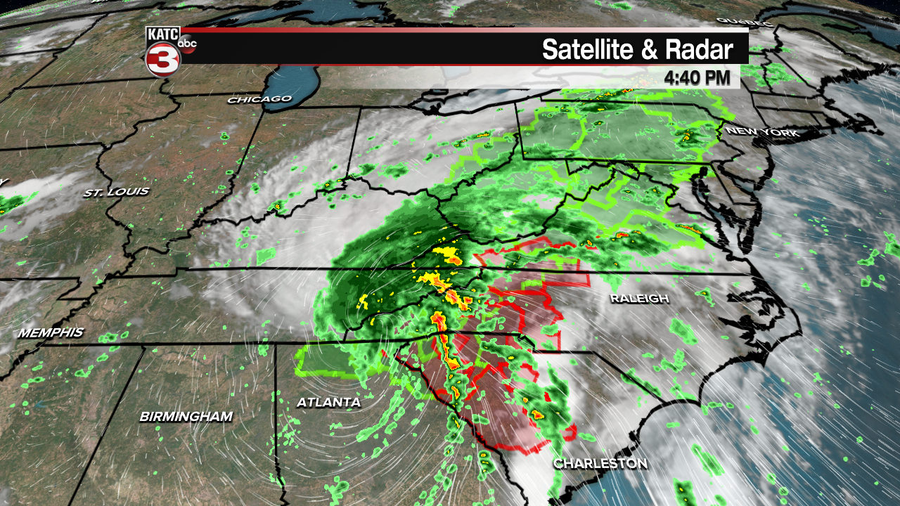
An additional 2 to 4 inches of rain with isolated maximum storm totals of 6 inches expected with this system through Wednesday.
To the east, Tropical Storm Henri near Bermuda, was strengthening Tuesday afternoon and is expected to become a hurricane while looping in the open Atlantic.

Henri should pose no direct threats to the U.S. other than some rip currents and elevated surf along the Mid-Atlantic States.
Farther south, Tropical Storm Grace near Jamaica is expected to become a hurricane Wednesday.

Grace is expected to impact the Yucatan Peninsula Wednesday night into Thursday and emerge and re-strengthen to a hurricane in the Bay of Campeche Friday before a second Mexican landfall by this weekend.

Tropical models continue to suggest Grace could be a stronger hurricane than the official forecasts.
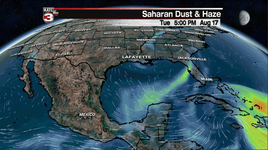
And on a rather positive note, it appears that there will be plenty of Saharan Dust covering large portions of the Tropical Atlantic over the next week to 10 days which should limit tropical activity into the last week of this month.
------------------------------------------------------------
Stay in touch with us anytime, anywhere.
To reach the newsroom or report a typo/correction, click HERE.
Sign up for newsletters emailed to your inbox. Select from these options: Breaking News, Evening News Headlines, Latest COVID-19 Headlines, Morning News Headlines, Special Offers
