


While the chance of scattered showers and thunderstorms won't be going away anytime soon, the risk of activity through mid-week should be a little lower than what it has been for Acadiana of late.
Rain chances look to be more confined to the afternoon/early evening hours with probabilities in the 40-50% range (still above normal for the time of year).
In turn, with fewer storms earlier in the day, temperatures should rise back into the lower 90s Tuesday and perhaps Wednesday before any activity gets kicking in the afternoon.

Deeper tropical moisture and more atmospheric instability are anticipated later this week and into the weekend, raising rain chances back up to near 70-80% by Friday continuing into the weekend.
See the latest KATC 10 Day Forecast.
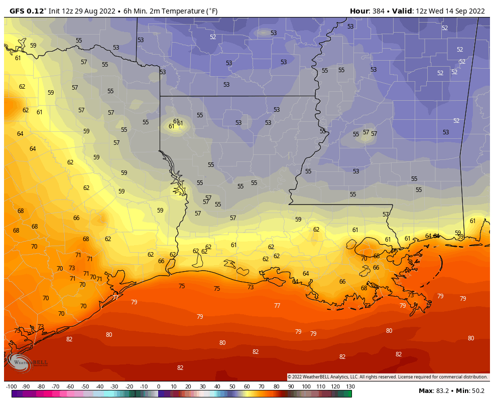
There could be some good news down the line...but tempered by the lack of accuracy of long range models, however both the GFS and Euro are hinting at our first half way decent cool front by mid-September!
While 16 day forecasts are generally horrible, it is a sign that we are just a few weeks away from the time of year when brief breaths of fresh air try to make it to the Gulf Coast.
Meanwhile in the tropics, while there are areas of interest in the Tropical Atlantic, at this time there's not a whole lot threatening the Gulf of Mexico over the next week other than tropical waves keeping the moisture high across portions of the region.

One system of interest that looks to develop in the near-term in the mid-Atlantic is currently expected to make the turn into the open Atlantic before threatening any land areas.
And given we're entering September in a couple of days, we should be seeing multiple areas of concern in the weeks ahead.
Historically August 29th has been a notorious in Louisiana hurricane history with Katrina, Isaac, and Ida all making landfall on this date.

Ida was a very high end Category 4 at landfall with 150 mph winds...and this damaging winds (and Pontchartrain surge) penetrated all the way toward the I-10/I-12 corridor.
------------------------------------------------------------
Stay in touch with us anytime, anywhere.
To reach the newsroom or report a typo/correction, click HERE.
Sign up for newsletters emailed to your inbox. Select from these options: Breaking News, Evening News Headlines, Latest COVID-19 Headlines, Morning News Headlines, Special Offers
