


Well, it looks like the nice stretch of weather we have been enjoying the past few days will start to come to an end on Friday.
Clouds will be moving back into the area tonight and that, coupled with southeasterly flow will hold our temperatures up.
It'll be a milder night for sure compared to the last couple of nights.
Expect a start in the upper 50s first thing on Friday morning.
A few light, isolated showers will be possible through Friday morning, but otherwise, expect a mostly cloudy sky.
Temperatures will be pushing the upper 70s by tomorrow afternoon.
A warm front will be lifting northward by late in the afternoon and into the evening and that boundary could help to generate a few scattered showers and storms.

However, I do not foresee the day being a washout or anything like that.
Furthermore, any storm that does develop could be on the strong to perhaps severe side and capable of producing damaging winds, hail and even an isolated tornado.
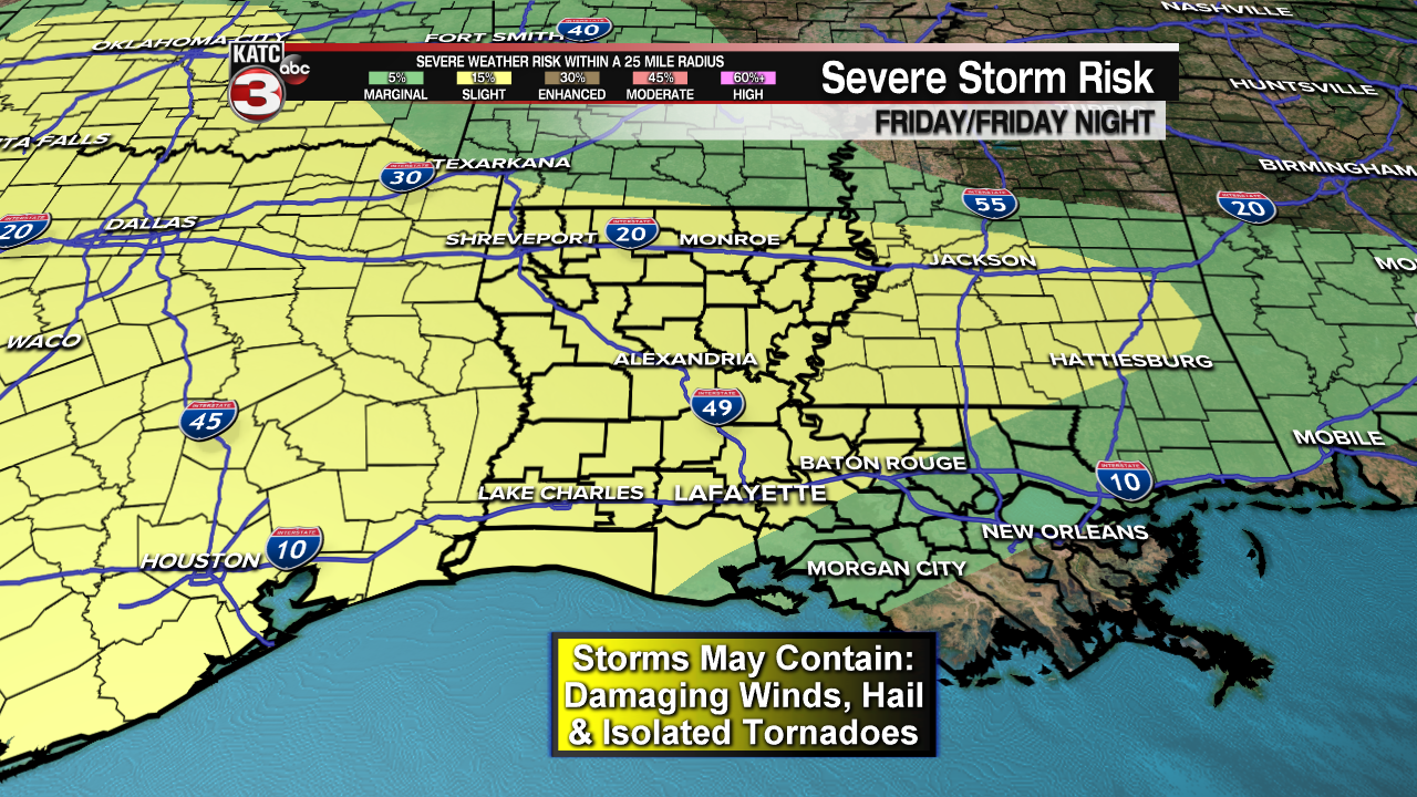
Most of Acadiana remains locked in for a slight risk (level 2 out of 5) to see severe weather tomorrow/tomorrow night.
It does appear that the greatest dynamics and ingredients for severe weather will be setting up just off to our north into CenLa and across northern portions of the state, but we'll still need to be weather aware.
Rain chances stay with us going into tomorrow night as the main surface low pushes through just to the north of the area.
Again, any storm that gets going through the overnight period could be on the stronger side, so make sure you have ways to receive weather alerts while you are asleep.
Of course, you can download the KATC weather app for the latest weather information.
Rainfall should not be much of an issue as most spots pick up less than an inch.
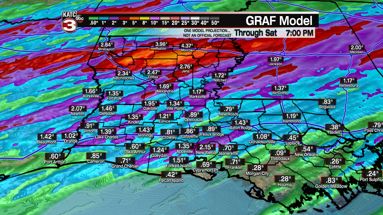

Some locally heavy downpours may certainly be possible.
Some lingering, early morning showers will be possible on Saturday, but then it's back to dry and mostly sunny conditions by Saturday afternoon.
It'll be warm as temperatures push the middle 80s!
A weak "cold" front will push through Saturday night ---> I use the term cold front lightly because temperatures won't really be dropping much behind it.
Plenty of sunshine going into Sunday with afternoon highs settling in close to 80°.
Quiet and warm start to next week as temperatures continue to push the lower 80s.
Our next weather maker will look to arrive sometime during the middle parts of next week.
------------------------------------------------------------
Stay in touch with us anytime, anywhere.
To reach the newsroom or report a typo/correction, click HERE.
Sign up for newsletters emailed to your inbox. Select from these options: Breaking News, Evening News Headlines, Latest COVID-19 Headlines, Morning News Headlines, Special Offers
