


Acadiana will get to enjoy a nice and mostly dry weekend before the weather turns to a more unsettled and wet pattern next week.
In the near term, expect another seasonably cool night through Saturday morning with lows ranging in the upper 50s to lower 60s.

Saturday will bring another day filled with a sun and cloud mix along with warmer temperatures pushing into the lower to mid-80s.

Winds will turn and increase from the south Saturday afternoon/evening insuring milder temperatures (mid-60s) Saturday night into Sunday morning.
Sunday will see more clouds than sun, but it should still be a relatively nice day.
There might be a very slight chance of a a brief pop-up shower into Sunday afternoon (near 10-15%) but this would be mostly likely closer toward Lake Charles rather than Lafayette.
Highs Sunday will be pushing into the mid-80s accompanied by increasing humidity.
Next week will be a different story as ample moisture from the Gulf of Mexico begins to feed into the area while a stormy pattern (and upper low) across Texas and Oklahoma will gradually spill into our region.

This means the chance of daily showers and thunderstorms will increase to the 50-60% range Monday increasing to the 60-80% range Tuesday through Friday at the very least.
And interestingly enough, the GFS Model has been consistently indicating that deeper tropical moisture and a potential disturbance could work its way toward the Gulf of Mexico toward the latter part of the week while the Euro Model doesn't recognize any potential disturbance.

It should be noted that last tropical season the GFS was more reliable than the Euro in the extended period forecasts, and you may remember last year, Tropical Storm Cristobal developed in the Gulf in the first week of June.
So a disturbance such as a depression or low-end tropical storm would not be out of the realm of possibility in the Gulf of Mexico during the last week or two of May.
Of course a lot could change forecast-wise in the days ahead, but something to watch for anywhere from Louisiana to Florida.
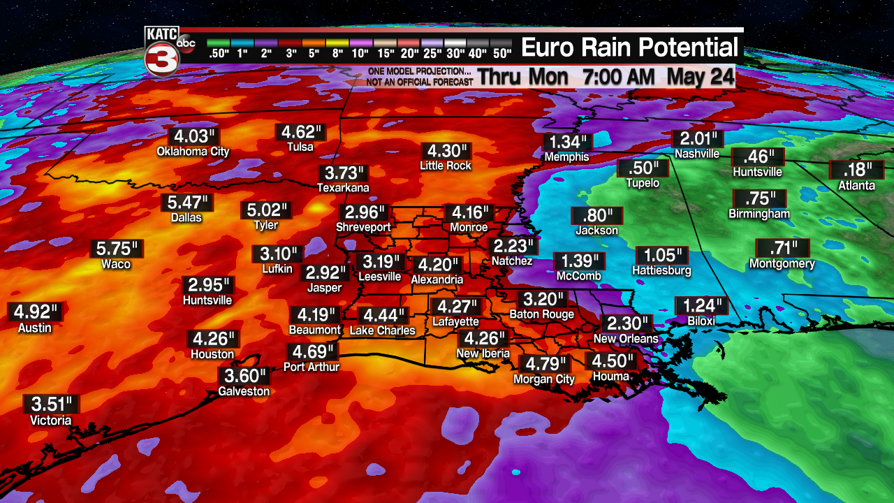
The bottom line for now though is that we should expect several inches of total rain accumulations...perhaps in the 3-6" range Monday through Sunday inclusive...but as we all know, those numbers can be easily doubled given our slow-moving pattern.
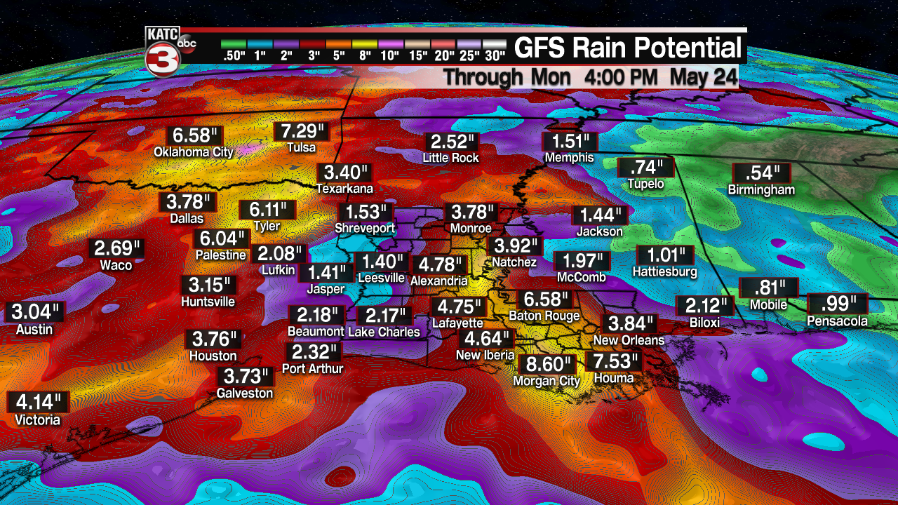
And with area soils still rather saturated combined with high water in our bayous and coulees, there could be some more flood concerns for Acadiana next week.
See the KATC 10 Day Forecast for the latest.
------------------------------------------------------------
Stay in touch with us anytime, anywhere.
To reach the newsroom or report a typo/correction, click HERE.
Sign up for newsletters emailed to your inbox. Select from these options: Breaking News, Evening News Headlines, Latest COVID-19 Headlines, Morning News Headlines, Special Offers
