


Acadiana remains on track not only for threatening a record high temperature Christmas Day, but the region will continue to experience near record matching highs for the better part of the next week.
It's not unusual for Acadiana to have a warm Christmas Eve or Day, but temperatures averaging some 15-20° above normal for the bulk of the last couple of weeks of the year is extremely unusual, and will likely lead to the warmest December for Lafayette on record after all is said and done.
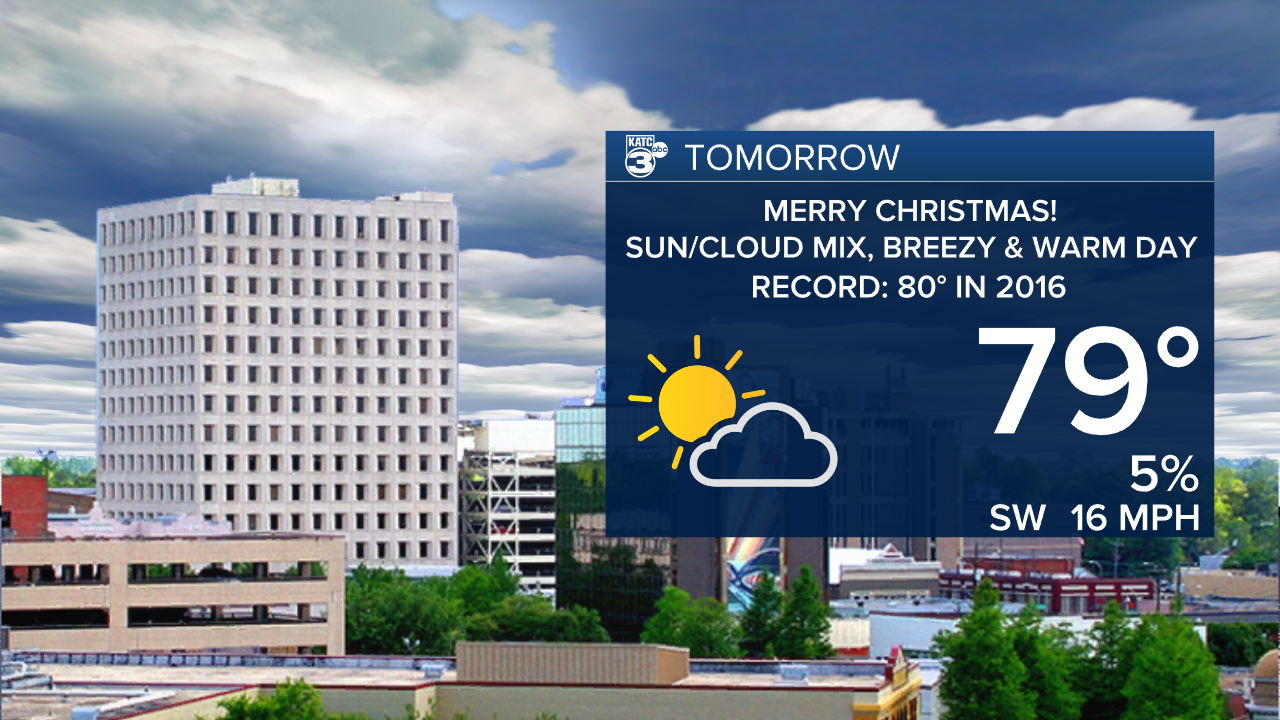
The record for Christmas in Lafayette is 80° set in 2016...most model data is going for 79° for our Saturday and the meteorologist's rule of thumb is to never forecast a "record, so we'll go with 79° for now!
In the near-term, the weather is looking exceptional for Santa's arrival overnight with mild temperatures in the mid-upper 60s accompanied by a slight tropical southerly breeze.
Last check on our Santa 3000 Tracker, had Santa in Eastern Europe heading for Scandinavia early this evening, already delivering more than 3.3 billion presents!

Christmas Day will bring another breezy and warm, sun and cloud mix with highs in the upper 70s to near 80° in a few spots.

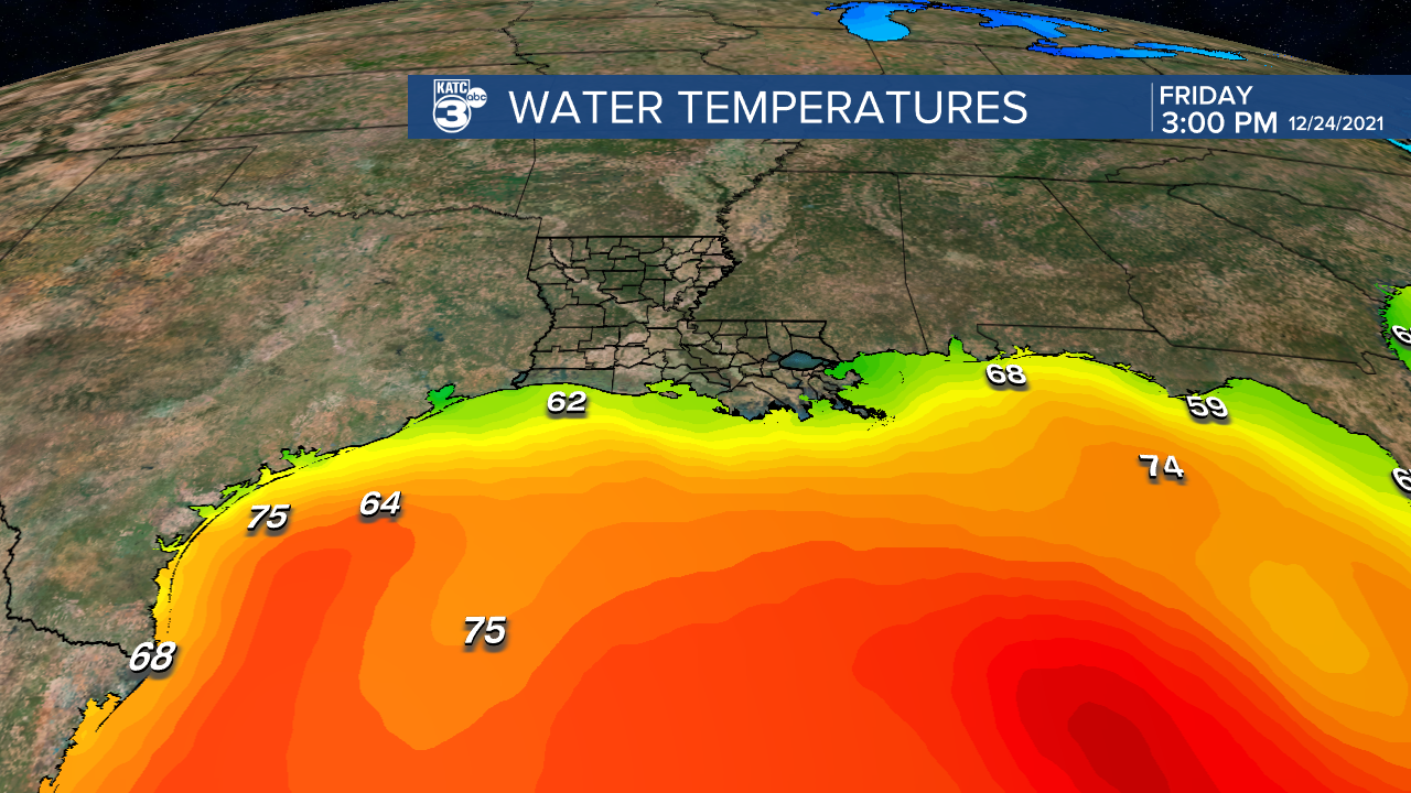
The main feature keeping our temperatures from getting too warm is the cooler shelf water temperatures in the lower 60s along our coast...eventually this will be less of a factor as southerly breezes continue in the days ahead.
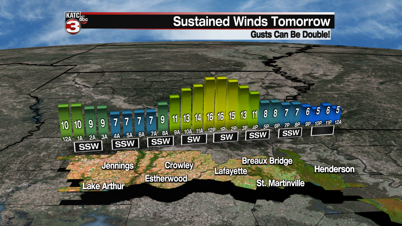
And those breezy southerly to southwesterly winds will continue for the next several days.
The pattern won't change a whole lot into early next week, but by mid-week deeper atmospheric moisture is expected to combine with weak disturbances aloft to produce the chance of scattered showers.
It appears that our next front may arrive later next weekend, but its impacts for now look limited to a couple of days and will only serve to get our temperatures closer to normal for a limited time.
Above normal temperatures are expected to ensue with perhaps a better shot of colder weather in a 14-16 days.
For now, consult the KATC 10 Day Forecast for the latest.
------------------------------------------------------------
Stay in touch with us anytime, anywhere.
To reach the newsroom or report a typo/correction, click HERE.
Sign up for newsletters emailed to your inbox. Select from these options: Breaking News, Evening News Headlines, Latest COVID-19 Headlines, Morning News Headlines, Special Offers
