


More scattered splash and dash showers and some thunderstorms remain in the forecast for Acadiana over the next few days, but additional upper energy and instability arriving this weekend could spell the threat of more persistent, heavy rains, and with that, perhaps a threat of flooding.
In the near term, expected scattered showers and a few storms to persist into our Wednesday evening with activity tapering to a few isolated showers overnight .

Temperatures will hold in the lower 70s overnight.
Thursday will bring more intervals of sun early before a healthy scattering of showers and storms develop anytime from mid-morning through the afternoon hours, tapering during the early evening.
Thanks to the additional clouds and shower activity, temperatures tomorrow...and in the days ahead, will stay below normal (89°), and closer to the low-mid 80s.

Little change in the pattern is anticipated Friday and perhaps Saturday, with daytime rain chances running in the 50-70% range for most of us.
Rainfall totals per our shorter range GRAF model indicates typical variance with scattered showers and storms, with rain totals ranging from a trace to better than 6" over the next 2 days! Most of us however should generally see an inch or two at most.
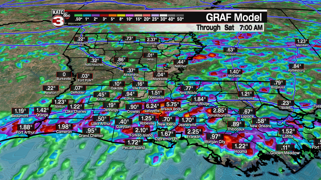
Of course these numbers will change with a scattered "storm" scenario, but this also hints that the storms we may see in the days ahead, while being scattered in nature, could be "slow-movers".
This weekend, a more substantial upper level low will reach the area, likely enhancing our thunderstorm threat and with that the threat of heavier, potentially flooding rains.

This appears to become most likely into the Sunday and Monday time-frame.
And with the grounds across the region still nearly saturated from our record rains in May, the threat of flooding looks to increase.
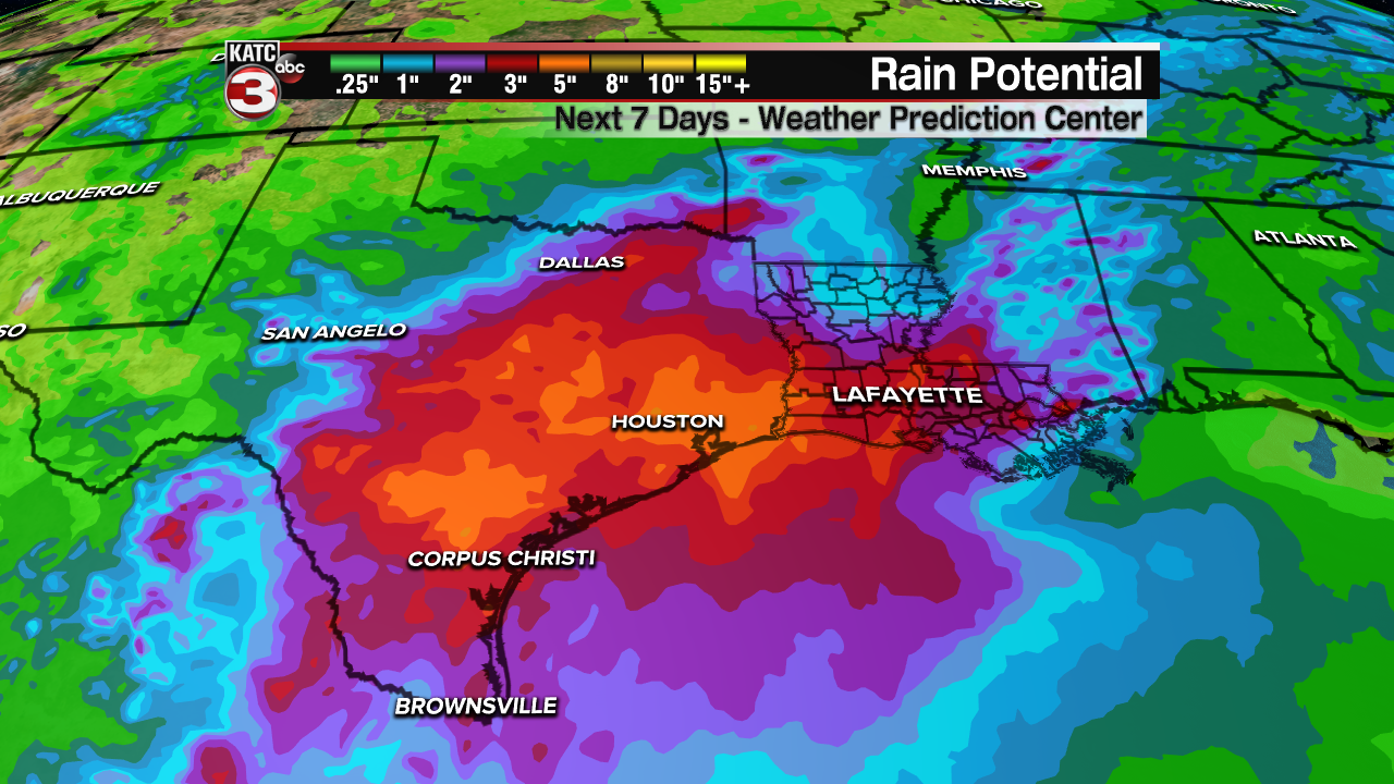
The Weather Prediction Center has inched their rain totals from Texas to Louisiana up to the 5-7" range...which generally means there may be a few isolated areas that receive double those amounts.
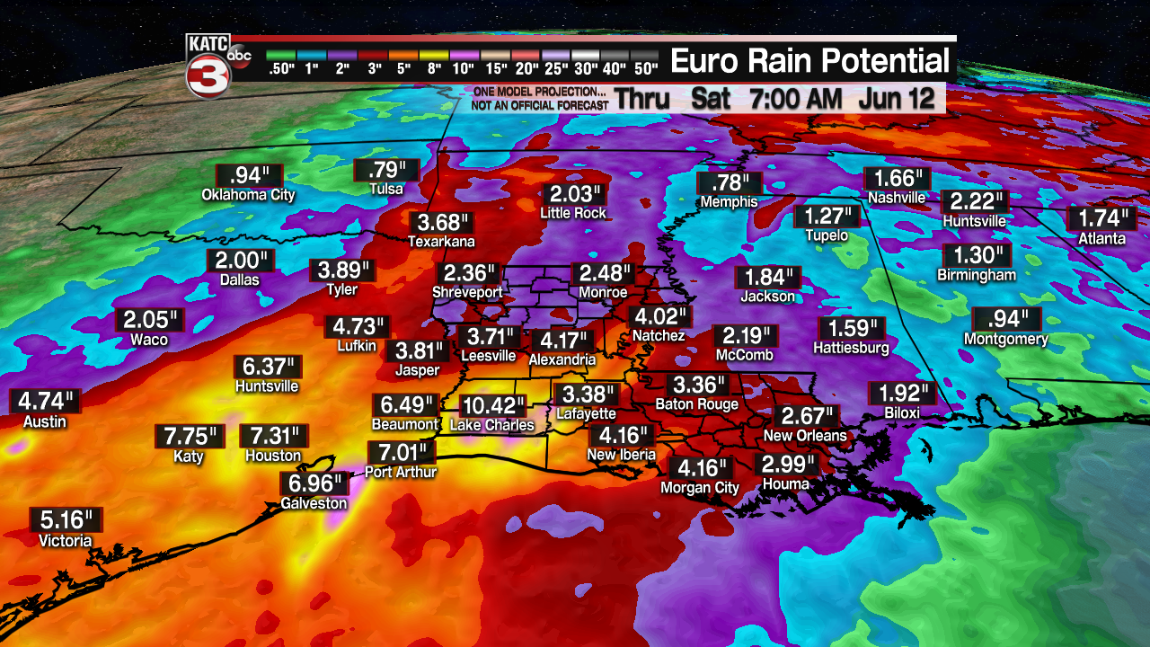
Meanwhile the latest GFS and Euro models continue to support a soggy scenario over the next 7-8 days with rain totals in some spots reaching 10" or more.

Eventually, Acadiana may see "flood watches" posted for portions of the area, with that most likely occurring into the weekend.
The pattern does seem to want to break mid-late next week as high pressure advances in from the east thereby lowering our rain chances.
After that it should be noted that the very long range (and relatively unreliable) models that take us into the third week of June are hinting at the possibility of very deep tropical moisture surging toward the Gulf of Mexico...we are certainly looking at a wet and unsettled start to meteorological summer following our soggy and record-breaking spring.
For the latest daily rain chances, consult the KATC 10 Day Forecast.
------------------------------------------------------------
Stay in touch with us anytime, anywhere.
To reach the newsroom or report a typo/correction, click HERE.
Sign up for newsletters emailed to your inbox. Select from these options: Breaking News, Evening News Headlines, Latest COVID-19 Headlines, Morning News Headlines, Special Offers
