


It was a beauty out there today with plentiful sunshine in place as afternoon highs climbed closer to normal (but still below normal for this time of year).
Another chilly night is in store across the area as low temperatures drop back into the mid and upper 30s under clear skies.

Some patchy frost and even some patchy fog will be possible by tomorrow morning...
Mostly sunny skies can be expected on Thursday as the warmer trend continues.
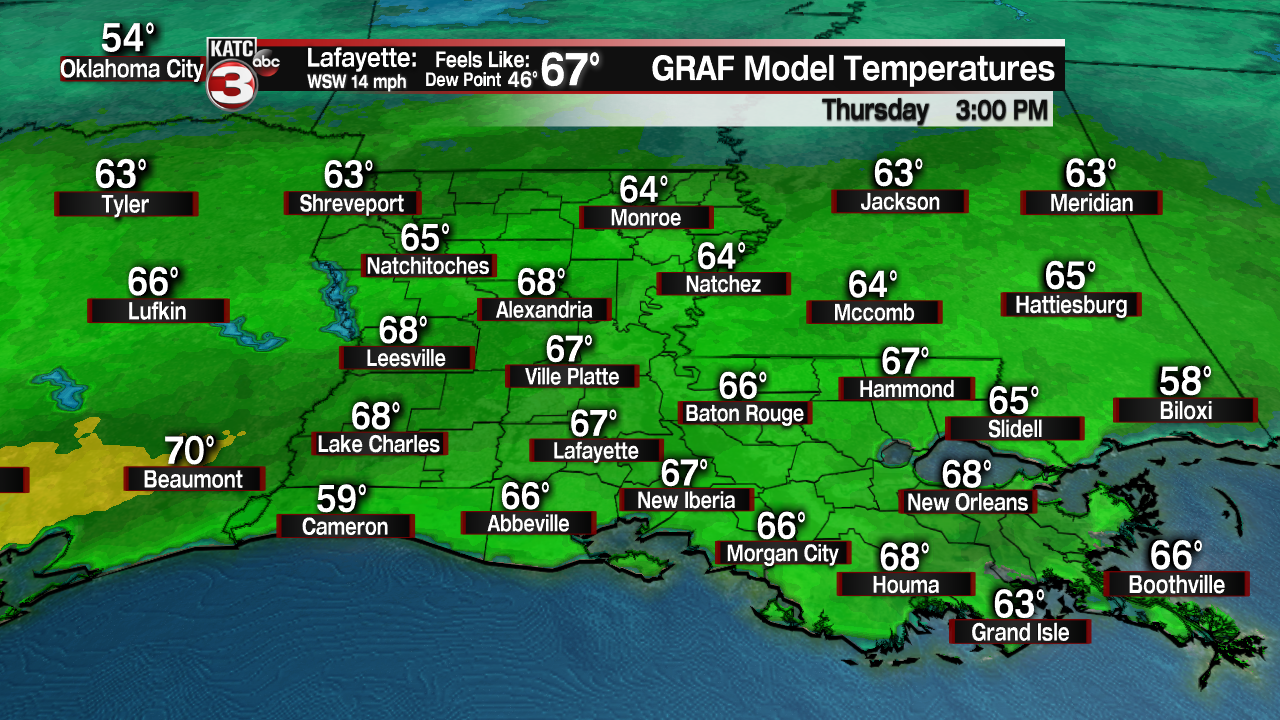
Temperatures will be milder as highs top out in the upper 60s to near 70 in spots as breezy southwesterly winds start to kick in.
A cold front will be moving through on Thursday evening/night

No precipitation is anticipated with this front, but we may see at least some cloud cover move in overnight on Thursday.
Back to the upper 50s on Friday afternoon under plenty of sunshine.
Upcoming weekend looks good but chilly with morning starts in the 30s and afternoon highs in the mid to upper 50s.
We'll see a relatively quiet start to next week with mainly sunny skies in place on Monday as highs climb into the lower 60s.
Clouds will start to build as we head into Tuesday ahead of our next upper-level disturbance.

Few spotty showers will start to move in by late in the afternoon on Tuesday.
Best rain chances arrive on Wednesday as an area of low pressure approaches the region
A few lingering, leftover showers will be possible going into next Thursday, but timing on that can still certainly change considering we are still about a week out.
Nicer weather looks to return as we round out next week!
Have a good one, y'all!
