


Warm and muggy across the region today as temperatures climbed into the lower 80s under mostly cloudy skies.
Clouds stay locked in with southerly winds continuing to bring in Gulf moisture overnight, so expect another muggy one out there.
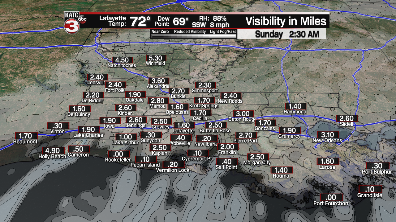
Overnight lows will only drop into the lower 70s.
With dew points getting near the actual air temperature once again tonight, some patchy fog will be possible, especially along the coastal parishes.
A frontal boundary will be approaching the area first thing tomorrow morning.

That will help to generate scattered showers and maybe even a few thundershowers across the region.
Instability will be lacking, so no severe weather is anticipated.

Rain chances will be highest through the early-mid morning time period.
The rain will be tapering off by the afternoon as we remain under cloudy skies.
Rain totals should remain less than a half an inch. Locally higher amounts possible...

Winds will be breezy out of the north at around 10-20 mph.
It turns slightly cooler behind that front with temperatures expected to drop into the 60s by tomorrow afternoon.
As long as the frontal boundary sags into the Gulf waters going into Monday, we will see a return of mostly sunny skies throughout the day.
Afternoon highs will be in the upper 60s to lower 70s on Monday.
That boundary will begin to make its jog back to the north as a warm front on Tuesday which will help to deliver on some scattered showers across the area.
Rain chances continue to increase going into Wednesday as a stronger cold front looks poised to push through.
Scattered showers and thunderstorms (some strong?) are likely throughout the day on Wednesday ahead of the front.
Drier and cooler weather will follow.
In fact, expect afternoon highs to drop into the low-mid 60s for next Thursday/Friday.
For now, it looks like more seasonable weather as we head into Easter weekend.
Continue to check back in with us for the latest.
Have a great rest to the weekend, y'all!
~Bradley
------------------------------------------------------------
Stay in touch with us anytime, anywhere.
To reach the newsroom or report a typo/correction, click HERE.
Sign up for newsletters emailed to your inbox. Select from these options: Breaking News, Evening News Headlines, Latest COVID-19 Headlines, Morning News Headlines, Special Offers
