


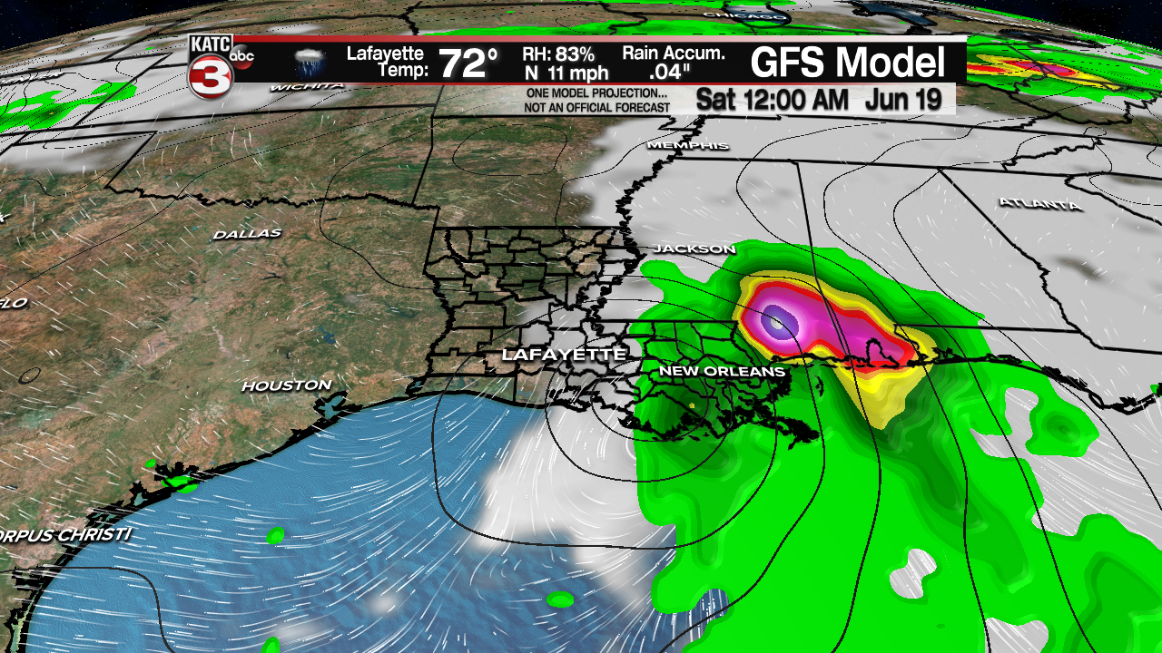
The National Hurricane Center has initiated advisories on a potential tropical cyclone in the Gulf of Mexico.

Potential Tropical Cyclone 3 with 30 mph winds was moving to the north at 9 mph.

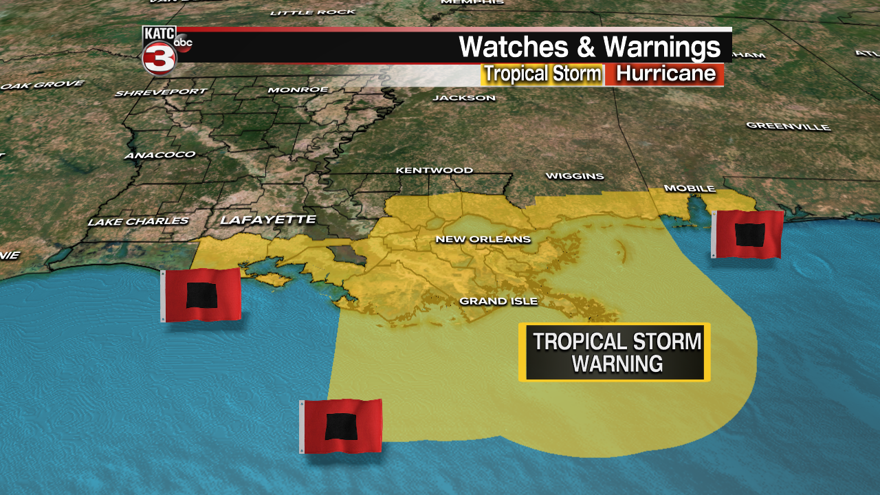
A Tropical Storm Warning has been issued from Intracoastal City to the Alabama/Florida border.
This system is expected to be near tropical storm strength as it approaches the Louisiana Coast late Friday, but the greatest threat of flooding and possible severe weather should primarily stay east of the Acadiana area.

Scattered tropical showers and storms could impact the Acadiana area as early as Friday afternoon with on and off showers and a few embedded storms more likely into Friday night and Saturday.
Model trends continue to indicate the heaviest rainfall and the threat of flooding will be focused toward Southeast Louisiana and areas east into Mississippi and Alabama.
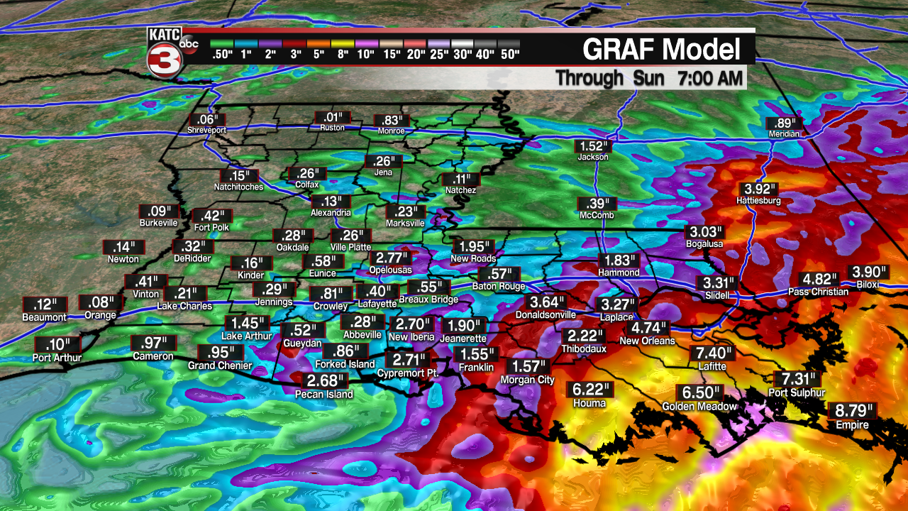
A Flash Flood Watch is in effect for Eastern Louisiana through Sunday morning for the potential of up to 6-10" of rain with this system.

Meanwhile in Acadiana, a few inches of rain will be possible, but widespread flooding is not anticipated at this time.
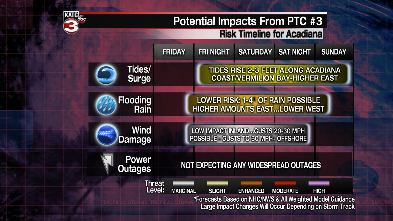
And even though the center of the low pressure system may move through portions of Acadiana, high winds are not expected in the area.

Wind gusts from late Friday through Saturday are expected to be in the 20-30 mph range for most of our area, with gusts possibly approaching 30-40 mph toward Eastern Louisiana in heavier storm activity.
Winds offshore could gust into the 50 mph range in organized squalls, primarily east of the Grand Isle area and toward the Mississippi Coast.
The wind field associated with this system will likely increase tides 1-3 feet above normal on the Acadiana Coast Friday through Sunday.
Although the system will move out of the area by Sunday, lingering deep tropical moisture will insure a good chance of showers and storms for the Acadiana area Sunday into next week.
Stay with KATC, katc.com and social media for the latest and live updates.
------------------------------------------------------------
Stay in touch with us anytime, anywhere.
To reach the newsroom or report a typo/correction, click HERE.
Sign up for newsletters emailed to your inbox. Select from these options: Breaking News, Evening News Headlines, Latest COVID-19 Headlines, Morning News Headlines, Special Offers
