


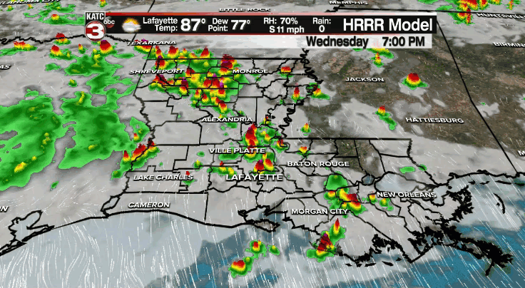
Scattered activity will remain possible through this evening.
Rain chances will ease after sunset, but re-development of some shower activity could occur through the overnight period and into daybreak Thursday morning.
It'll be warm and muggy otherwise as temperatures settle into the middle and upper 70s.
A pretty typical August pattern will be in store for Acadiana's Thursday.
Expect hot and humid conditions out there with scattered showers and a few storms.
Any one storm will be capable of producing locally heavy rainfall and lightning--per usual for the time of year.
Temperatures will make their way into the lower 90s.
A ridge of high pressure will bank into the region by Friday and into the weekend which will lower our rain chances.
Instead of rain, it'll be about the heat and humidity.
Temperatures will get well into the 90s with those heat indices settling into the triple digits.
Rain chances will stay lowered to start the following week, but they'll be back as we start to see a break in the pattern by mid-week.
In the tropics:
Fred is now just a remnant low and is bringing heavy rain across portions of the northeast.
Grace was upgraded to a hurricane this morning with winds of 75 mph. It'll continue to track through the Caribbean before impacting the Yucatan Thursday morning.
It'll then emerge into the Bay of Campeche and make a second Mexican landfall over the weekend.

The system will be no threat to Acadiana.
Henri is located to the south and west of Bermuda.
It'll make a run at hurricane status as it begins to turn to the north.
It could get pretty close to the east coast with time, but we'll have to see how that plays out.
Henri is no threat to us.
The rest of then tropics are quiet at this time.
