


A few scattered storms will remain possible this evening as activity tries to roll in from the west across the Atchafalaya.
Otherwise, it'll be back to fair skies after midnight.
Very warm and muggy night ahead as lows struggle to dip into the upper 70s.
The heat will continue on Sunday as temperatures climb into the middle 90s.
Heat indices will settle in around 101-106°.
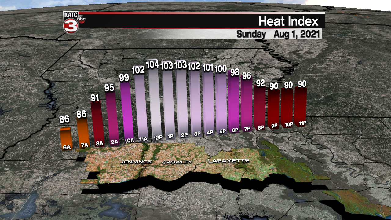
Continue to take proper heat precautions out there and try to avoid being outside during peak heating hours (~2-5pm)
Isolated storm activity will be possible through the afternoon/evening hours as well.

A trough of low pressure will be digging across the eastern US on Monday with an associated frontal boundary at the surface that will be advancing southward.
That boundary, coupled with increasing low-level moisture and daytime heating, will help to generate a slightly better scattering of showers and storms for Monday afternoon and evening.
Rain chances will stay slightly elevated for Tuesday as the front slowly tries to push offshore.
With any luck (and models continue to hint at it ), the boundary will push far enough south by mid-week to usher in some drier, perhaps less humid air.

We have to keep in mind that is now August, so any sort of front won't really have much of a drastic impact on our temperatures, although we are likely to get a break from the oppressive heat that we've been dealing with this past week--IF it comes to fruition.
We'll continue to monitor the progression of the pattern in the days ahead.
Moisture will lift back northward by the end of the week and into the following weekend.
In the Tropics:
All remains quiet with no developments at least in the next 5 days!
