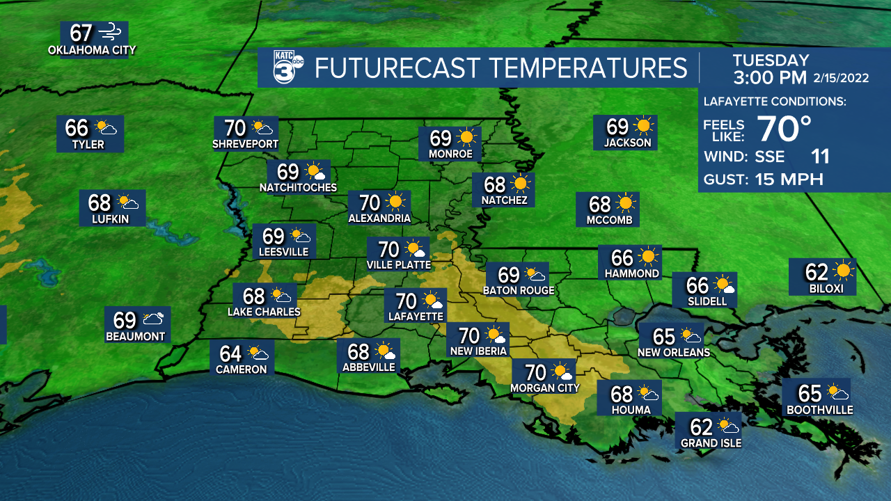
After another chilly start Tuesday, milder temperatures are in the forecast with highs reaching the lower 70s Tuesday and mid-70s for Wednesday and Thursday.
Acadiana's next weather-maker is expected to arrive Thursday in the form of a cold front with an excellent chance of showers and storms ahead of it.
In the near term, it's a "heart-warming" forecast ahead with excellent snuggling conditions expected as low temperatures by Tuesday morning drop into the mid-upper 30s in most locations.

Mostly sunny skies will continue into Tuesday as high pressure slides east of our region engendering east to southeast winds into mid-week.

Temperatures Tuesday afternoon will likely reach the upper 60s to lower 70s.
It will be much milder Tuesday night into Wednesday morning as southeasterly winds will be ushering higher Gulf humidity along with temperatures holding closer to the mid-50s.

Wednesday is expected to be breezy and milder under partly, to at times, mostly cloudy skies.
Highs Wednesday should reach well into the more spring-like mid-70s.

Acadiana's next weather-maker will arrive Thursday accompanied by an excellent chance of showers and thunderstorms.

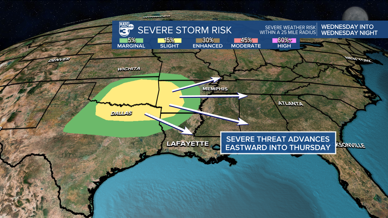
The Storm Prediction Center has much of the state hatched in for a slight risk of severe storms Thursday.

Once again it appears that the best storm dynamics may manifest north of our area, into the usual spring severe weather states of Arkansas, Mississippi, Tennessee, Kentucky and Alabama...and the severe weather threat there back through Texas may be more substantial than just a "slight" risk...stay tuned for future updates.

Acadiana does need the rain but the models are quite varied indicating anywhere between 1/2" or less up to an inch or two.


Thereafter cooler, drier weather should move back into the region Friday into the weekend but another quick warm-up is expected into next week.
The KATC 10 Day Forecast features more 70°+ days...maybe an 80° day, but also has more 30s at night..this the way it goes in February, but it certainly looks like we have turned the "winter" corner.
Climate Notes:
How dry we are...after a record wet summer, a very dry fall/winter and well below normal rains since October has manifested into a moderate to severe drought for much of the state.

Since November 1st Lafayette has received 6.43" of rain, some 10.76" below normal.

In response to this, a state-wide burn ban has been issued by the State Fire Marshal's Office.
------------------------------------------------------------
Stay in touch with us anytime, anywhere.
To reach the newsroom or report a typo/correction, click HERE.
Sign up for newsletters emailed to your inbox. Select from these options: Breaking News, Evening News Headlines, Latest COVID-19 Headlines, Morning News Headlines, Special Offers


