Acadiana's foggy and mild spring pattern will continue into the weekend with the prospect of a better chance of scattered showers and perhaps a few storms by late Saturday into Sunday.
A big swing in the pattern is still for the area into mid-next week.
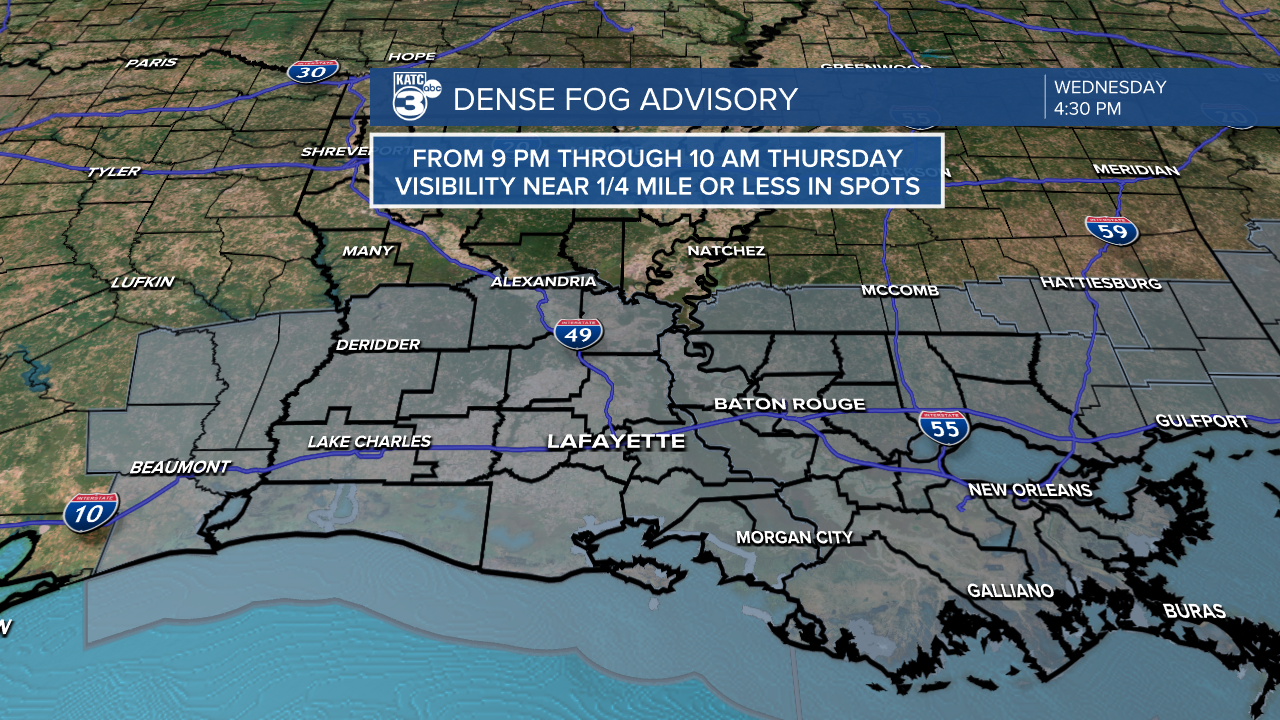
In the near term, a Dense Fog Advisory will be in effect for all of Acadiana starting Wednesday evening at 9:00 pm and will continue through 10:00 am Thursday.

Look for visibilities to drop to the 1/4-1/2 mile range by Thursday morning with a few spots going below 1/4 mile.

Temperatures overnight will be near where our daytime highs should be this time of year, in the mid-upper 60s.
The morning fog will slowly lift to mostly cloudy skies by late Thursday morning with partly sunny and warm conditions anticipated into the afternoon.
Temperatures Thursday afternoon should reach near 82°...but depending on how quickly the fog burns off, the afternoon high temperature could approach the record of 84°.
Rain chances Thursday will be back down to 10% or less.

The pattern will be quite similar Friday into Saturday, but by Saturday evening an upper disturbance may trigger scattered showers and perhaps a few thunderstorms late Saturday, and especially into Saturday night with activity slow to taper Sunday.
Rain chances this weekend will increase to the 50-60% range primarily Saturday night into Sunday.
And don't expect a whole lot in the way of rain accumulations this weekend with totals likely less than 1/2", but once again, a good part of the weekend will be cloudy and occasionally rainy which will make it six weekends in a row of unsettled weather dating back through all of November.

The pattern next week is expected to get more dynamic with the chance of scattered showers a possibility again late Monday into Monday night.

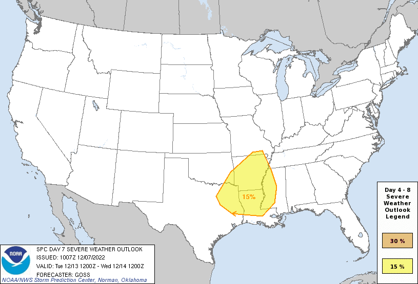
By late Tuesday into Wednesday a strong cold front associated with a "whopper" of a storm system rolling the west to the nation's mid-section is expected bring scattered to numerous thunderstorms to the region with the possibility of some severe weather as well.
The Storm Prediction Center already has a "Slight Risk" area up for a system that is 6 days out for the possibility of severe storms next Tuesday...now mind you this storm system we're tracking hasn't even left Eastern Siberia!

Thus timing and impacts of next week's system will likely be tweaked in the days ahead.
Acadiana could also see a pretty good soaking of a couple of inches with next week's system.

The same storm system is expected to lay down healthy snows for most of the West through High Plains and Upper Midwest.

Behind the front sharply cooler/colder conditions are expected toward the end of next week into the following weekend with highs getting pushed down closer to the 50s while lows could dip into the 30s and 40s.
Our long term ensemble models continue to indicate that chilly/colder than normal conditions may persist or chill further through the week leading up to Christmas...stay tuned!
See the KATC 10 Day Forecast for the latest.
------------------------------------------------------------
Stay in touch with us anytime, anywhere.
To reach the newsroom or report a typo/correction, click HERE.
Sign up for newsletters emailed to your inbox. Select from these options: Breaking News, Evening News Headlines, Latest COVID-19 Headlines, Morning News Headlines, Special Offers


