


Fog will be likely again late tonight into early Saturday morning.

It will likely be dense in spots, so keep that mind if you plan on being on the roadways.
Overnight lows will settle into the upper 50s.
Expect the fog to lift out of here by mid-morning, and then it'll be back to a mixture of sun and clouds throughout our Saturday.
We stay warm for the time of the year as highs push the middle to upper 70s into the afternoon.

Fog will be likely once again Sunday morning.
We'll see more of the same Sunday with temperatures continuing to climb into the upper 70s under partly to mostly cloudy skies.
Rain chances will stay rather isolated in nature this weekend (10-20%).
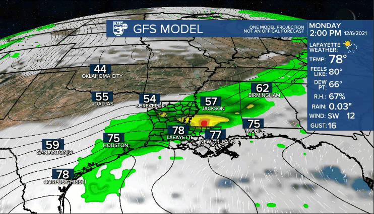
Better rain chances will come on Monday as a cold front advances into the area.
Timing looks to be during the middle parts of the day...
The boundary, however, will get hung up and start to lift back to the north as a warm front on Tuesday, so no significant cool down is expected.
Scattered showers will remain in the forecast for both Tuesday and Wednesday before things will start to settle down by the end of next week.
Initial rainfall estimates look to be around 1-2" through next week.
Furthermore, the storm track late next week may actually bypass us to the north, keeping a southerly flow and warmer than normal pattern in place.
We'll see how that plays out in the days ahead.
We could also be talking a stronger front by the latter half of next weekend, but too early to tell for sure (days 8-10).
Have a great weekend, Acadiana, and enjoy all the events that will be going on!
~Bradley
