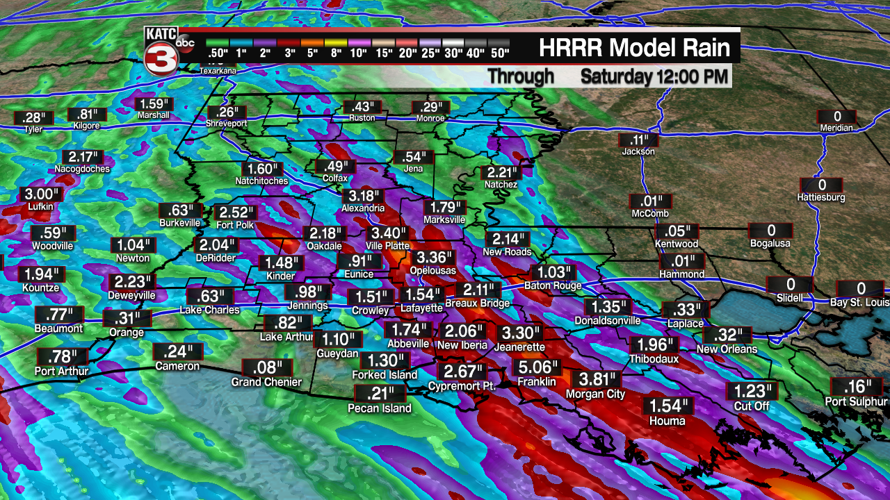
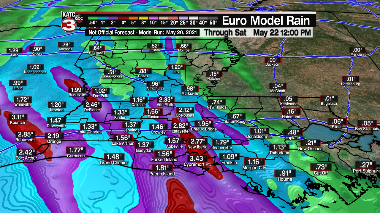
The never-ending pattern that has been responsible for all of the shower and thunderstorm activity across the region this week will remain in place for one more day.
With 3.50" of rain falling at Lafayette regional last night and early this morning, May 2021 became the second wettest May on record.
For more information on that, be sure to check out my separate article (https://www.katc.com/news/may-2021-moves-into-second-for-wettest-mays-of-all-time).
We've been able to catch another nice little break in the action this afternoon across Acadiana which is allowing some of the water to drain slowly.
However, with any additional rain falling on already very saturated grounds, it won't take much to cause localized flash flooding issues and flooding in low-lying areas.
As a result, a flash flood WATCH remains in place through Friday afternoon.
An additional 2-4" of rainfall will be possible with locally higher amounts in spots as well.

Wherever those storms decide to "train" over the same areas for an extended period of time is where we'll see those higher amounts set up, so we'll have to watch that.

Scattered showers and storms will be possible through this evening and overnight period with rain chances staying elevated throughout most of Friday.

As has been the case the last couple of days, it won't necessarily be raining all day long, but shower activity will be out there, so keep the rain gear nearby.
A ridge of high pressure will begin to bank in from the east by the weekend which will finally help to dry us out!
Temperatures will be settling into the lower to middle 80s as well.
A drier, more seasonable pattern will look to take shape into next week.
------------------------------------------------------------
Stay in touch with us anytime, anywhere.
To reach the newsroom or report a typo/correction, click HERE.
Sign up for newsletters emailed to your inbox. Select from these options: Breaking News, Evening News Headlines, Latest COVID-19 Headlines, Morning News Headlines, Special Offers


