


The first legitimate cool front of Acadiana's late summer season is on the way for Thursday.
This front will bring significantly lower dew points and humidity Thursday with refreshingly cooler temperatures expected to arrive by Friday morning.
In the near term, it will be rather warm and humid through Wednesday with highs reaching the lower 90s.
Per usual, there will be the risk of an isolated shower or thundershower during the early Tuesday evening period and again for Wednesday afternoon.

Rain chances Wednesday will be in the 20% range with highs approaching the still quite warm lower 90s.
Temperatures at night and during the morning hours will be mostly in the seasonable lower 70s through Thursday morning.
The cool front should move across the area by Thursday morning supplying mostly sunny and more pleasant conditions Thursday afternoon.
Temperatures will still push near 90° Thursday afternoon but the humidity (along with the dew points) will be noticeably more comfortable.

The coolest air arrives into the region Friday morning with temperatures dropping into the low-mid 60s. Some readings could get as low as the upper 50s across northern-most portions of Acadiana!
Look for sunshine and comfortable humidity to carry into the weekend, with sunny and pleasant conditions expected Friday and Saturday.
By Sunday, humidity, clouds and the slight chance of a few showers should return for the afternoon.
Tropical moisture accompanied by good chance of scattered showers and storms should return to the region mid-next week.
See the KATC 10 Day Forecast for the latest.
Meanwhile in the tropics, an area of disturbed weather in the Gulf of Mexico flared-up Tuesday as thunderstorms became more numerous, but remained relatively disorganized.
This system has a slightly better chance of development (at 40%) as it travels northeastward over the next few days.

The main impacts should stay east of Acadiana and much of Louisiana with elevated rain chances and breezy conditions anticipated for the Florida Panhandle later this week.
Upper level wind shear should hamper and development of this potential system while in the Gulf.
Elsewhere, there are no other major suspect areas at this time outside of large and powerful Hurricane Larry in the open Atlantic.
Larry should curve east of Bermuda but will bring elevated surf and breezy condition to the island.
Closer to home, forecast models do continue to indicate that a couple of surges of tropical moisture will be on the way toward the Western Gulf next week.
At this time upper atmospheric conditions don't appear overly favorable for significant development, but we'll keep a close watch on this area as we approach the peak of hurricane season next week.
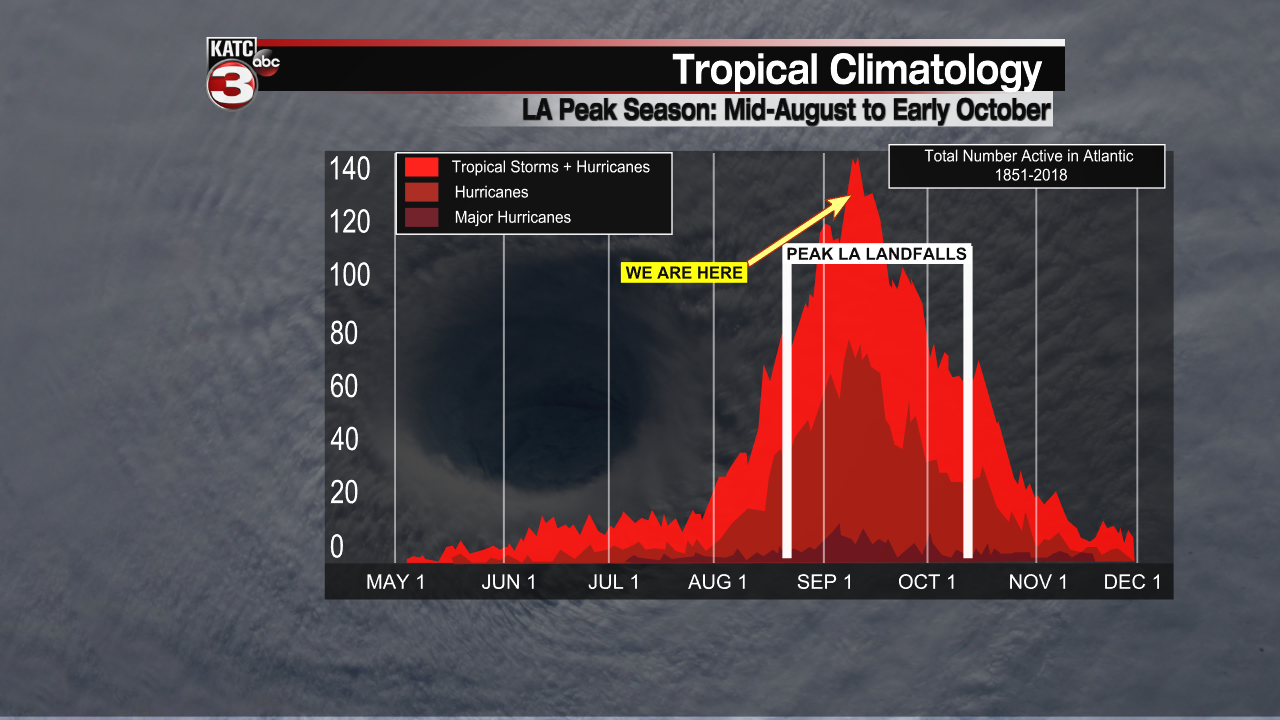
The peak mid-point of hurricane season arrives this weekend.
------------------------------------------------------------
Stay in touch with us anytime, anywhere.
To reach the newsroom or report a typo/correction, click HERE.
Sign up for newsletters emailed to your inbox. Select from these options: Breaking News, Evening News Headlines, Latest COVID-19 Headlines, Morning News Headlines, Special Offers
