


A strong cool arriving overnight will bring some very nice weather to Acadiana for the rest of the week and into the weekend.
The front will be moving through the Acadiana region between 11 pm and 3 am, and ahead of it, scattered showers and some thunderstorms are expected.
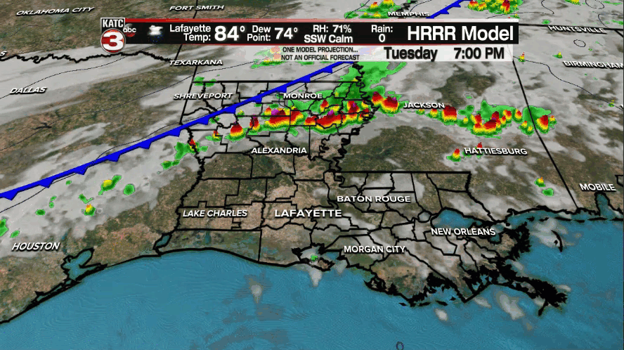
A few storms may contain strong and gusty winds, frequent lightning, and brief torrential downpours, but no flooding is anticipated as the storms will be rolling quickly southeastward.
Behind the front, lingering cloud cover is expected most of the night with a few light showers/sprinkles likely tapering after 2-4 am
A fresh north breeze will kick in behind the front overnight with temperatures dropping into the mid-60s by morning.
After some morning cloudiness, a sun and high cloud mix is expected with those clouds gradually thinning as the day wears on.

Temperatures will top out in the upper 70s to near 80° Wednesday accompanied by breezy N/NNE winds near 15-25 mph.
It will really feel like fall into Wednesday evening/night with temperatures dropping into the mid-50s by daybreak Thursday.
A very nice stretch weather will continue Thursday into the weekend with mostly sunny skies accompanied by high temperatures in the upper 70s to lower 80s...by Sunday readings will probably be pushing the mid-80s but the humidity should still be low.
Overnight/morning lows will stay in the 50s into the weekend.
It appears that a return flow from the Gulf of Mexico will establish Monday with humidity rising followed by a fairly decent chance of scattered showers and perhaps a few storms by next Tuesday and Wednesday.
See the KATC 10 Day Forecast for the latest.
While there will be no tropical systems threatening the Gulf over the next week, the Atlantic Basin remains relatively busy with two tropical systems, and two burgeoning disturbances.
Tropical storm Rose and Tropical Depression Peter remain minimal systems with not much of a future in the open Atlantic.

Meanwhile the remnants of Odette in the open North Atlantic has a 40% chance of regenerating while perhaps undergoing a cyclonic loop (track) per the National Hurricane Center (NHC).
Finally, a disturbance (designated as 98L) southwest of the Cabo Verde Islands in the Eastern Tropical Atlantic continues to bet better organized.

The NHC gives this system a 90% chance of developing into a depression later this week, with models eventually strengthening this system to a hurricane.
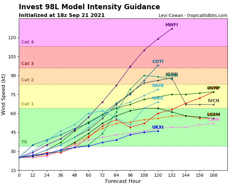
The next name on the list is "Sam"...at this point it appears that this system should also remain an Atlantic Ocean storm.
And while the Gulf of Mexico is expected to stay shut down for the better part of the next week, today's models do suggest that tropical moisture and perhaps and area of disturbed weather may develop in the Northwest Caribbean in the 10-14 day time-frame...no worries for now, but the tropical season is far from being over.
------------------------------------------------------------
Stay in touch with us anytime, anywhere.
To reach the newsroom or report a typo/correction, click HERE.
Sign up for newsletters emailed to your inbox. Select from these options: Breaking News, Evening News Headlines, Latest COVID-19 Headlines, Morning News Headlines, Special Offers
