


It will be a dreary finish to the week Friday with overcast skies and periods of rain developing across the Acadiana area.
A strong cold front will follow in the wee morning hours of Saturday bringing back a winter chill to the area...but after the weekend, expect a spring-like warm up for next week.
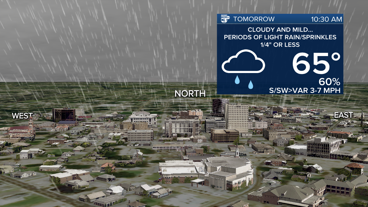
In the near term, mostly cloudy skies accompanied by some patchy fog and perhaps a few sprinkles are expected toward daybreak Friday.
Lows will hover in the mid-upper 50s through Friday morning with high temperatures limited to the low-mid 60s in the afternoon thanks to the clouds and rain shower activity.
More patchy light rain/drizzle/mist is anticipated into Friday night ahead and accompanying a robust cold front that will barrel through the area prior to daybreak Saturday.

Do not expect much in the way of significant rainfall accompanying this system with rain totals 1/4" or less in most areas...perhaps slightly more near the coast as the main impetus with the weather system will be south of our area.

Temperatures will plummet and stay in the 40s all day long Saturday with gusty northerly winds (up to the 30 mph range) and cloud cover making it feel colder!

After a few lingering light showers possible early Saturday, the rest of the day should be dry but cloudy and blustery, with wind chills likely to be in the mid-upper 30s.
Skies will clear Saturday night into Sunday morning with lows dropping into the low-mid 30s...so some tender plants, whatever are left after the deep freeze in January, will require some attention.
Full sun is expected Sunday with diminishing winds allowing temperatures to rise back into the mid-upper 50s.
Expect another cold one Sunday night into Monday morning with lows in the low-mid 30s, and a frost may be possible come Monday morning, particularly for the northern parishes of Acadiana.
Thereafter, temperatures will moderate nicely next week with spring-like readings in the mid-upper 70s expected Tuesday through Thursday.
Another weaker and dry front arrives Friday with no significant rain chances, and in the balance of the 10 Day Forecast.
Climate Notes: The latest Drought Monitor notes that the drought stemming from last year has been pretty much all been eliminated.

There are still some dry spots in Central Louisiana but compare the current status as compared with just 2-3 weeks ago, but thanks to wet a December and January, the area has seen great improvement in our soil moisture content.
------------------------------------------------------------
Stay in touch with us anytime, anywhere.
To reach the newsroom or report a typo/correction, click HERE.
Sign up for newsletters emailed to your inbox. Select from these options: Breaking News, Evening News Headlines, Latest COVID-19 Headlines, Morning News Headlines, Special Offers
