


After a break from our wet and stormy pattern, Acadiana can expect a good chance of storms to return by Tuesday night with activity likely continuing into Wednesday.
Quiet conditions returned Monday afternoon after widespread showers and storms pummeled much of the area overnight into Monday morning.
Rain totals along and north of the I-10 Parishes ranged in the 2-4" range with isolated spots receiving upwards of 5-6" or more, especially toward Western and Southeastern Louisiana.

Some flooding was reported in and around the Henderson area as of Monday morning.
It appears that our area should be void of significant disturbances through Tuesday afternoon, but the pattern will become much more conducive for showers and storms again Tuesday night into Wednesday as a cool front approaches the region.

In the near term, there should be a slight chance of a few scattered showers and storms overnight through Tuesday morning (near 20-30%) while a few more scattered storms may spark off into Tuesday afternoon (near 40%).
Warm and humid conditions can be expected overnight through Tuesday morning with some patchy fog possible...lows will be in the low-mid 70s.
Tuesday will bring plenty of clouds but we do expect a few intervals of afternoon sun with temperatures topping out near the mid-80s..
The chances of showers and storms look to increase Tuesday evening with widespread activity into Wednesday.
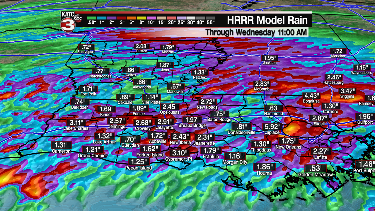
Some locally heavy rains of a couple of inches will be possible, but it remains quite unclear where any hot spots may develop.
Nonetheless, with saturated grounds along and north of the I-10 corridor there could be a flash flood watch issued sometime on Tuesday for portions of the Acadiana area if the widespread storms do become more imminent.
In addition, the Storm Prediction Center has much of Acadiana hatched in for a marginal risk of severe storms Tuesday night into Wednesday with the may concerns, if any, for storms that may contain strong and gusty winds and perhaps some hail.
Thereafter, drier more pleasant weather will return for the latter part of the week and into the weekend...with pleasantly cool morning lows possibly pushing into the upper 50s again by Friday morning.
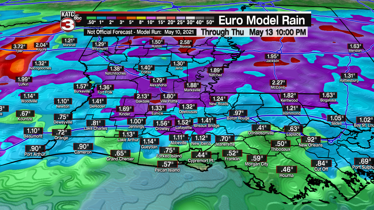
Higher humidity and rain chances look to return for early through mid-next week.
See the KATC 10 Day forecast for the latest.
----------------------------------------------------------
Stay in touch with us anytime, anywhere.
To reach the newsroom or report a typo/correction, click HERE.
Sign up for newsletters emailed to your inbox. Select from these options: Breaking News, Evening News Headlines, Latest COVID-19 Headlines, Morning News Headlines, Special Offers
