


The first batch of heat advisories has rolled out for the south, affecting Concordia and Catahoula parishes, as well as numerous counties in Mississippi. While Acadiana hasn't officially issued any heat alerts, be prepared for a hot Friday as temperatures climb into the low 90s!
There’s a chance we might catch a break with a passing shower. The heat index is expected to soar between 99° and 107°.

Saturday looks to be just as hot, with highs in the low 90s and a heat index creeping close to 99°. Keep the water bottle nearby!


The NHC continues to monitor an area of low pressure that is expected to form over the Bay of Campeche tomorrow. This low pressure system is set to move inland over eastern Mexico.

This system will bring moisture that will interact with a weak frontal boundary early next week, which means our rain chances will be increasing starting late this weekend. Keep the rain gear nearby!

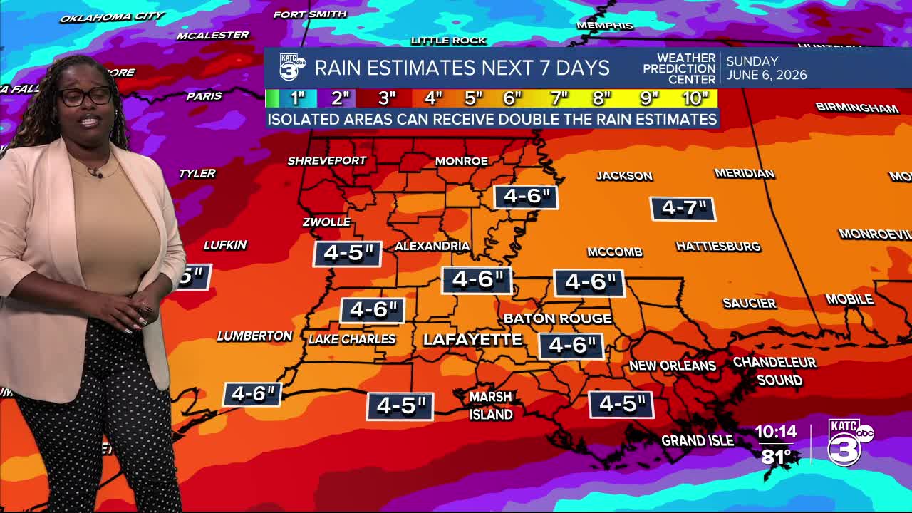
We enter yet another wet period across the state. Under this tropical airmass, we may see some intense storms producing high rain rates. The WPC has highlighted areas along I-10 and north with a slight risk (2/5) for heavy rainfall on Monday.

We could be looking at rainfall amounts up to 5 inches, with some areas seeing up to 10 inches!

Follow Meteorologist Breyanna Lewis for further updates.
See the KATC 10 Day Forecast for the latest.
