


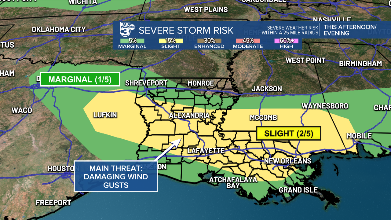
CENLA and Acadiana are currently facing a marginal (1/5) to slight (2/5) risk for isolated severe storms today.
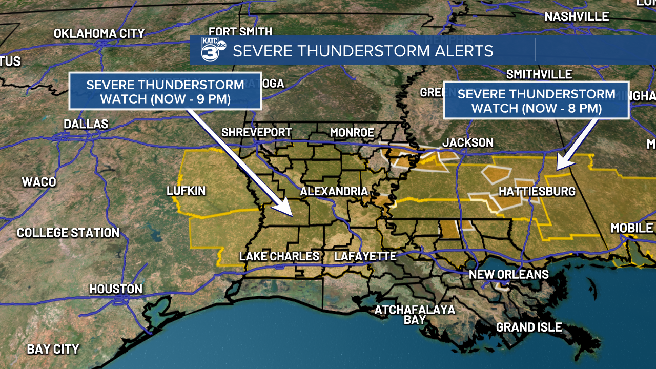
The Severe Thunderstorm Watch has been issued for much of Louisiana through 9 PM tonight.
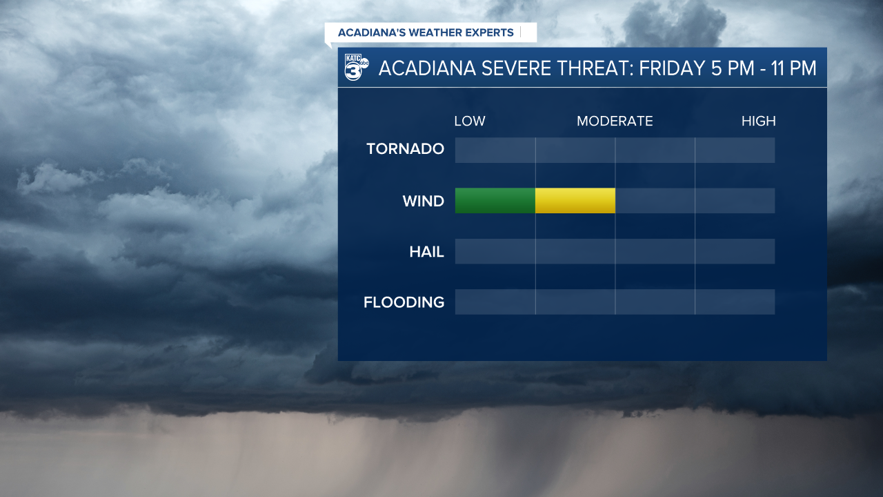
The primary concern is damaging wind gusts reaching 58+ mph, along with potential lightning and brief downpours in any storms that develop.
A weak frontal boundary will pass through late this afternoon into the evening, bringing a line or a few clusters of thunderstorms. This is all thanks to the combination of daytime heating and a moist airmass that’s primed for strong to severe storms.
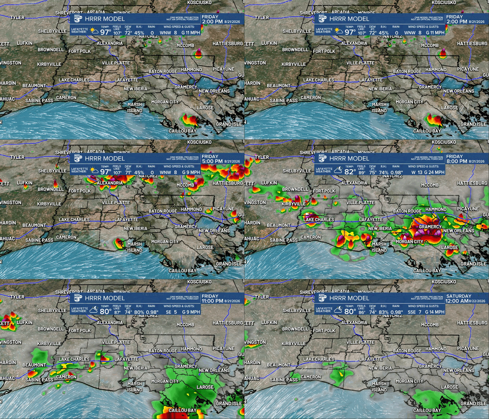
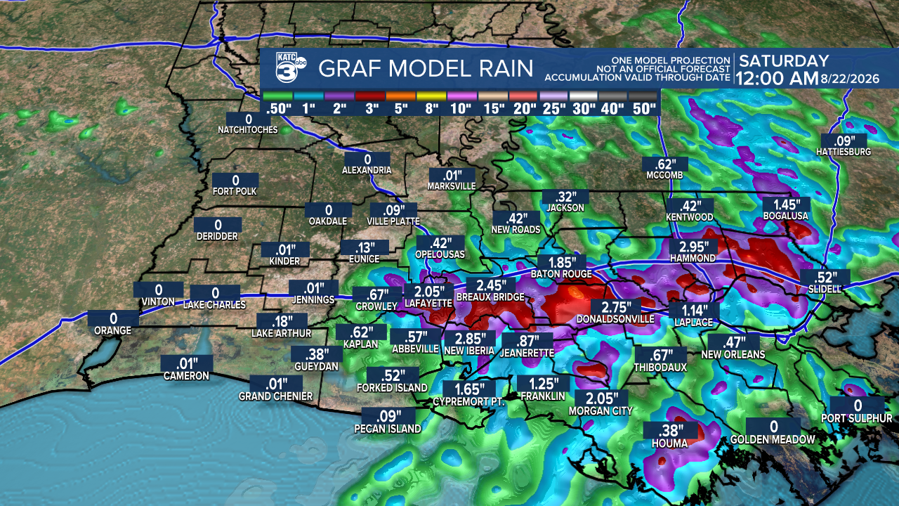
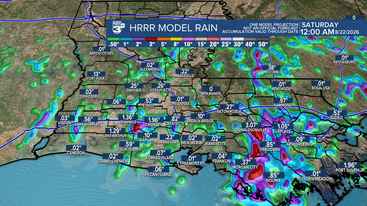
As for rainfall, the GRAF and HRRR models are showing some differences. The GRAF shows around 3 inches while the HRRR estimates up to 2 inches. Given how fast the storms are moving, we may not see significant totals, but we’ll gladly take any rainfall to help hydrate our grounds!
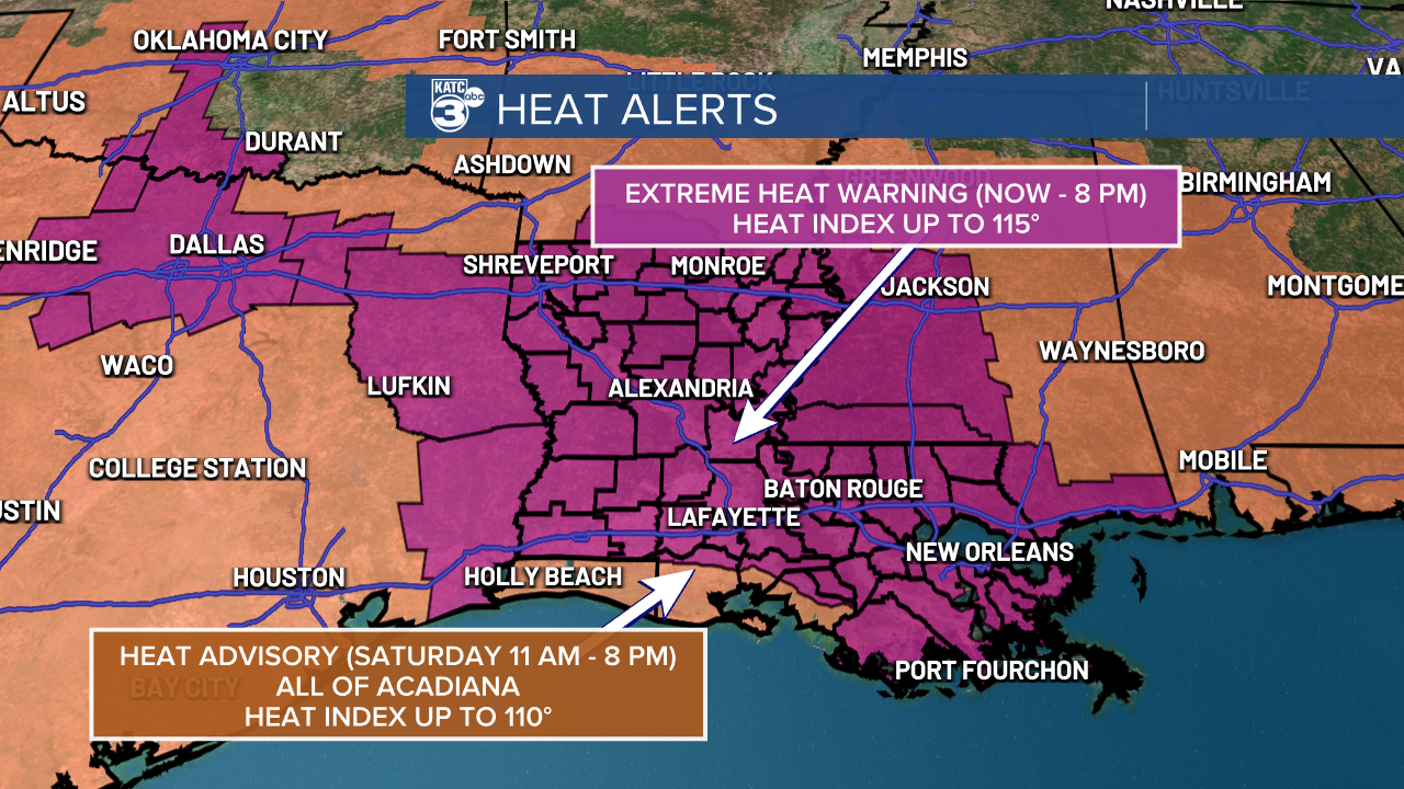
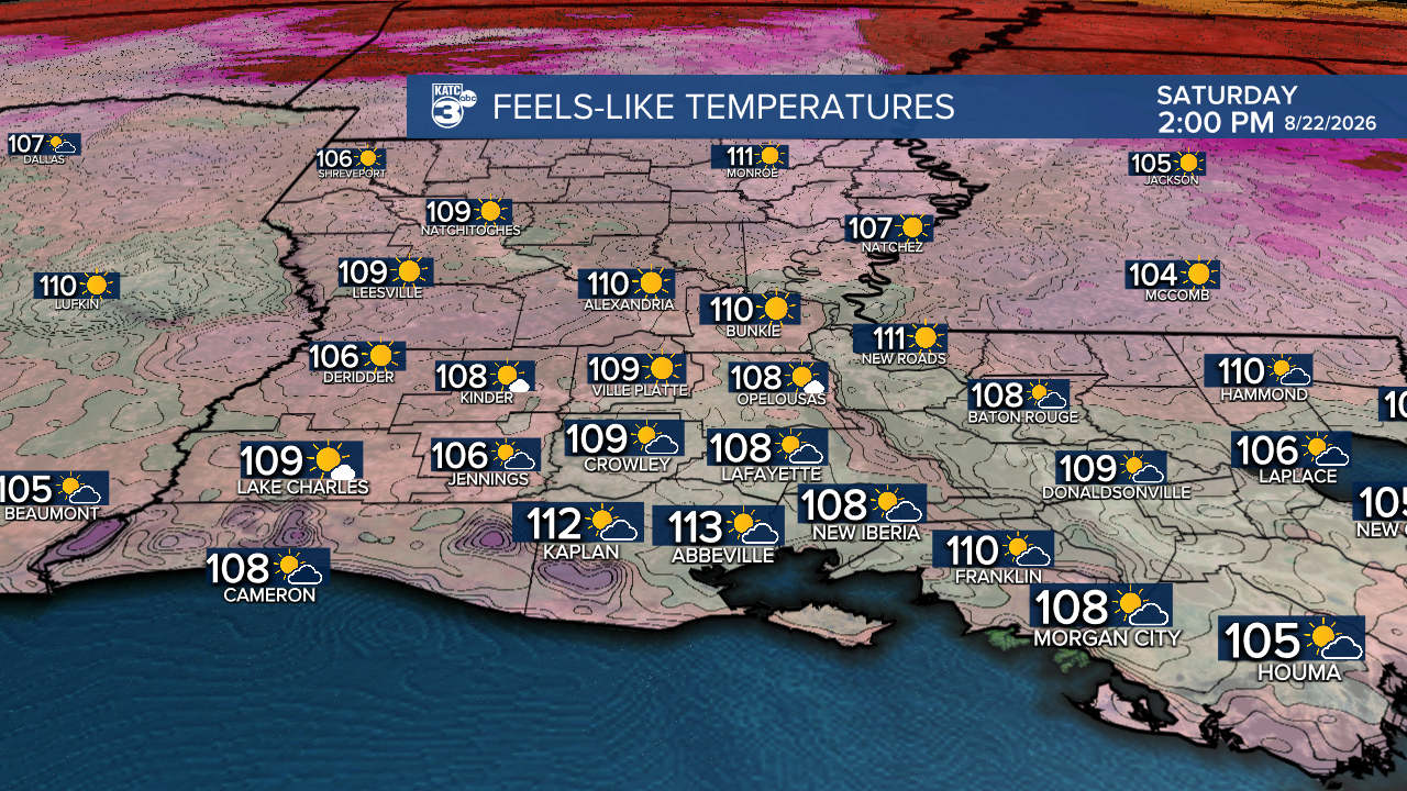
For the rest of the weekend, hot temperatures are sticking around. Another batch of heat alerts have been issued for Saturday.
Follow Meteorologist Breyanna Lewis for further updates.
See the KATC 10 Day Forecast for the latest.

