

We have a few ongoing isolated storms in various areas of Acadiana this afternoon. These storms may produce gusty winds, hence why we have a marginal (1/5) risk in place today.

This will remain isolated in nature throughout the evening. Drier conditions are on tap for tomorrow and Friday, just in time for high school football. However, rain chance increase next week.

Let's talk about temperatures. A high of 75° would be great right now! Sadly, for now, we'll continue to have warm nights in the mid to upper 60s. Tomorrow's highs return to the 90s.


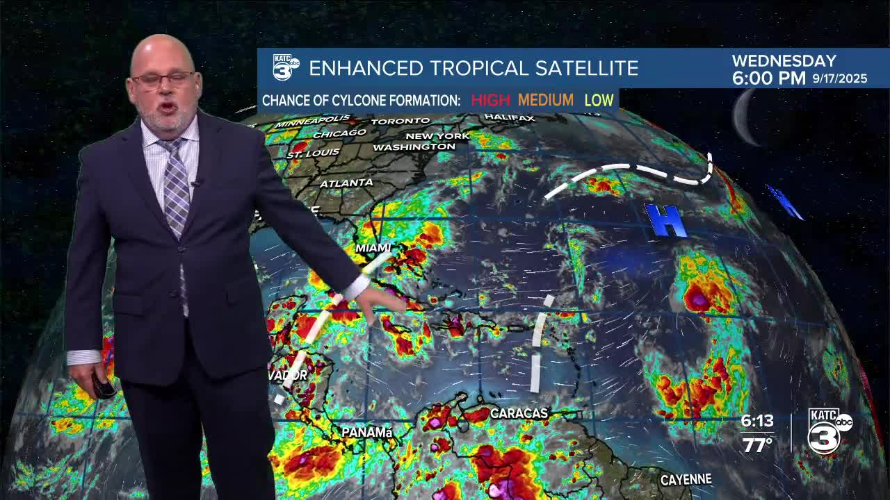
We have a few things to discuss regarding the tropics! Tropical Depression Seven has been upgraded to Tropical Storm Gabrielle.

Gabrielle formed in the central Atlantic this afternoon and is roughly 990 miles east of the northern Leeward Islands. An interesting aspect of this tropical storm is that the circulation has reformed farther north since the last advisory. Over time, it is expected to become more organized, with the forecast track hinting at a Category 1 hurricane sometime late this weekend.

Behind Gabrielle, there are two tropical waves that are expected to gradually develop over the next several days. The good news for us is that we do not anticipate any tropical development at this time.

See the KATC 10 Day Forecast for the latest.
