


The enhanced (3/5) risk of severe weather has shifted more towards Northern Louisiana and Mississippi tonight. No major changes for Acadiana, we're still under a marginal (1/5) to slight (2/5) risk.

Damaging winds and large hail are still the primary threats. The tornado risk is still low, but not at zero.
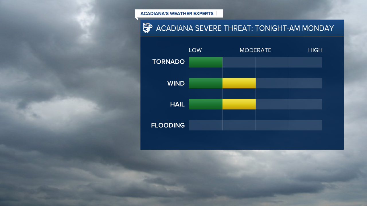
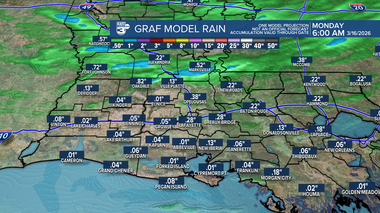
Rainfall amounts are still low, around a quarter of an inch, with higher amounts near half an inch in CENLA.
Timing:
- Approaching Alexandria: 7-8 PM
- Near Northwest Acadiana: 9-10 PM
- Over Lafayette: 10-11 PM
- Exiting Eastern Acadiana: Around midnight
Stay alert if we have any watches or warnings!
It looks like winter isn’t quite done with us yet. Freeze Watches and Warnings have returned to our area! Time to dust off those coats because we’re in for a chilly couple of days ahead.

Tonight, we expect temperatures to drop quickly, with lows mostly in the 40s.
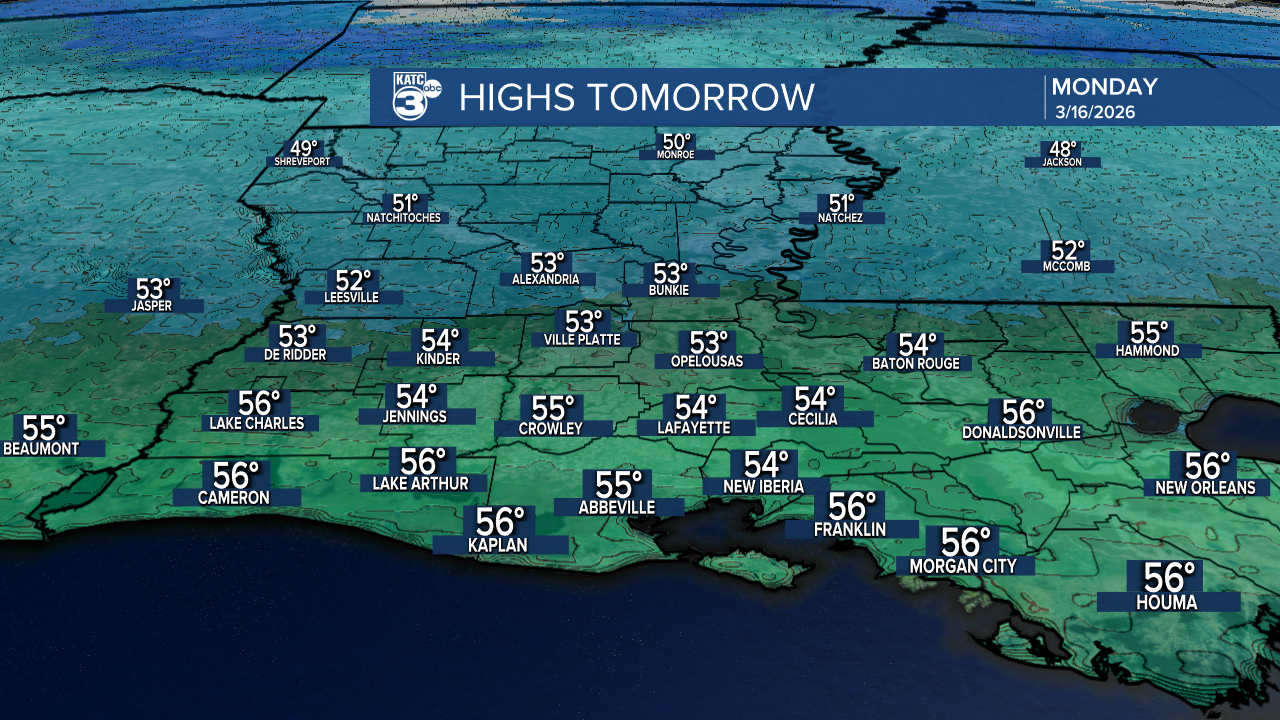
Tomorrow, highs will top out in the 50s, and with gusty winds, it’ll feel even cooler with feels-like temperatures in the 40s!
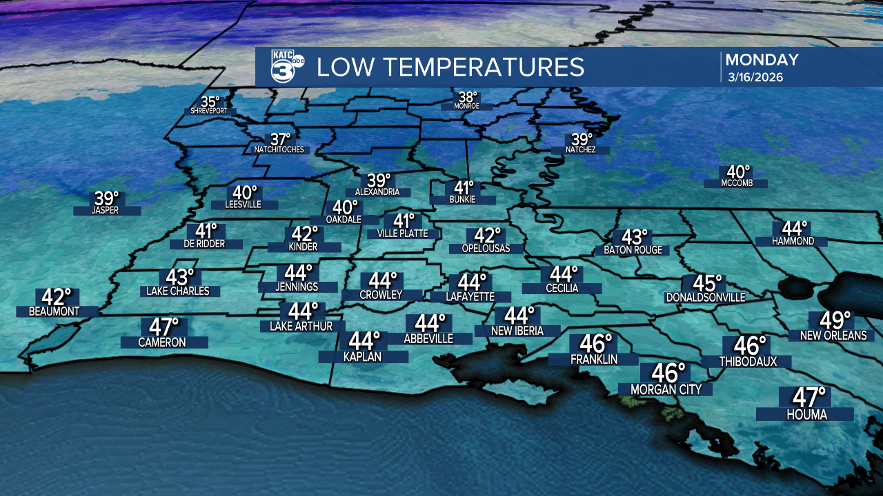
Monday night will be the coldest with temperatures at or below freezing, prompting a FREEZE WARNING for Allen, Evangeline, and St. Landry Parishes. A FREEZE WATCH is effect for Jeff Davis, Acadia, Lafayette, St. Martin, and Iberia Parishes as temperatures fall to the freezing mark.
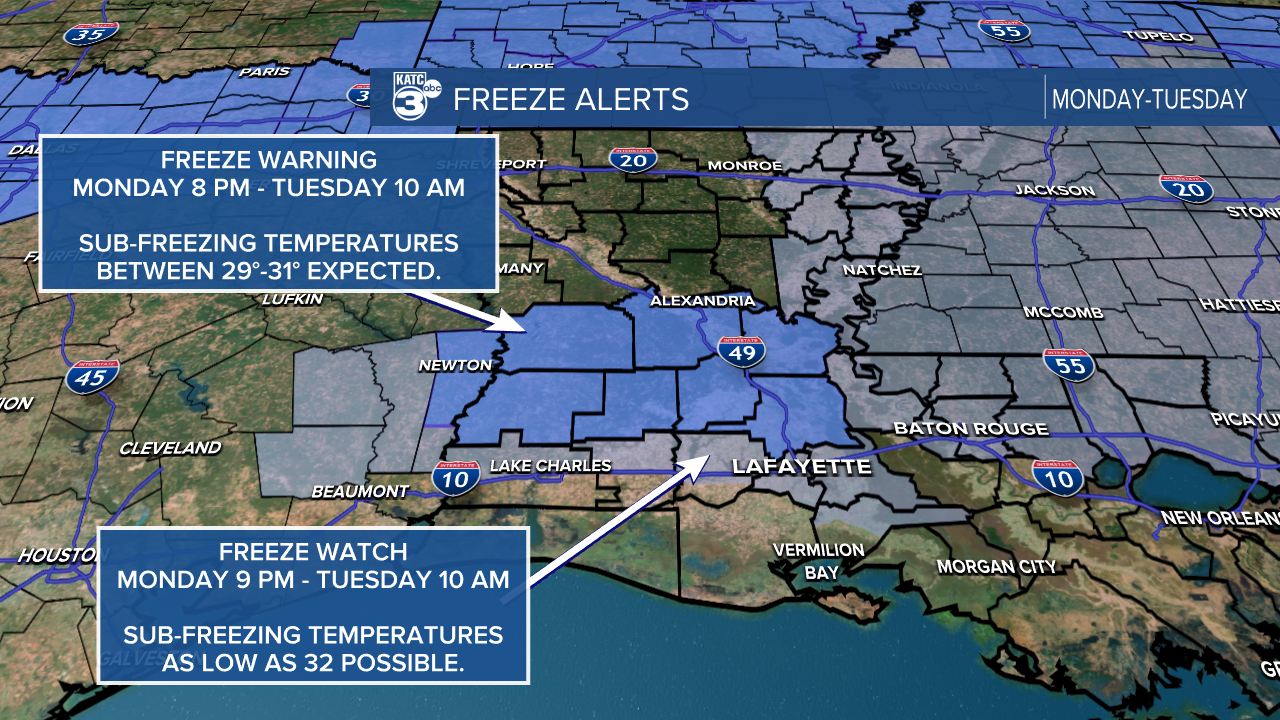
The rest of Acadiana manages to remain above freezing in the mid to upper 30s . Since it's the planting season, you may want to consider covering tender vegetation!

On Tuesday, we’ll see a slight warm-up with highs climbing into the mid and upper 50s, but don’t let your guard down just yet. This unseasonal cold snap in March is definitely beyond the average last freeze date.

It’s been quite a windy day, with gusts between 20 and 30 mph. Tomorrow, those winds are expected to increase to 40 mph.

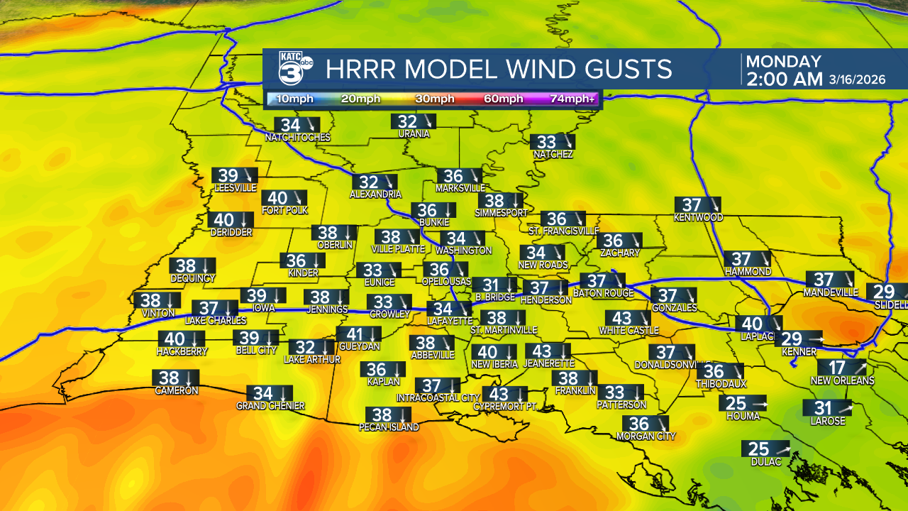

A Wind Advisory remains in effect until Monday evening.

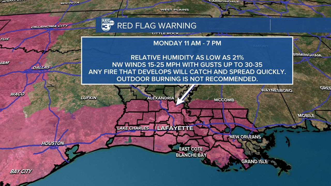
A Red Flag Warning will be in place tomorrow due to the arrival of drier air combined with these strong winds.
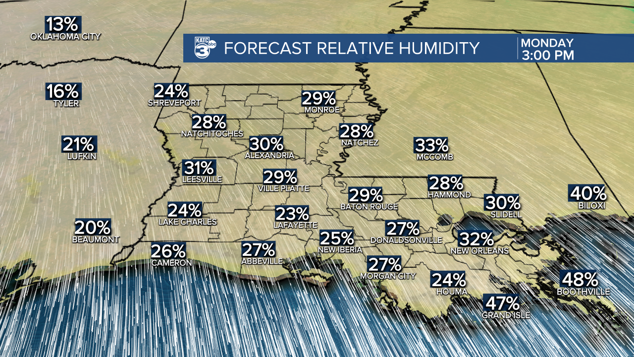
This means conditions are ripe for fire development, especially given the ongoing drought. Fires can spread rapidly in these conditions, so please avoid outside burning and any activities that could spark an open flame.
Follow Meteorologist Breyanna Lewis for further updates.
See the KATC 10 Day Forecast for the latest.
