

We'll round out this holiday weekend with more heat and humidity, but a little better chance for some much needed rainfall. Several areas receiving some rain over the course of the weekend, but there's still plenty of real estate that has remained very, very dry. For most of the summer, we've had a stubborn dome of high pressure over the middle part of the country, but today an upper low is positioned over northern Texas.
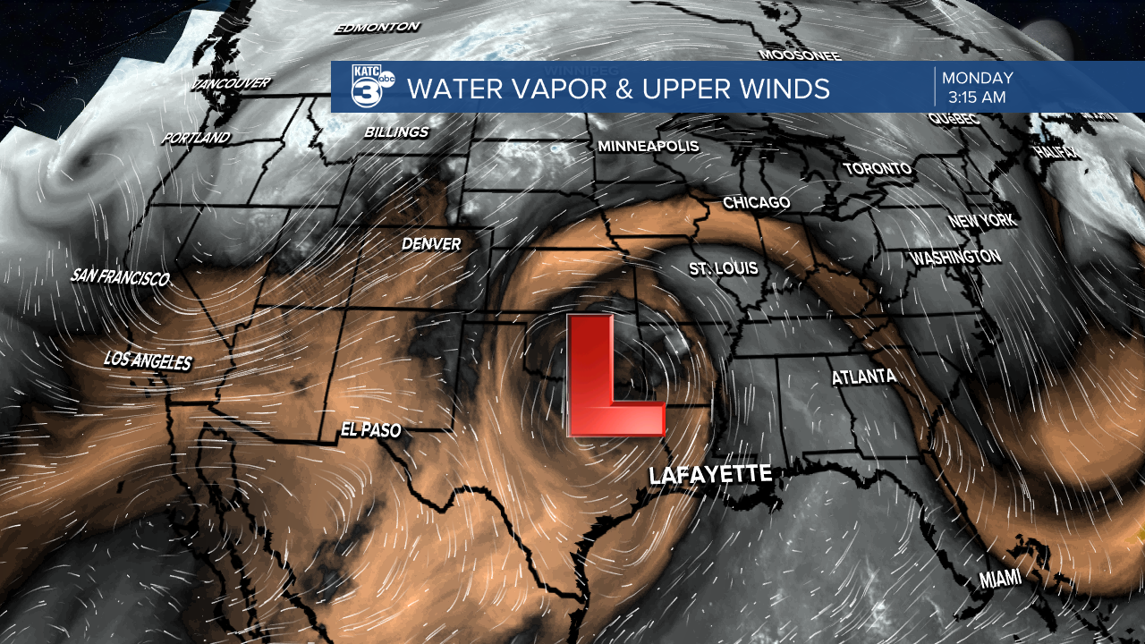
This is pulling a bit more moisture from the Gulf, and with more unstable air, those afternoon storms will continue to break out. This upper low is going to open up as a trough today before moving eastward later this week. Today looks to be the best chance for widespread coverage of rain, although most of the rain will be concentrated during the peak heating hours of the afternoon. Therefore, if you have outdoor Labor Day plans, the earlier in the day, the better.

Temperatures are expected to hit the mid to upper 90s with heat index values between 105-108. Temperatures will cool around scattered thunderstorms this afternoon. Winds will generally be light out of the southeast. More of the same is expected Tuesday as the trough passes east. Then a ridge of high pressure is expected to rebuild for the mid and latter part of the week, so rain chances will be dropping off and highs will approach 100 degrees again Wednesday through Friday.
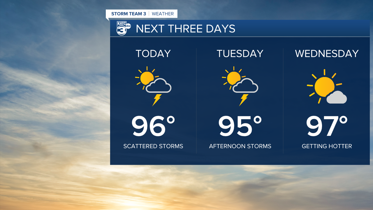
This upcoming weekend could bring a bit more rain Saturday as a trough digs across the eastern half of the country. Then, drier air pushes in for Sunday into next week. This will allow temperatures at night to drop into the lower 70s, although highs will still reach the mid 90s during the day.

Tropical weather has been much more active the past couple of weeks, as expected since the peak of the hurricane season activity typically happens this week and next week. Tropical Storm Gert will continue to weaken in the central Atlantic, while Tropical Depression Katia is struggling in the eastern Atlantic.

Another tropical wave off the African Coast is expected to become Tropical Storm, and eventually Hurricane Lee. This will need to be watched as it drifts westward toward the northern Caribbean.
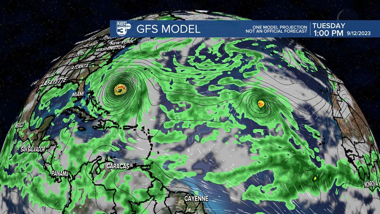
It appears now that a trough digging across the eastern half of the U.S. this weekend will steer Lee away from the Gulf of Mexico, but the east coast of the U.S. will need to keep a close watch next week. Many models are forecasting an intense hurricane, but any landfall on the continental United States is uncertain.
