


High pressure will generally control the weather over Acadiana through the weekend. Stable air will keep the showers and thunderstorms away from the region today and tomorrow. Because of the lack of cloud cover, these long June days will give the sun plenty of time to heat things up. After a muggy start this morning, expect highs to reach 90 degrees under partly cloudy skies. Heat index values will reach 100.

With less cloud cover overnight, expect temperatures to dip a couple of degrees cooler. Expect lows to drop into the low to mid 70s. Winds will be light out of the south.

More sunshine is expected for Saturday. Highs again reaching the low 90s with heat index values hovering around 100 degrees again. The ridge will weaken and drift westward into Sunday. This will allow for a few more clouds by the afternoon. Highs will climb into the lower 90s again, but a few more storms are possible into the afternoon.

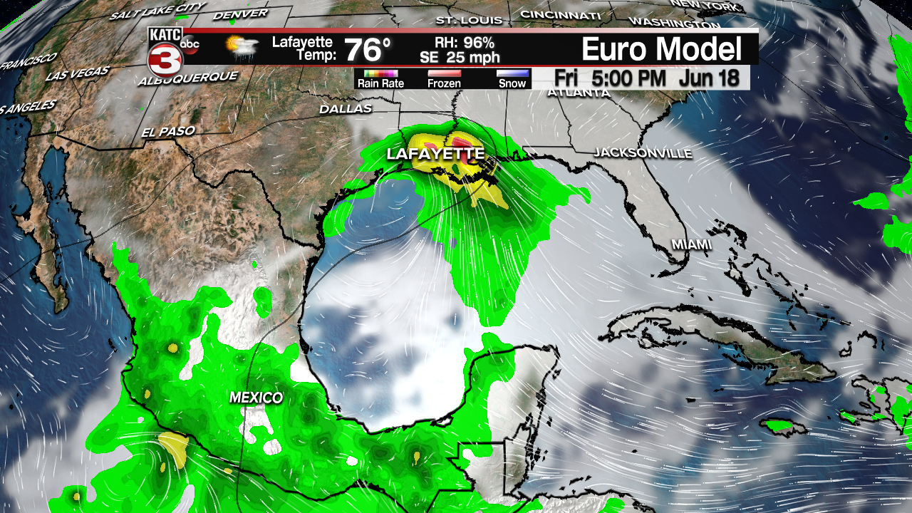
Next week, we can expect sunny type of afternoon showers and storms. Highs will remain in the 90s for daytime highs. Late next week, we'll be watching the Gulf of Mexico. Both the EURO and the GFS are hinting at some tropical weather in the western Gulf by Thursday and Friday. The GFS appears more aggressive in developing something, while the EURO has a weak low. Both would indicate rising rain chances into the Father's Day weekend.
