

Even though most tend to think that Labor Day Weekend is the unofficial end of summer, we in Louisiana know the summer weather likes to stick around for a while. And for the weekend, it will be hot, and could be dangerous as so many are still dealing with no electricity due to Hurricane Ida.
For the past few days we've see a weak frontal boundary draped across central Louisiana. This has been a focal point for thunderstorm development that has shot a few outflow boundaries southward toward Acadiana bringing late afternoon and evening storms since the middle part of the week. With plenty of moisture in place, some of these storms have managed to produce tremendous amounts of rain in isolated areas.
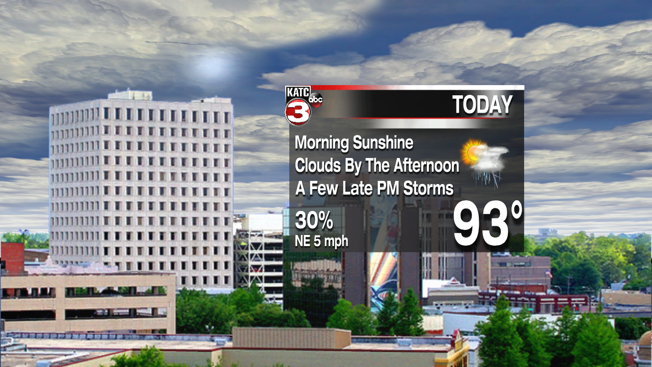
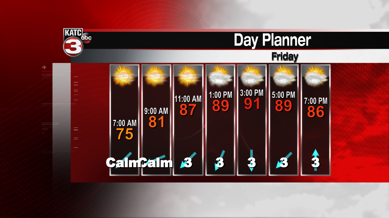
That front is now draped over Acadiana. While it may feel somewhat drier over central and northern Louisiana, here at home we're still seeing dew points in the low to mid 70s. With the front in place over our region, the focal point for those storms will be here, and will likely develop a few hours earlier and hopefully fall apart a little earlier too. By the weekend, a ridge of high pressure in the upper levels will build and rain chances will drop off. Unfortunately, that means temperatures back in the mid 90s and heat index values over 105.
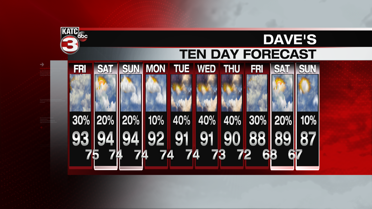
This pattern is expected to stick around through Labor Day, then somewhat higher rain chances will return toward the mid week. This will be a combination of the ridge breaking down and a front dropping southward toward the Gulf Coast. In addition, there could be some tropical moisture associated with a weakness in the western Bay of Campeche. There is a hint of some slightly cooler and drier air by the end of next week. We've advertised some lows in the 60s by next weekend. Fingers crossed!
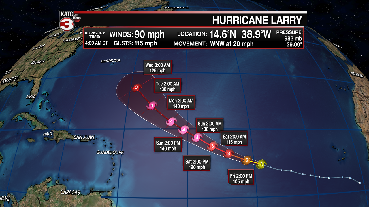
Hurricane Larry is the only player in the Atlantic Basin today, and is expected to strengthen. Larry is forecast to drift toward the northwest and won't affect any land through the forecast period. Since there are no tropical watches or warnings because of its location over the Atlantic, advisories only come out every six hours, so until there's a watch, the advisories will be issued at 4am, 10am, 4pm and 10pm. Other waves are looking pretty disorganized and most likely won't be developing over the weekend. Some models are indicating a low pressure area developing over the Bay of Campeche into next week. There will be significant shear in that area, so anything intense isn't expected as of now, so we'll just keep the rain chances a bit more elevated into the middle part of next week.
