


The weather's looking pretty similar for tomorrow, with a mild night ahead in the upper 60s.

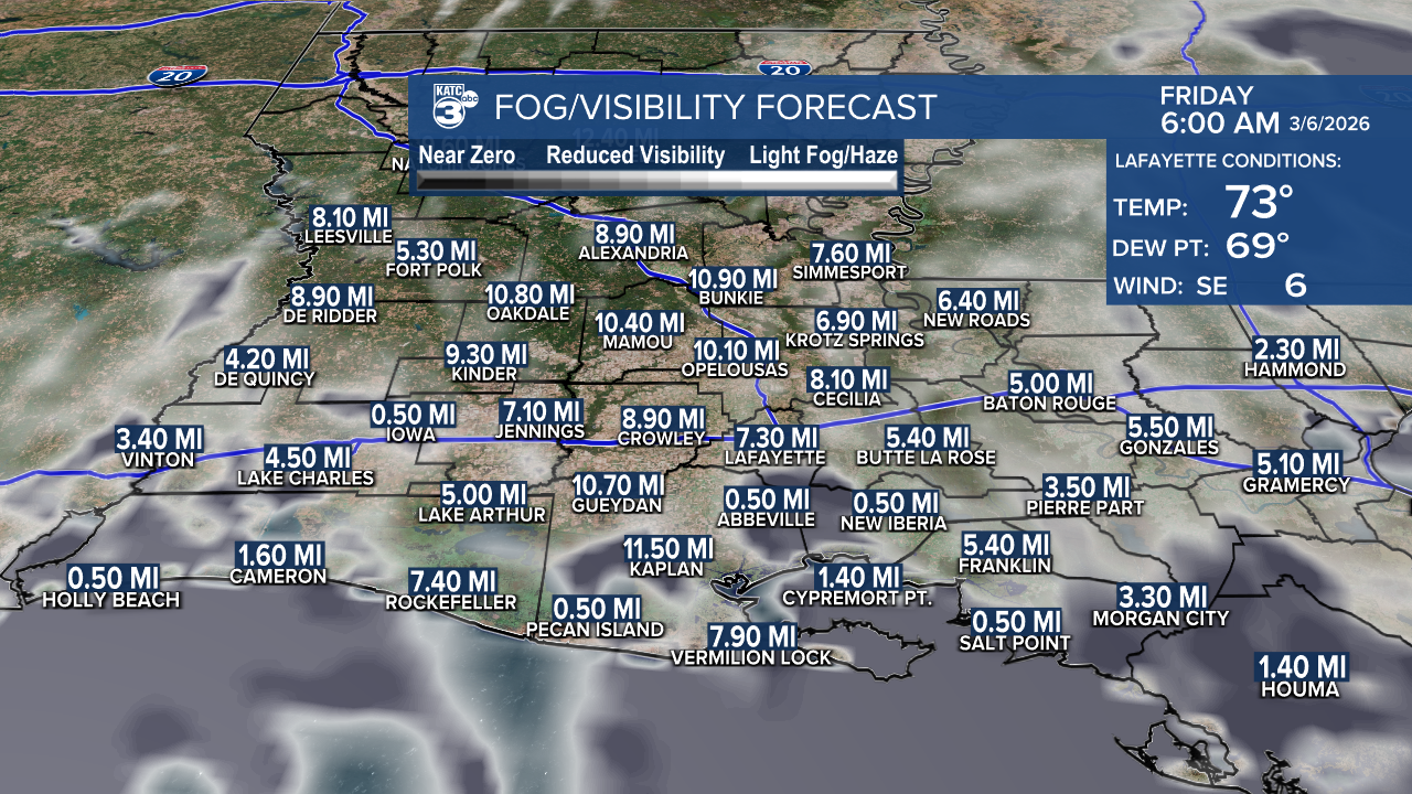
If you're near the coast, keep an eye out for some patchy fog!
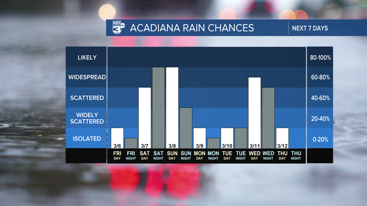
Tomorrow’s highs will be in the low 80s, and while we might see a few light pop-up showers, it'll be higher rain chances coming this weekend.

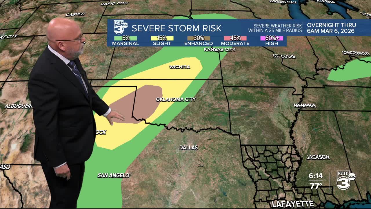
It’s been a turbulent week, especially in the Great Plains and Midwest, as they continue to face severe weather through this weekend. The severe weather shifts south into our area Saturday afternoon/evening.


The primary risks include damaging winds and potential flooding, with secondary threats of isolated tornadoes or two and large hail.
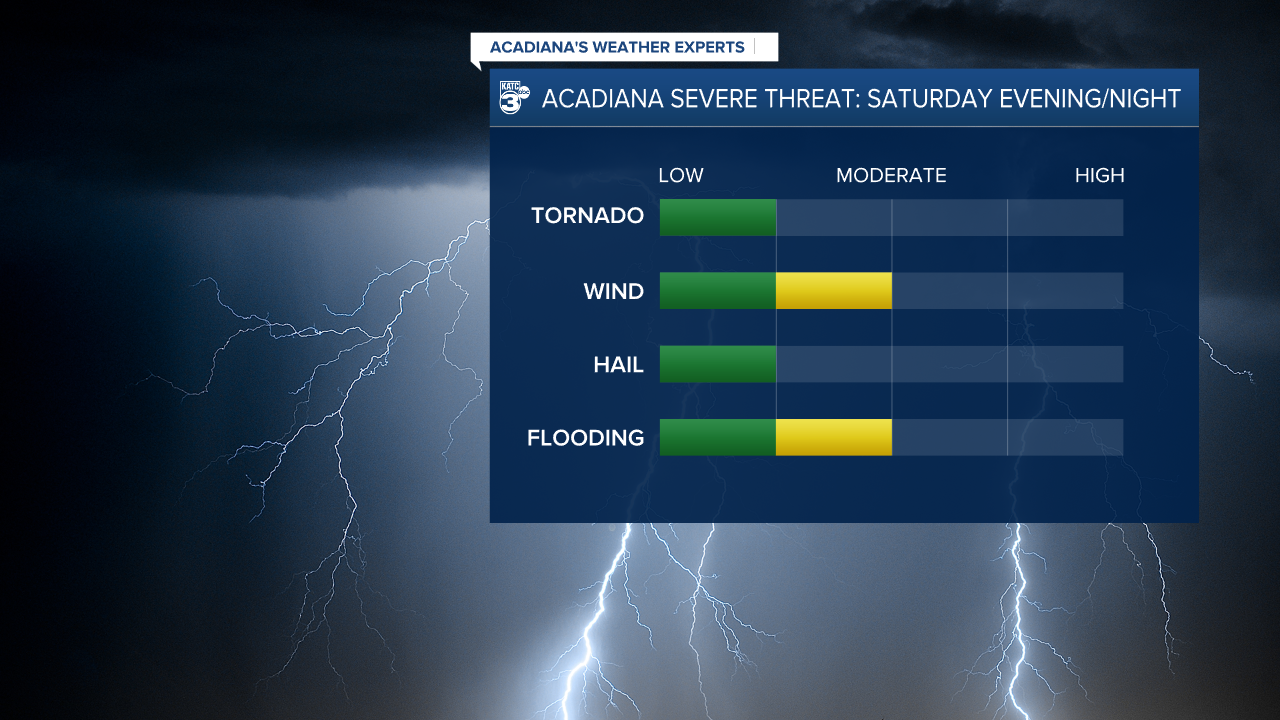
Much of CENLA is under a slight (2/4) risk for flooding, while a portion of Acadiana is under a marginal (1/4) risk.

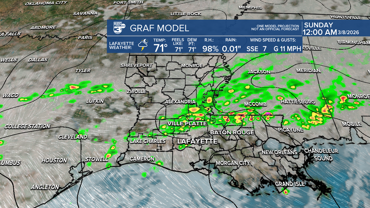
These conditions may evolve over the next day or so. We can expect rainfall amounts up to 2" this weekend with heavy rainfall at times.
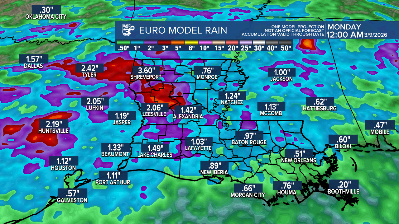
While this rain will help ease some of the ongoing drought conditions, it won’t fully cover the rainfall deficits we've been experiencing.
Another severe weather event gears up next Tuesday for the Great Plains.
Stay weather aware!
Follow Meteorologist Breyanna Lewis for further updates.
See the KATC 10 Day Forecast for the latest.
