


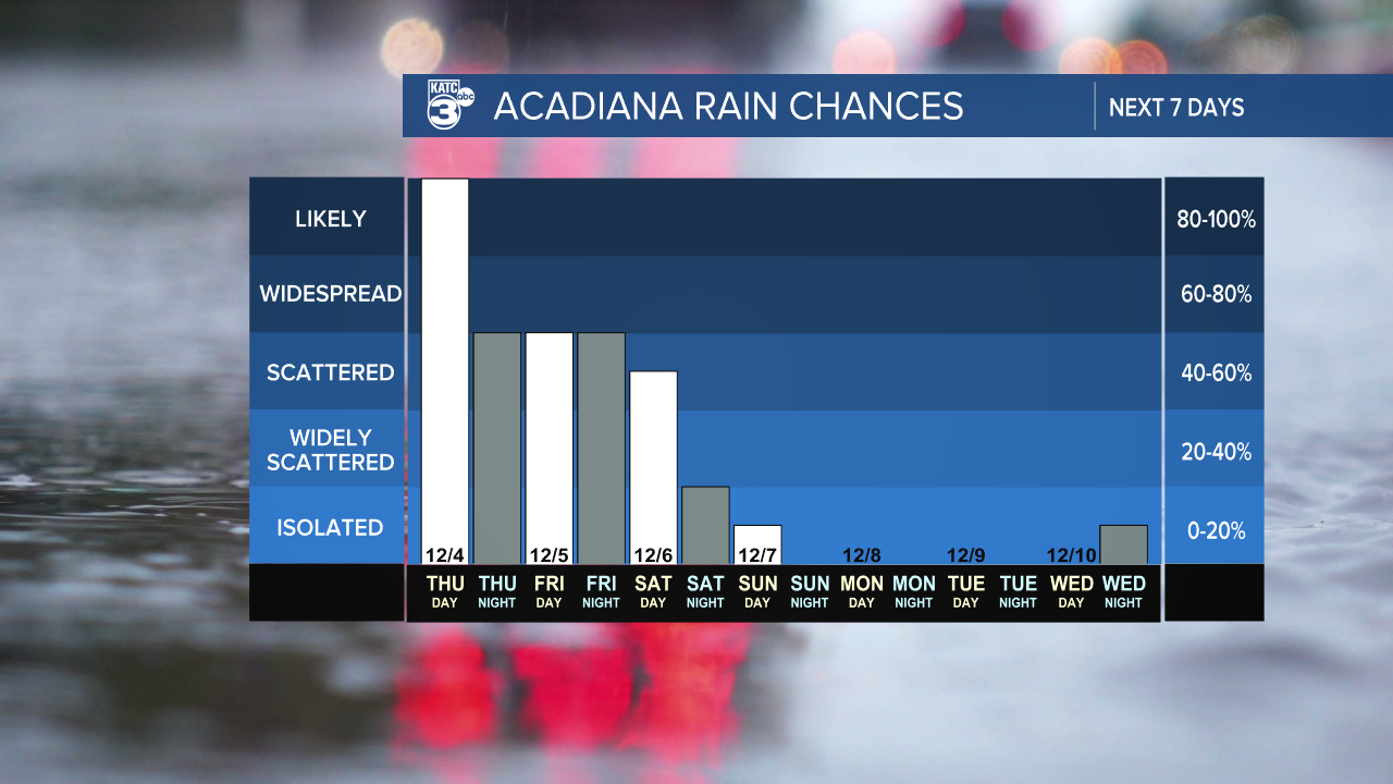
It’s been a chilly and dry few days, but that’s about to change! A coastal low is moving into the northern Gulf tonight, bringing widespread showers and a few isolated thunderstorms. While we don’t anticipate any severe weather, a couple of strong storms could develop.
Rainfall amounts are expected to be high, with most areas likely seeing between 1 and 4 inches, and isolated spots could receive 5 inches or more. Due to this forecast, we're under a marginal risk (1/5) for flash flooding.
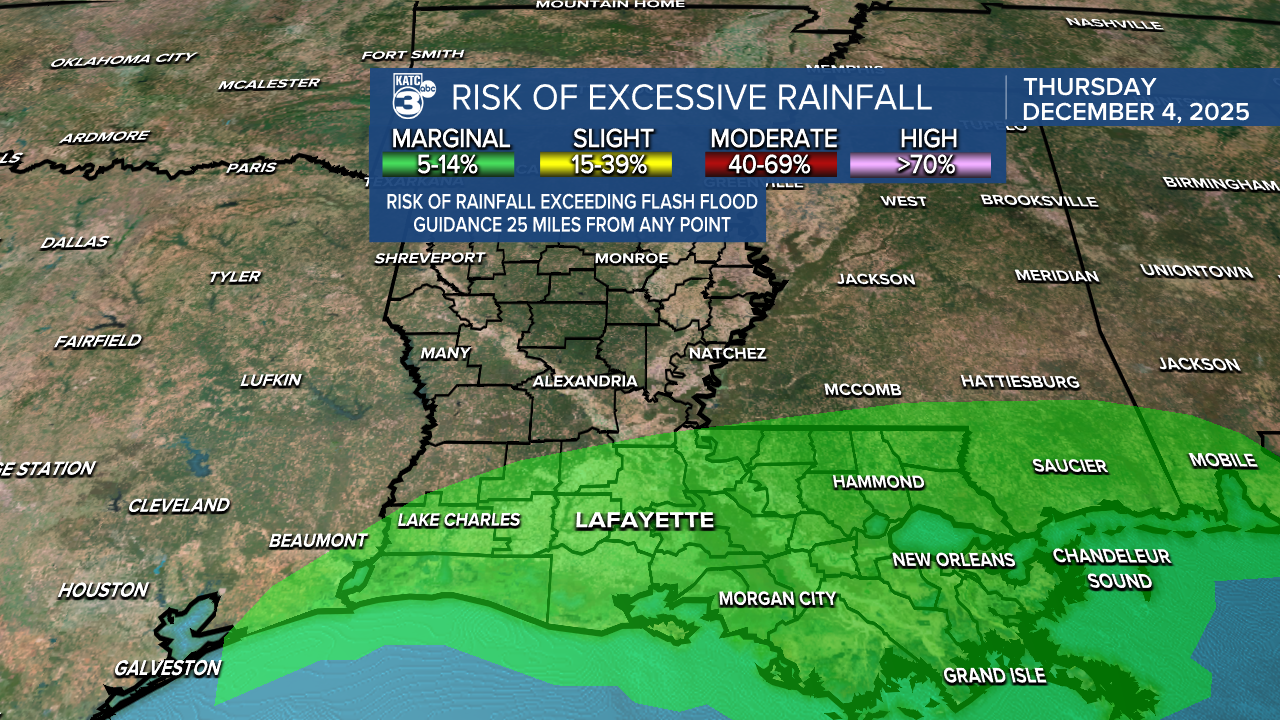
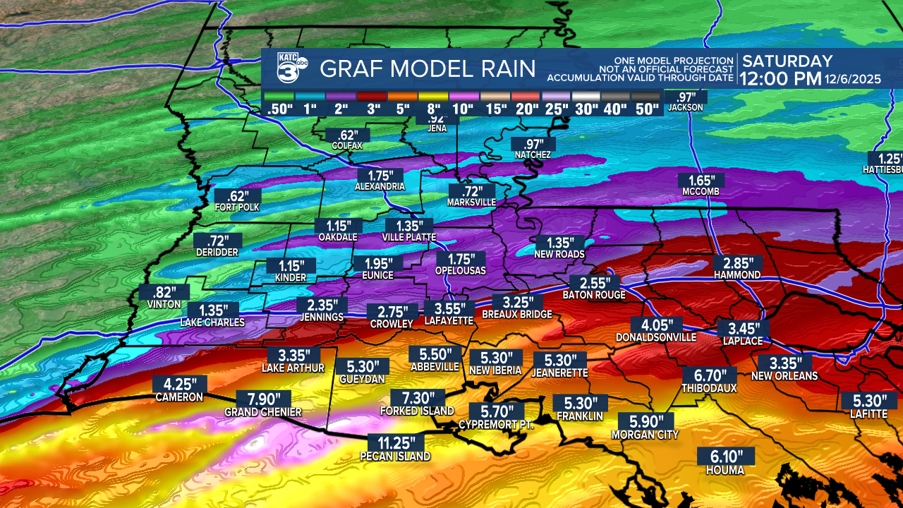
Some models even suggest localized areas could see up to 11 inches of rain! If a flood watch is issued, please stay alert, as localized flooding, ponding, and minor street flooding are likely.
The heaviest rain will start after midnight and continue throughout Thursday, with on-and-off showers. Expect a brief pause in the rain until Friday afternoon, when it will start up again.
By Saturday, the showers will begin to taper off as a front moves in, and a high-pressure system will return on Sunday, bringing back dry conditions. Temperatures will gradually warm up—YAY!

Follow Meteorologist Breyanna Lewis for further updates.
See the KATC 10 Day Forecast for the latest.
