

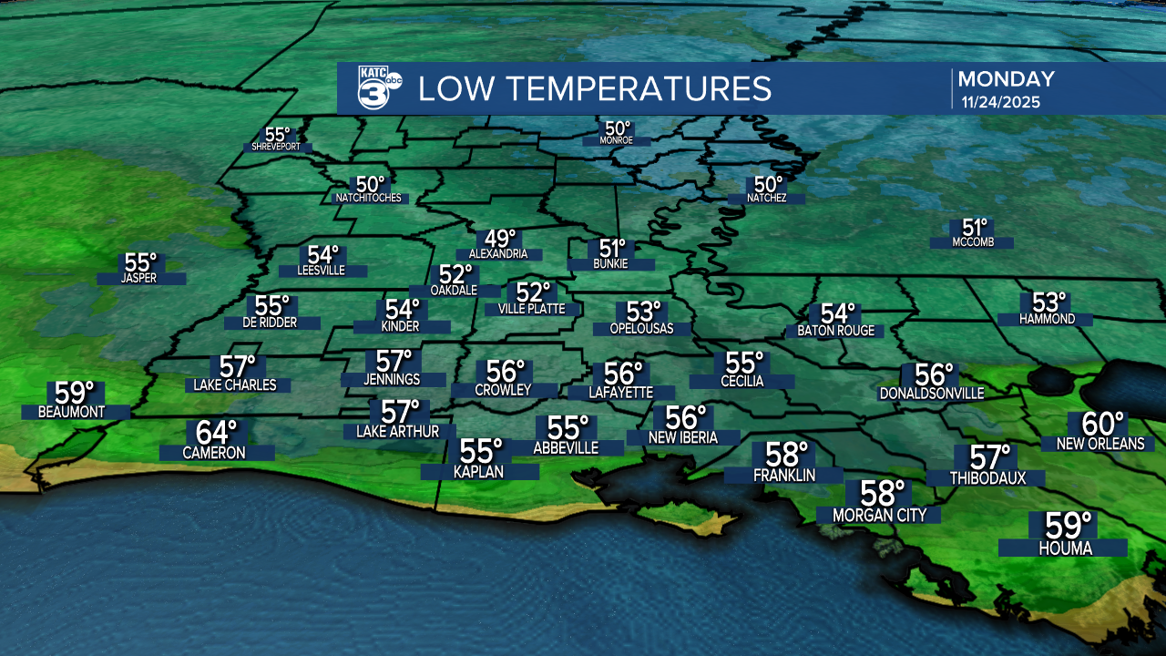
What a fantastic way to wrap up the weekend! Today's highs were in the 70s—still a bit above average for this time of year. We kicked off the day with lows in the 50s, just a touch above the norm.

As we head into the evening, expect temperatures to stay cool, hovering in the mid-50s.
Looking ahead to tomorrow, Acadiana is in for some warm weather with highs reaching the low 80s! If you're in northern Louisiana, you can look forward to cooler temperatures in the low to upper 70s. Short sleeves are still a go for tomorrow!

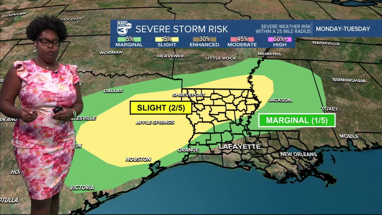
After a few quiet weather days, the forecast turns active.

Tomorrow, an upper-level disturbance will bring a low-end severe weather threat to northern and central Louisiana. The marginal (1/5) risk zone extends from Allen to northern St. Landry parishes, so stay alert as conditions could change.

The marginal (1/5) shifts towards the east Tuesday morning through the afternoon.

Acadiana is no longer under a marginal (1/4) risk for flash flooding on Monday night.

Most rainfall amounts should remain under an inch, although isolated storms might produce higher totals.

We can see a few streamer showers and storms Monday afternoon, but the main line arrives after midnight (Monday 9 PM to 8 AM Tuesday) and continues towards the southeast through daybreak.


All modes of severe weather are in play, including a brief spin-up tornado, hail, or gusty winds.

On Tuesday morning, storms are expected to gradually weaken, and we can anticipate a few lingering showers into the early afternoon. By Tuesday afternoon, we’ll welcome a dry spell as the first cold front moves through.
Great news for Thanksgiving—our weather looks to stay dry and cool as another front arrives on Wednesday!
Looking ahead to next weekend, it seems we could see more unsettled weather with showers and storms returning to the area.
Follow Meteorologist Breyanna Lewis for further updates.
See the KATC 10 Day Forecast for the latest.
